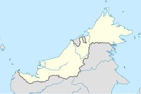
Miri is a coastal city in north-eastern Sarawak, Malaysia, located near the border of Brunei, on the island of Borneo. The city covers an area of 997.43 square kilometres (385.11 sq mi), located 798 kilometres (496 mi) northeast of Kuching and 329 kilometres (204 mi) southwest of Kota Kinabalu. Miri is the second largest city in Sarawak, with a population of 356,900 as of 2020. The city is also the capital of Miri District, Miri Division.

Miri Division is one of the twelve administrative divisions of Sarawak, Malaysia.

The Meradong District is located in Sarikei Division, Sarawak, Malaysia. The capital of Meradong District is Bintangor, Sarawak. The official census in 2006 stated Meradong as covering 719 sq km, making it the smallest district of Sarawak in terms of geographic area, and the district population from the 2010 National Census was 28,672. It is situated nearby Sarikei District.

Lundu is a town and the capital of Lundu District located in the northwest of Kuching Division of Sarawak, Malaysia, and borders the Indonesian Province of West Kalimantan.
The Igan River is a river in Sarawak, Malaysia. It joins the Sungai Rajang in Sibu. The 95 km long river is still used as the primary route for travel to a number of rural districts in Sarawak.

The Simunjan District is a district in the Samarahan Division of Sarawak, Malaysia, located between Serian and Sri Aman. It borders Sebuyau and Samarahan and lies approximately 51.4 kilometres (32 mi) east-south-east of the state capital Kuching.

Sungai Tujoh, is the westernmost point of Brunei. It is located in the Belait district.

Koompassia excelsa is an emergent tropical rainforest tree species in the family Fabaceae. It is found in Indonesia, Brunei, Malaysia, the Philippines, and Thailand. It is one of the tallest tropical tree species: the tallest measured specimen is 85.8 m or 88 m(281 or 289 ft) tall.
Maludam, Saribas is a very small town and sub district in Betong Division, Sarawak, Malaysia. It is made up of a small town including some modern longhouses with a few Malay fishing villages nearby. The majority of people are Malays, with some Ibans and Chinese. Maludam was made a district in 1985.

The Borneo lowland rain forests is an ecoregion, within the tropical and subtropical moist broadleaf forests biome, of the large island of Borneo in Southeast Asia. It supports approximately 15,000 plant species, 380 bird species and several mammal species. The Borneo lowland rain forests is diminishing due to logging, hunting and conversion to commercial land use.

Tatau District is one of the two districts of Bintulu Division in Sarawak, Malaysia. It has a total area of 4,945.80 square kilometres. The largest town in the district is Tatau.

The Bintulu District is one of two districts of Bintulu Division in Sarawak, Malaysia. It has a total area of 7,220.40 square kilometres. Bintulu District has a sub-district, which is Sebauh. There are two towns in Bintulu District, namely Bintulu, which is the capital of both Bintulu District and Bintulu Division, and Sebauh.
Berawan is an Austronesian language of Sarawak.
Tupong is a state constituency in Sarawak, Malaysia, that has been represented in the Sarawak State Legislative Assembly since 1991.
Pelagus is a state constituency in Sarawak, Malaysia, that has been represented in the Sarawak State Legislative Assembly since 1969.

The Sultanate of Sarawak was a Malay kingdom, located in present-day Kuching Division, Sarawak. The kingdom was founded in 1599, after the conquest of the preceding Santubong Kingdom and the later Sultanate of Brunei.

The Kuala Penyu District is an administrative district in the Malaysian state of Sabah, part of the Interior Division which includes the districts of Beaufort, Keningau, Kuala Penyu, Nabawan, Sipitang, Tambunan and Tenom. The capital of the district is in Kuala Penyu Town.

Pasir Mas District is a district (jajahan) in Kelantan, Malaysia. The district covers an area of 614.15 square kilometers and is bordered by the districts of Tumpat District to the north, Tanah Merah District to the south, Kota Bharu District to the east, and the Thai district of Su-ngai Kolok to the west.


