Kinabalu Park

Last updated

Kinabalu Park
Mount kinabalu 01.png
Malaysia relief location map.jpg
Red pog.svg
Location of Kinabalu Park in Malaysia
Location Sabah, Malaysia
Nearest city Kota Kinabalu, Tuaran (Tamparuli), Kota Belud, Ranau
Coordinates 6°09′N116°39′E / 6.15°N 116.65°E / 6.15; 116.65
Area754 km2 (291 sq mi)
Established1964
Visitors611,624(in 2010)
Governing body Sabah Parks
Official nameKinabalu Park
TypeNatural
Criteriaix, x
Designated2000 (24th session)
Reference no. 1012
Region Asia-Pacific

Kinabalu Park (Malay : Taman Kinabalu), established as one of the first national parks of Malaysia in 1964, is Malaysia's first World Heritage Site designated by UNESCO in December 2000 for its "outstanding universal values" and the role as one of the most important biological sites in the world with more than 4,500 species of flora and fauna, including 326 bird and around 100 mammal species, [1] and over 110 land snail species. [2]

Contents

Located on the west coast of Sabah, Malaysian Borneo, it covers an area of 754 square kilometres surrounding Mount Kinabalu, which at 4,095.2 meters, is the highest mountain on the island of Borneo.

The park is one of the most popular tourist spots in Sabah and Malaysia in general. In 2010, the park received 611,624 visitors, including 47,613 climbers. [3]

The site has been identified by UNESCO as a Centre of Plant Diversity for Southeast Asia, as it contains representatives from at least half of all Borneo’s plant species and is extremely rich in species with elements from China, Australia, the Himalayas, Malaysia and pan tropical floras. [4]

History

The region was designated as a national park in 1964. British colonial administrator and naturalist Hugh Low led an expedition from Tuaran to the region in 1851. He also became the first recorded man to reach the peak of Mount Kinabalu. [5] The highest peak of the mountain was later named after him—Low's Peak.

Geography

Kinabalu Park is situated on the Crocker Range on the western coast of Sabah. It is located within the district of Ranau, within the West Coast Division. The park is not to be confused with Crocker Range National Park which is a separate park in the south.

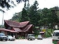
The park headquarters is 88 kilometres away from the city of Kota Kinabalu. There are sealed roads leading towards the park headquarters from other parts of Sabah. It is situated on the southern boundary of Kinabalu Park, at an elevation of 1,563 m (5,128 ft).

Administration and park features

Rajah Lodge accommodation with tree ferns in the foreground Rajah Lodge.jpg
Rajah Lodge accommodation with tree ferns in the foreground

This park is administered by an organisation called Sabah Parks. Accommodations in the form of chalets can be found in the park, mostly around the headquarters. Reservations for accommodation and mountain climbing guides are processed through Sutera Sanctuary Lodges, a private company. Every person who wishes to climb the mountain must be accompanied by a qualified guide. Sutera is now requiring hikers to stay one night at their lodge near the entrance, in addition to a required stay at Laban Rata. The cost to stay is considerably higher than at lodging just outside the park and includes a mandatory purchase of meals, etc.

The mountain summit trail begins at Timpohon. There is also an alternative route called the Mesilau Trail.

A notable feature of the park is Low's Gully. It is a 1.6-kilometer deep ravine stretching 10 kilometres on the side of the mountain peak.

Ecology

Vegetation of the Mount Kinabalu summit plateau Gunung Kinabalu.jpg
Vegetation of the Mount Kinabalu summit plateau

This botanical site contains a variety of flora and fauna that ranges over 4 climate zones; from rich lowland dipterocarp forest through the montane oak, rhododendron, to the coniferous forests, to the alpine meadow plants, and to the stunted bushes of summit zone. The mountain is also known for its many carnivorous plant and orchid species, most notably Nepenthes rajah .

It is also home to a multitude of endemic animal species, including the Kinabalu giant red leech and Kinabalu giant earthworm. The park also plays host to a variety of birds, insects, mammals, amphibians, and reptiles.

Mount Kinabalu is one of the youngest non-volcanic mountains in the world. It was formed within the last 10 to 35 million years. The mountain still grows at a rate of 5 millimetres a year

Related Research Articles

<span class="mw-page-title-main">Geography of Malaysia</span> Physical Features of Malaysia

The geography of Malaysia includes both the physical and the human geography of Malaysia, a Southeast Asian country made up of two major landmasses separated by water—Peninsular Malaysia to the West and East Malaysia to the East—and numerous smaller islands that surround those landmasses. Peninsular Malaysia is on the southernmost part of the Malay Peninsula, south of Thailand, north of Singapore and east of the Indonesian island of Sumatra; East Malaysia comprises most of the northern part of Borneo island, and shares land borders with Brunei to the north and Indonesian Borneo to the south.

<span class="mw-page-title-main">Mount Kinabalu</span> Highest mountain in Malaysia

Mount Kinabalu is the highest mountain in Borneo and Malaysia. With an elevation of 4,095 metres (13,435 ft), it is third-highest peak of an island on Earth, and 20th most prominent mountain in the world by topographic prominence. The mountain is located in Ranau district, West Coast Division of Sabah, Malaysia. It is protected as Kinabalu Park, a World Heritage Site.

<span class="mw-page-title-main">Kota Kinabalu</span> State capital city and district capital in Sabah, Malaysia

Kota Kinabalu, colloquially referred to as KK, is the state capital of Sabah, Malaysia. It is also the capital of the Kota Kinabalu District as well as the West Coast Division of Sabah. The city is located on the northwest coast of Borneo facing the South China Sea. The Tunku Abdul Rahman National Park lies to its west and Mount Kinabalu, which gave the city its name, is located to its east. Kota Kinabalu has a population of 452,058 according to the 2010 census; when the adjacent Penampang and Putatan districts are included, the metro area has a combined population of 628,725. The 2020 Census revealed an increase in the municipal population to 500,421, while the wider area including Penampang and Putatan Districts had a population of 731,406.

<span class="mw-page-title-main">Ranau District</span> District in Sabah, Malaysia

The Ranau District is an administrative district in the Malaysian state of Sabah, part of the West Coast Division which includes the districts of Kota Belud, Kota Kinabalu, Papar, Penampang, Putatan, Ranau and Tuaran. The capital of the district is in Ranau Town. The landlocked district bordering the Sandakan Division to the east until it meets the Interior Division border. Ranau sits 108 km (67 mi) east of Kota Kinabalu and 227 km (141 mi) west of Sandakan. As of the 2010 Census, the population of the district was 94,092, an almost entirely Dusun ethnic community.

<span class="mw-page-title-main">Crocker Range National Park</span> National park in Malaysia

Crocker Range National Park was established in 1984, although the area had previously been under protection as a forest reserve. It covers the north-south Crocker Range, of 1200-1800 metre mountains in Sabah, Malaysia. In the vicinity of park headquarters, there is a resort that provides accommodation and food services. Other visitors facilities such as an exhibition centre, insectarium, fernarium, observation tower and trekking trail can also be found.

<span class="mw-page-title-main">Bornean ferret badger</span> Species of carnivore

The Bornean ferret badger, also known as Everett's ferret badger or the Kinabalu ferret badger, is a small, nocturnal and omnivorous mammal that is endemic to the island of Borneo. It is a member of the family Mustelidae and is one of six species of the genus Melogale. It is listed as endangered on the IUCN Red List of Threatened Species due to its small distribution range, which includes Kinabalu National Park and Crocker Range National Park.

<span class="mw-page-title-main">Mount Tambuyukon</span> Mountain in Sabah, Malaysia

Mount Tambuyukon or Tamboyukon is a mountain located at the West Coast Division of Sabah, Malaysia. It is considered the third-highest mountain in the country with height at 2,579 metres (8,461 ft), lying north of the highest Mount Kinabalu.

<i>Nepenthes lowii</i> Species of pitcher plant from Borneo

Nepenthes lowii, or Low's pitcher-plant, is a tropical pitcher plant endemic to Borneo. It is named after Hugh Low, who discovered it on Mount Kinabalu. This species is perhaps the most unusual in the genus, being characterised by its strongly constricted upper pitchers, which bear a greatly reduced peristome and a reflexed lid with numerous bristles on its lower surface.

<span class="mw-page-title-main">Crocker Mountains</span> Mountain range in Sabah, Malaysia

Crocker Mountains is a mountain range extending from the West Coast until Interior divisions of Sabah, Malaysia that separates the west and east coast of Sabah. At an average height of 1,800 metres (5,906 ft), it is the highest mountain range in the state named after the British administrator in North Borneo, William Maunder Crocker.

<span class="mw-page-title-main">Poring</span> Tourist resort in Sabah, Malaysia

Poring is a small tourist resort in Sabah, Malaysia. Located 40 km south-east of the Kinabalu National Park Headquarters, in the district of Ranau, Poring is situated in lowland rainforest, contrasting with the montane and submontane rainforest of Kinabalu National Park. The name Poring comes from a Kadazandusun word for a bamboo species found in the area.

<span class="mw-page-title-main">Danum Valley Conservation Area</span> Protected area in Sabah, Malaysia

Danum Valley Conservation Area is a 438 square kilometres tract of relatively undisturbed lowland dipterocarp forest in Sabah, Malaysia. It has an extensive diversity of tropical flora and fauna, including such species as the rare Bornean orangutans, gibbons, mousedeer, clouded leopards and over 270 bird species. Activities offered are jungle treks, river swimming, bird watching, night jungle tours and excursions to nearby logging sites and timber mills.

<i>Nepenthes macrophylla</i> Species of pitcher plant from Borneo

Nepenthes macrophylla, the large-leaved pitcher-plant, is a tropical pitcher plant known only from a very restrictive elevation on Mount Trusmadi in Sabah, Malaysian Borneo.

<span class="mw-page-title-main">Mesilau</span>

Mesilau, named after Mesilau River, is an area situated at approximately 2,000 m (6,562 ft) above sea level on the East Ridge of Mount Kinabalu in Kinabalu National Park, Sabah, Malaysian Borneo. It is the site of the Mesilau Nature Resort, which is owned and operated by Sutera Sanctuary Lodges.

Mount Trusmadi or Trus Madi is a mountain located at the Interior Division of Sabah, Malaysia. It is considered as the second highest mountain in both Sabah and Malaysia at 2,642 metres (8,668 ft), after Mount Kinabalu with Trusmadi offering a tougher climbing challenge than the latter.

<span class="mw-page-title-main">Trusmadi Range</span>

Trusmadi Range or Trus Madi is a mountain range in Interior Division and parts of West Coast Division of Sabah, Malaysia that also separates the west and east coast of Sabah aside from the main Crocker Mountains. With a length of about 80 kilometres, the range includes the state's second highest peak, Mount Trusmadi, after which it is named.

<span class="mw-page-title-main">Borneo montane rain forests</span> Ecoregion in Borneo

The Borneo montane rain forests is an ecoregion on the island of Borneo in Southeast Asia. It includes montane tropical and subtropical moist broadleaf forests, also known as a cloud forests. The ecoregion is partly in East Malaysia and Indonesia (Kalimantan).

<i>Nepenthes of Mount Kinabalu</i>

Nepenthes of Mount Kinabalu is a monograph by Shigeo Kurata on the tropical pitcher plants of Mount Kinabalu and the surrounding area of Kinabalu National Park in Sabah, Borneo. It was published in 1976 by Sabah National Parks Trustees as the second booklet of the Sabah National Parks series. The monograph is Kurata's most important work on Nepenthes and significantly contributed to popular interest in these plants. It is noted for its high quality colour photographs of plants in habitat. In the book's preface, Kurata writes:

While Nepenthes were often enumerated as an important component of the flora of this mountain, a book on this genus—relating exclusively to Kinabalu had never been published to this date. With such a situation and the interest shown by visitors to the Kinabalu National Park in the genus, Mr. D.V. Jenkins, Assistant Director, Sabah National Parks was prompted to publish a guide book on the species found within the park and I was delighted to be asked to write the text.

<span class="mw-page-title-main">Biodiversity of Borneo</span>

The island of Borneo is located on the Sunda Shelf, which is an extensive region in Southeast Asia of immense importance in terms of biodiversity, biogeography and phylogeography of fauna and flora that had attracted Alfred Russel Wallace and other biologists from all over the world.

<span class="mw-page-title-main">Greater Sunda Islands</span> Group of four islands in Indonesian Archipelago

The Greater Sunda Islands are four tropical islands situated within the Indonesian Archipelago, in the Pacific Ocean. The islands, Borneo, Java, Sulawesi and Sumatra, are internationally recognised for their ecological diversity and rich culture. Together with the Lesser Sunda Islands to their southeast, they comprise the archipelago known as the Sunda Islands.

Mount Alab is a mountain located at the West Coast Division of Sabah, Malaysia. The mountain is located approximately 30 km (19 mi) from Sabah's capital of Kota Kinabalu, where it can be highly visible from the city on a clear sky and easily recognisable with the presence of telecommunications tower near its peak, approximately at 5°49′47″N116°20′30″E. With a height of 1,951 metres (6,401 ft), it is the highest mountain within the Crocker Range in Sabah outside the protected park area and lies to the south of the highest peak on Borneo island, the Mount Kinabalu.

References

  1. Chilling out in a tropical destination Archived 23 May 2016 at the Wayback Machine . The Jakarta Post, 12 June 2011.
  2. Liew, T.S., M. Schilthuizen & M. Lakim, 2017. The determinants of land snail diversity along a tropical elevational gradient: insularity, geometry, and niches. Journal of Biogeography, 37: 1071-1078
  3. "Annual Report 2010". Sabah Parks . pp. 108–114. Retrieved 26 May 2021.
  4. "Kinabalu Park". UNESCO World Heritage Centre. Retrieved 9 August 2021.
  5. "Kinabalu Park". Sabah Parks. Archived from the original on 4 August 2008. Retrieved 1 November 2008.