Nam Ha National Protected Area

Last updated
Nam Ha National Protected Area
IUCN category VI (protected area with sustainable use of natural resources)
LuangNamtha ThamKaoRao1 tango7174.jpg
Tham Khao Rao caves in Nam Ha NPA
Laos adm location map.svg
Red pog.svg
Location in Laos
Location Luang Namtha Province, Laos
Nearest city Luang Namtha
Coordinates 20°49′1″N101°15′10″E / 20.81694°N 101.25278°E / 20.81694; 101.25278 Coordinates: 20°49′1″N101°15′10″E / 20.81694°N 101.25278°E / 20.81694; 101.25278
Area2,224 km2 (860 sq mi)
Designated29 October 1993 (1993-10-29)
Visitors6,500(in 2008) [1]
Website www.namha-npa.org/info/nam_ha_npa.htm

Nam Ha National Protected Area is a national protected area in Luang Namtha Province in northern Laos. This mostly forested park is home to a variety of ethnic groups and diverse animal and plant species. [2] The park is an ecotourism destination. [1] [3]

Contents

Geography

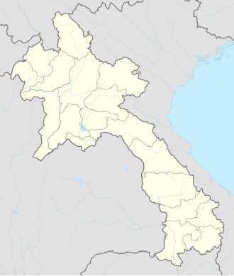
Nam Ha National Protected Area is located about 5 km (3 mi) southwest of Luang Namtha and covers parts of all five of the province's districts. The park's area is 2,224 km2 (860 sq mi). The park encompasses the Nam Ha Important Bird Area with an area of 1,845 km2 (710 sq mi). [4]

Elevations range from about 500 m (1,640 ft) to the park's peak at 2,094 m (6,870 ft). The park incorporates three rivers which drain into the Mekong: the Nam Tha, Nam Fa and Nam Long. The Nam Tha is the Mekong's first major tributary after entering Laos. [2]

History

In 1980 Nam Ha was identified as a Provincial Protected Area. In 1993 Nam Ha National Protected Area was initially decreed to cover 697 km2 (270 sq mi). This was extended in 1999 to cover the present area of 2,224 km2 (860 sq mi). [2] In 2003 Nam Ha was designated an ASEAN Heritage Park, the only one in Laos. [5] In 2006 the Nam Ha Ecotourism Project (a joint UNESCO–Lao project to sustainably manage the park) won the Equator Prize. [1]

Flora and fauna

The park's main forest type is mixed secondary deciduous forest including secondary evergreen forest. At the park's lower elevations, in the Luang Namtha plain, human modification of the forest is evident and habitats include bamboo and scrub areas. [2]

Animal species include Assam macaque, clouded leopard, gaur, tiger, elephant and a possibly unique species of muntjac. [2] [4] The frog species Amolops akhaorum is only known from the park. [6] It is named for the local Akha people who helped with the fieldwork of the team who discovered the species in 2007. [7]

The park is host to diverse bird species: about 300 species are recorded here. [2] A few species are unique in Laos to Nam Ha: crested finchbill, white-bellied redstart and white-necked laughingthrush. [4]

Threats

Nam Ha faces a number of environmental threats. The most significant is slash-and-burn agriculture. Harvesting of forest products, including timber, is also a threat. Hunting of wildlife is conducted by both residents and outsiders. Domesticated animals roam freely, disturbing wildlife and damaging wild habitats. [2] Clearance of forested land for rubber plantations has occurred. [1]

See also

Related Research Articles

<span class="mw-page-title-main">Luang Namtha</span> District & municipality in Luang Namtha Province, Laos

Luang Namtha is a district as well as the capital of Luang Namtha Province in northern Laos. The city lies on the Tha River.

<span class="mw-page-title-main">Nam Et-Phou Louey</span>

Nam Et-Phou Louey National Protected Area (NPA) is a protected area in northern Laos, covering 5,959 km2 (2,301 sq mi) in three provinces: Houaphan, Luang Prabang, and Xieng Khouang. The park includes a 3,000 km2 (1,200 sq mi) core area where human access and wildlife harvest is prohibited and a 2,950 km2 buffer area where pre-existing villages are allocated land for subsistence living.

<span class="mw-page-title-main">Phi Pan Nam Range</span> Mountain range in Thailand and Laos

The Phi Pan Nam Range, also Pee Pan Nam, is a 400 km (249 mi) long system of mountain ranges in the eastern half of the Thai highlands. It is mostly in Thailand, although a small section in the northeast is within Sainyabuli and Bokeo Provinces, Laos.

<span class="mw-page-title-main">Ban Nam Di</span> Village in Laos

Ban Nam Di is a village in Luang Namtha Province, Laos, located about 6 kilometres (3.7 mi) northeast of Luang Namtha. It has a population of about 500. The Nam Di River flows nearby and the Nam Di waterfall is about a 1 kilometre (0.62 mi) from the village. The village is famous for its bamboo paper making by the Lanten peoples. The locals are adept at turning bamboo into pulp on the river banks and making paper by spreading it thinly over square cotton screens. The paper is usually primarily for Taoist religious purposes, but in recent years the villagers have been producing it as souvenirs for tourists. The houses in the village are mainly made with bamboo roofs.

<span class="mw-page-title-main">Bokeo province</span> Smallest and least populous province of Laos

Bokèo is a northern province of Laos. It is the smallest and least populous province in the country. Bokeo province covers an area of 6,196 square kilometres (2,392 sq mi). Bokeo province borders Luang Namtha province to the northeast, Oudomxai province to the east, Xaignabouli province to the south, and Thailand to the southwest and Burma to the west and northwest. The province has five districts:. It is rich in deposits of precious and semiprecious stones. Bokeo's provincial capital is Houayxay on the Mekong River. The province is in the Golden Triangle, at the border of Myanmar and Thailand. There are 34 ethnic groups in the province. Houay Xay is the border town with Thailand and regional economic centre.

<span class="mw-page-title-main">Bolikhamsai province</span> Province of Laos

Bolikhamsai is a province of Laos. Pakxan, Thaphabat, Pakkading, Borikhane, Viengthong, and Khamkeut are its districts and Pakxan is its capital city. The province is the site of the Nam Theun 2 Dam, the country's largest hydroelectric project.

<span class="mw-page-title-main">Vientiane province</span> Province of Laos

Vientiane province is a province of Laos in the country's northwest. As of 2015 the province had a population of 419,090. Vientiane province covers an area of 15,610 square kilometres (6,030 sq mi) composed of 11 districts. The principal towns are Vang Vieng and Muang Phôn-Hông.

<span class="mw-page-title-main">Khammouane province</span> Province of Laos

Khammouane province (Khammouan) is a province in the center of Laos. Its capital lies at Thakhek.

<span class="mw-page-title-main">Salavan province</span> Province of Laos

Salavan is a province of Laos, located in the south of the country. Its earlier name was Saravan which was changed by Thai to Salavan in 1828. It was part of the Champasak Kingdom in an area known as Muang Mang inhabited by minorities of Mon-Khmer groups.

<span class="mw-page-title-main">Luang Namtha province</span> Province of Laos

Luang Namtha is a province of Laos in the country's north. From 1966 to 1976 it formed, together with Bokeo, the province of Houakhong. Luang Namtha province covers an area of 9,325 square kilometres (3,600 sq mi). Its provincial capital is Luang Namtha. The province borders Yunnan, China to the north, Oudomxai province to the east and southeast, Bokeo province to the southwest, and Shan State, Burma to the northwest.

<span class="mw-page-title-main">Sainyabuli province</span> Province of Laos

Saiyabuli province is a province in northwest Laos. Saiyabuli town is the capital of the province. Saiyabuli is the only Lao province that is completely west of the Mekong River.

<span class="mw-page-title-main">Vientiane Prefecture</span> Prefecture of Laos

Vientiane is a prefecture of Laos, in the northwest Laos. The national capital, Vientiane, is in the prefecture. The prefecture was created in 1989, when it was split off from Vientiane province.

<span class="mw-page-title-main">Luang Prabang province</span> Province of Laos

Luang Prabang is a province in northern Laos. Its capital of the same name, Luang Prabang, was the capital of the Lan Xang Kingdom during the 13th to 16th centuries. It is listed since 1995 by UNESCO as a World Heritage Site for unique architectural, religious and cultural heritage, a blend of the rural and urban developments over several centuries, including the French colonial influences during the 19th and 20th centuries. The province has 12 districts. The Royal Palace, the national museum in the capital city, and the Phou Loei Protected Reserve are important sites. Notable temples in the province are the Wat Xieng Thong, Wat Wisunarat, Wat Sen, Wat Xieng Muan, and Wat Manorom. The Lao New Year is celebrated in April as The Bun Pi Mai.

<span class="mw-page-title-main">Oudomxay province</span> Province of Laos

Oudomxay is a province of Laos, located in the northwest of the country. Its capital is Muang Xai.

The Battle of Luang Namtha, fought between January 1962 and May 1963, was a series of clashes in the Laotian Civil War. It came about as a result of the turmoil following Laotian independence as a result of the First Indochina War with France. The Kingdom of Laos had foreign soldiers on its soil, and a political struggle in progress concerning those outside troops. Following a coup and counter-coup that left General Phoumi Nosavan in charge, the general decided on military action to settle the political issue of interlopers in Laos.

Xe Pian National Protected Area is a national protected area in Champasak and Attapeu provinces in southern Laos. This forested, hilly park is home to significant wetlands and a great diversity of animal, bird and fish species. It is an ecotourism destination.

Phou Xieng Thong National Protected Area is a national protected area in Salavan and Champasak provinces of southern Laos. This park, the country's only park on the Mekong river, is home to a wide variety of animal and plant species, some endangered. The park is an ecotourism destination.

Dong Phou Vieng National Protected Area is a national protected area in Savannakhet Province in central Laos. This mostly forested park is home to large variety of animal species and contains part of the former Ho Chi Minh trail. The park is home to the Katang ethnic group and is an ecotourism destination.

Nam Kading National Protected Area is a national protected area in Bolikhamsai Province in central Laos. This rugged and largely inaccessible park, cut through by its namesake Nam Kading river, is home to a wide variety of plant and animal species, some endangered. Due to its ruggedness, the park lacks any significant human settlement.

Amolops akhaorum is a species of true frogs discovered in 2007 in the Nam Ha National Protected Area, north-western Laos. It is still only known from its type locality. The specific name akhaorum refers to the local Akha people who helped with the fieldwork of the team who discovered the species.

References

  1. 1 2 3 4 "Nam Ha Ecotourism Project" (PDF). UNDP Equator Initiative . Retrieved 27 November 2014.
  2. 1 2 3 4 5 6 7 "Nam Ha NBCA". Greater Mekong Subregion Sustainable Tourism Development Project in Lao PDR. Archived from the original on 6 January 2014. Retrieved 26 November 2014.
  3. Ray, Nick; Bloom, Greg; Waters, Richard (February 2014). Lonely Planet Laos (8th ed.). Lonely Planet. p. 106. ISBN   978-1-7432-1825-9.
  4. 1 2 3 "Birdlife Data Zone: Nam Ha". BirdLife International. 2003. Retrieved 5 June 2017.
  5. "List of ASEAN Heritage Parks". ASEAN Centre for Biodiversity . Retrieved 16 March 2015.
  6. Frost, Darrel R. (2017). "Amolops akhaorum Stuart, Bain, Phimmachak, and Spence, 2010". Amphibian Species of the World: an Online Reference. Version 6.0. American Museum of Natural History. Retrieved 14 July 2017.
  7. Stuart, B.L.; Bain, R.H.; Phimmachak, S.; Spence, K. (2010). "Phylogenetic systematics of the Amolops monticola group (Amphibia: Ranidae), with description of a new species from northwestern Laos" (PDF). Herpetologica. 66 (1): 52–66. Archived (PDF) from the original on 2016-10-22.