Related Research Articles
Happy Valley is a census-designated place (CDP) in Kenai Peninsula Borough, Alaska, United States. At the 2010 census the population was 593, up from 489 in 2000.
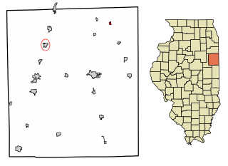
Beaverville is a village in Beaverville Township, Iroquois County, Illinois, United States. The population was 362 at the 2010 census.

Cloverly is an unincorporated town and census-designated place in Montgomery County, Maryland, United States. Its population was 15,285 as of the 2020 census.
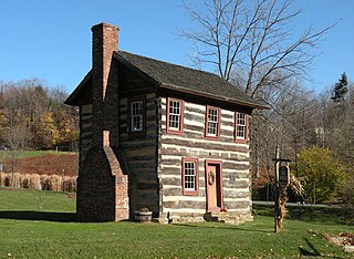
Upper St. Clair is a township with home rule status in southern Allegheny County, Pennsylvania, situated about 8 miles (13 km) south of Downtown Pittsburgh. It is known for being an affluent suburb with a nationally recognized school district. As of the 2010 census, the township population was 19,229.
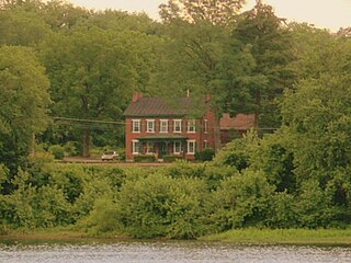
East Buffalo Township is a township in Union County, Pennsylvania, United States. The population was 5,730 at the 2000 census. The township is home to Bucknell University, which lies mostly in East Buffalo Township and partly in the Borough of Lewisburg.

Cudahy is a city in Milwaukee County, Wisconsin, United States. The population was 18,267 at the 2010 census.
The Armistice of Saint Jean d'Acre concluded the Syria-Lebanon Campaign of World War II. The Armistice, signed on 14 July 1941, was between Allied forces in the Middle East under the command of British General Henry Maitland Wilson, and Vichy France forces in Syria and Lebanon, under the command of General Henri Dentz, Commander in Chief of the Army of the Levant and as High Commissioner of the Levant.
Saint James is an unincorporated community in Wheatland Township, Fayette County, Illinois, United States.
Hoopersville is an unincorporated community in Dorchester County, Maryland, United States. The Hooper Island Light was listed on the National Register of Historic Places in 2002.

Lochiel is an unincorporated community in Union Township, Benton County, in the U.S. state of Indiana.

Dangjeong Station is an infill station on the Seoul Metropolitan Subway Line 1. It serves the city of Gunpo in Gyeonggi-do, South Korea and is the subway station closest to Hansei University.
Ferry Village is a hamlet in the town of Grand Island in Erie County, New York, United States.
Indian Field is an unincorporated community in Richmond County, in the U.S. state of Virginia.
Montrose Park is a populated place and unincorporated community in Susquehanna Township, Dauphin County, Pennsylvania in the Harrisburg-Carlisle Metropolitan Statistical Area in the United States.

Mifflin Cross Roads is an unincorporated community in Beaver Township, Columbia County, Pennsylvania. It is named after Thomas Mifflin, first governor of Pennsylvania, and located three miles east of Mainville.
BPL is the call sign of the official long-wave time signal service of the People's Republic of China, operated by the Chinese Academy of Sciences, broadcasting on 100 kHz from CAS's National Time Service Center in Pucheng County, Shaanxi at 34°56′54″N109°32′34″E, roughly 70 km northeast of Lintong, along with NTSC's short-wave time signal BPM on 2.5, 5.0, 10.0, and 15.0 MHz.
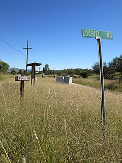
Lochiel is a populated place and former border crossing in southern Santa Cruz County, Arizona, United States, approximately 25 miles east of Nogales. The townsite is located in the southwestern part of the San Rafael Valley on Washington Gulch, about 1.5 miles west of the Santa Cruz River. It was first settled in the late-1870s and mostly abandoned by 1986. The town served the ranches of the San Rafael Valley and the Washington Camp and Duquesne mining towns of the Patagonia Mountains, approximately five miles to the northwest up Washington Gulch.
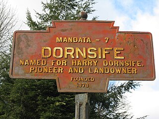
Dornsife is a populated place in Little Mahanoy Township, Northumberland County, Pennsylvania, United States, with a ZIP code of 17823. As of the 2010 U.S. Census, the ZIP Code Tabulation Area had a population of 1,273, with a median age of 41.9.

El Castillo is a census-designated place located in Starr County, Texas. It is a new CDP formed from part of the old La Victoria CDP for the 2010 census with a population of 188.
Events from the year 1748 in Scotland.
References
- ↑ "Lochiel Populated Place Profile". Home Town Locator. Retrieved October 20, 2013.
- ↑ "Lochiel, United States". ITA. Retrieved October 20, 2013.
- ↑ "Lochiel". Geographic Names Information System . United States Geological Survey.
Coordinates: 40°56′54″N76°57′16″W / 40.94833°N 76.95444°W
