Description
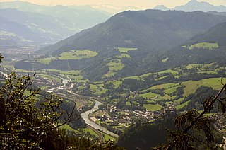
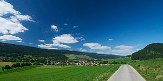
Many longitudinal valleys follow the strike of the rock strata or significant geological fault lines. These are formed in conjunction with the tectonic movements during mountain building, which in turn are due to plate tectonic processes. The faults are structures that reach deep into the lower part of the Earth's crust, which is already in place before the actual mountain building phase and is later reactivated. The Periadriatic Seam in the Alps is a good example of this. In the formation of longitudinal valleys, however, nappe overthrusts also play a major, if not the most important, role. The nappes that are present in many young fold mountain ranges are responsible to a large extent for the morphological division of a mountain belt into parallel chains. In such cases, longitudinal valleys generally run along the so-called leading edge of the nappe (the overthrust front) and are oriented at right angles to the direction of movement of the tectonic nappes, which in turn correspond to the direction of movement of the colliding continental blocks.
This configuration results in a course that runs with the strike of the geological units. This is an important criterion for the definition of a longitudinal valley. In contrast, a transverse valley cuts across the strike.
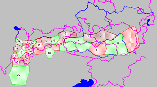
Particularly long valley systems that are occupied by several rivers, sometimes running in opposite directions, are known in German as Längstalfurchen ("longitudinal troughs"), as opposed to the usual Längstäler, although no such distinction is made in English. The Eastern Alps and other Alpine ranges have many such troughs, which are almost straight for a distance of several hundred miles and were accentuated by glacial processes during the Pleistocene.

The Alps form part of a Cenozoic orogenic belt of mountain chains, called the Alpide belt, that stretches through southern Europe and Asia from the Atlantic all the way to the Himalayas. This belt of mountain chains was formed during the Alpine orogeny. A gap in these mountain chains in central Europe separates the Alps from the Carpathians to the east. Orogeny took place continuously and tectonic subsidence has produced the gaps in between.

A mountain chain is a row of high mountain summits, a linear sequence of interconnected or related mountains, or a contiguous ridge of mountains within a larger mountain range. The term is also used for elongated fold mountains with several parallel chains.

The Kitzbühel Alps are a mountain range of the Central Eastern Alps surrounding the town of Kitzbühel in Tyrol, Austria. Geologically they are part of the western slate zone.

The Central Eastern Alps, also referred to as Austrian Central Alps or just Central Alps, comprise the main chain of the Eastern Alps in Austria and the adjacent regions of Switzerland, Liechtenstein, Italy and Slovenia. South them is the Southern Limestone Alps.

The High Tauern are a mountain range on the main chain of the Central Eastern Alps, comprising the highest peaks east of the Brenner Pass. The crest forms the southern border of the Austrian states of Salzburg, Carinthia and East Tyrol, with a small part in the southwest belongs to the Italian province of South Tyrol. The range includes Austria's highest mountain, the Grossglockner at 3,798 metres (12,461 ft) above the Adriatic.

In geology, a nappe or thrust sheet is a large sheetlike body of rock that has been moved more than 2 km (1.2 mi) or 5 km (3.1 mi) above a thrust fault from its original position. Nappes form in compressional tectonic settings like continental collision zones or on the overriding plate in active subduction zones. Nappes form when a mass of rock is forced over another rock mass, typically on a low angle fault plane. The resulting structure may include large-scale recumbent folds, shearing along the fault plane, imbricate thrust stacks, fensters and klippes.

The Eastern Alps are usually defined as the area east of a line from Lake Constance and the Alpine Rhine valley, up to the Splügen Pass at the Alpine divide, and down the Liro River to Lake Como in the south. The peaks and mountain passes are lower than the Western Alps, while the range itself is broader and less arched.

The Radstadt Tauern are a subrange of the Central Eastern Alps in Austria. Together with the Schladming Tauern, the Rottenmann and Wölz Tauern and the Seckau Tauern the Radstadt Tauern form the major range of mountains known as the Low Tauern. The mountains are found in the southeast of the Austrian state of Salzburg, between the upper reaches of the Enns and Mur rivers.
Styrian Seeberg Pass is a high mountain pass in the Austrian Alps, located in the Bundesland of Styria, east of the Hochschwab Mountains. The pass forms the most important connection between the Mürz Valley at Kapfenberg and the pilgrimage destination of Mariazell. At the same time, it forms the division between the watersheds of the Mur and the Enns.

Décollement is a gliding plane between two rock masses, also known as a basal detachment fault. Décollements are a deformational structure, resulting in independent styles of deformation in the rocks above and below the fault. They are associated with both compressional settings and extensional settings.

The Western Carpathians are a mountain range and geomorphological province that forms the western part of the Carpathian Mountains.

Radstädter Tauern Pass is a high mountain pass in the Austrian state of Salzburg, connecting the town of Radstadt in the Pongau region with Mauterndorf in Lungau.

The Salzburg Slate Alps are a mountain range of the Eastern Alps, in the Austrian state of Salzburg. Situated within the greywacke zone, they could be regarded either as part of the Northern Limestone Alps or of the Central Eastern Alps.

The Hochschwab, Hochschwab Mountains, Hochschwab Alps or Hochschwab Group is a mountain range in the Northern Limestone Alps of Austria. The range is in the Styria. The highest peak is also called Hochschwab and is 2,277 metres above the Adriatic.

The Mieming(er) Range, Mieminger Chain or Mieminger Mountains, is a mountain range of the Northern Limestone Alps in the Eastern Alps. It is located entirely in Austria within the state of Tyrol. This sub-group is somewhat in the shadows of its more famous neighbour, the Wetterstein to the north. Whilst the region around the Coburger Hut and the lakes of Seebensee and Drachensee in the west and the Hohe Munde in the extreme east receive large numbers of visitors, the less developed central area remains very quiet. The Hohe Munde is also a popular and challenging ski touring destination.

The Mürzsteg Alps or Mürztal Alps are a mountain range in the Eastern Alps, which lie in the Austrian state of Styria, with a small part of the range in Lower Austria. The highest peak is the Hohe Veitsch in the centre of the group, while largest massif is the Schneealpe in the northwest, near the Rax.

The Gailtal Alps, is a mountain range of the Southern Limestone Alps in Austria. It rises between the River Drava (Drau) and the Gail valley and through the southern part of East Tyrol. Its western group called "Lienz Dolomites", is sometimes counted as part of this range and sometimes seen as separate.

The geology of Germany is heavily influenced by several phases of orogeny in the Paleozoic and the Cenozoic, by sedimentation in shelf seas and epicontinental seas and on plains in the Permian and Mesozoic as well as by the Quaternary glaciations.
The geology of Austria consists of Precambrian rocks and minerals together with younger marine sedimentary rocks uplifted by the Alpine orogeny.


