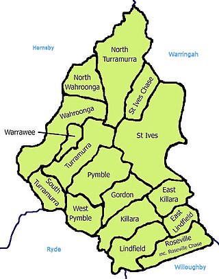
St Ives is a suburb on the Upper North Shore of Sydney in the state of New South Wales, Australia 18 kilometres north of the Sydney Central Business District in the local government area of Ku-ring-gai Council. St Ives Chase is a separate adjacent area, designated suburb, to the west and north.

Branxton is a town in the Hunter Region of New South Wales, Australia. Branxton is 171 kilometres (106 mi) north of Sydney via the Sydney–Newcastle Freeway and New England Highway. Branxton is located mostly in the City of Cessnock, but part of it is in Singleton Shire.
Belford is a town in the Hunter Region of New South Wales, Australia. In 2016 it had a population of 171, and a median age of 36.

Marsfield is a suburb in the Northern Sydney region of Sydney, in the state of New South Wales, Australia. Marsfield is located 16 kilometres north-west of the Sydney central business district in the local government area of the City of Ryde.
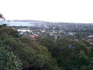
North Curl Curl is a suburb in northern Sydney, in the state of New South Wales, Australia 19 kilometres north-east of the Sydney central business district, in the local government area of Northern Beaches Council. It is part of the Northern Beaches region.
Narraweena is a suburb of northern Sydney, in the state of New South Wales, Australia. Narraweena is 18 kilometres north-east of the Sydney central business district, in the local government area of Northern Beaches Council and is part of the Northern Beaches region.
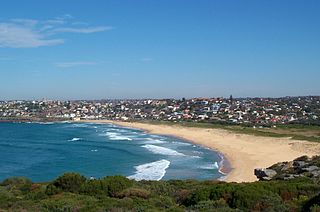
Curl Curl is a suburb of northern Sydney in the state of New South Wales, Australia, 18 kilometres (11 mi) north-east of the Sydney central business district, in the local government area of Northern Beaches Council. It is part of the Northern Beaches region.

Chatswood West is a suburb on the Lower North Shore of Sydney, in the state of New South Wales, Australia. Chatswood West is located 11 kilometres north-west of the Sydney central business district, in the local government areas of the City of Willoughby and City of Ryde. Chatswood is a separate suburb to the east. The locality of Chatswood located west of the Pacific Highway is informally known as West Chatswood, and should not be confused with the separate suburb of Chatswood West, nor should it be confused with the West Chatswood Post Office on Railway Street in the suburb of Chatswood. Chatswood West shares the same postcode as Chatswood which is 2067.

Woodville is a rural suburb in the Hunter Region of New South Wales, Australia that is shared between the Port Stephens and Maitland local government areas (LGA). Most of the suburb lies to the east of the Paterson River in the Port Stephens LGA while a small area of approximately 1.3 square kilometres (0.5 sq mi), to the west of the Paterson, is within the boundaries of the Maitland LGA.

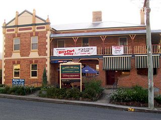
Greta is a small town in the Hunter Region of New South Wales, Australia.
Lochinvar is a village in the Hunter Region of New South Wales, Australia, eleven kilometres west of the regional centre of Maitland. Lochinvar is within the boundaries of the City of Maitland local government area and is named after Lochinvar, a loch in southern Scotland.
East Gresford is a village in the Hunter Region of New South Wales, Australia in Dungog Shire. The village is located 192 kilometres (119 mi) north of Sydney and the nearest major centres are Singleton some 42 kilometres (26 mi) southwest and Maitland to the south. In the 2006 census, it had a population of 289.

Mooney Mooney is a small waterfront village and suburb of the Central Coast region of New South Wales, Australia. It is located in the Central Coast Council local government area at the end of a peninsula extending southwards into the Hawkesbury River, that is situated 50 kilometres (31 mi) north of Sydney. Mooney Mooney has two islands which are Peat Island and Spectacle Island.
Duns Creek is a rural residential suburb in the Hunter Region of New South Wales, Australia, located near the historic village of Paterson in the north-western corner of the Port Stephens Council local government area.

Bendemeer is a village of 485 people on the Macdonald River in the New England region of New South Wales, Australia. It is situated at the junction of the New England and Oxley Highways.

Aberglasslyn is a rapidly expanding suburb of Maitland, located in the Hunter Valley of New South Wales Australia.

Largs is a developing township adjacent to Bolwarra Heights and is a suburb in the City of Maitland in the Hunter Region of New South Wales, Australia. It is located on the eastern side of the Hunter River, 6 km north of the Maitland CBD. As of 2018, the Maitland LGA is seeing new development along elevated areas adjacent to the river flood plain. Maitland is an established city. Schools and all normal community facilities are available. The City of Maitland covers an area of 390 square kilometres.
Bolwarra Heights is a suburb in the City of Maitland in the Hunter Region of New South Wales, Australia. It is located on the eastern side of the Hunter River, approximately 5 km (3.1 mi) north of the Maitland central business district. Mainly a residential suburb, Bolwarra Heights is bordered to the east by Largs. The traditional owners and custodians of the Maitland area are the Wonnarua people.
Bolwarra is a suburb in the City of Maitland in the Hunter Region of New South Wales, Australia.
Wirragulla is a small country town located between Dungog and Maitland in the Hunter Region of Australia. Wirragulla had a population of 25 people in the 2021 Census.

