Lowndes Grove

Last updated

Lowndes Grove
Lowndes Grove (House), Saint Margaret Street & Sixth Avenue, Charleston (Charleston County, South Carolina).jpg
Lowndes Grove in 1940
USA South Carolina location map.svg
Red pog.svg
Usa edcp location map.svg
Red pog.svg
Location260 St. Margaret St., Charleston, South Carolina
Coordinates 32°48′6″N79°57′58″W / 32.80167°N 79.96611°W / 32.80167; -79.96611
Built1786
Architectural styleGeorgian
NRHP reference No. 78002500 [1]
Added to NRHPAugust 30, 1978

Lowndes Grove, also known as The Grove [2] or Grove Farm, is a waterfront estate built in about 1786 on the Ashley River in Charleston. [3] It is located in the Wagener Terrace neighborhood on a triangular plot of land bordered by St. Margaret Street, 5th Avenue, and 6th Avenue. [4] It was named to the National Register of Historic Places on August 30, 1978. [1] [3] [5] [6]

Contents

History

John Gibbes built a house and garden with greenhouses on The Grove before the Revolutionary War. [2] The house was probably located near Indian Hill on the Citadel campus. It was likely destroyed in 1779, [7] but the gardens remained. Around 1786, heirs of the Gibbes family divided the land into smaller tracts, and three of the northernmost parcels were acquired by George Abbot Hall. Since the 1791 inventory of Hall's estate mentioned a house, it is assumed that the house was built around 1786. [3] The next owners were the Beaufain brothers of the West Indies who operated a small farming operation on the site. They sold the house, which they had named Wedderburn Lodge, to Mary Clodner Vesey. She, in turn, in 1803, sold the property to William Lowndes, who was elected to the U.S. Congress. He served in Congress until he resigned due to poor health in 1822. [3] After several owners, a Charleston businessman, Frederick W. Wagener, acquired the house. He was the president and one of the chief promoters of the South Carolina Inter-State and West Indian Exposition, which was held in 1901–1902. The exposition was held on his 250 acres (100 ha) and the Lowndes Grove house was used as the Woman's Building. [3] [8]

In 1918, James Sottile purchased Lowndes Grove. Sottile owned and developed the Isle of Palms and later Sottile Farms, and by the time of his death in 1964, he was one of the richest people in America. [9] Sottile developed much of the original land of the plantation into the streets and lots that surround the estate today. [10]

In 2007, the home was purchased by the Patrick family who restored the property and made it an event venue. The house was featured in the Netflix series, Outer Banks (2020), as the set for the Cameron family's home. [11]

Architecture

It is a 1+12-story frame house on a raised basement. The top one and one-half stories are frame construction. The lower story and basement are stucco-covered brick. The house was probably designed in the Georgian style, but its original appearance has been lost during the course of many renovations. It probably had a double portico, modified in about 1830 into a five-bay upper piazza with Doric columns and balustrades. The three center bays project forward and have a pediment and oculus. The piazza and house have entablature with modillion and dentil blocks. In the 1830 renovations, the house was extended toward the rear. The sides of the house have nine over nine lights. [3]

The house has a hip roof that was covered with terra cotta tiles in the 1920s. There are two dormers on each of the sides and three dormers in the rear. The house has two interior chimneys with corbelled caps. [3]

The interior has a four-room plan with central hallway. The ceilings and walls are plastered. The house has its original floors. Most major rooms are decorated in Adamsesque style with cornices, ceiling medallions, and carved mantels. The first and second story rooms on the northwest were decorated in Regency style when the house was enlarged. The first floor room toward the northeast was badly damaged in a fire during the 20th century. The room was rebuilt as a kitchen and library. The house has a spiral staircase with circular skylight. [3] Additional pictures are available. [12] [13]

See also

Related Research Articles

<span class="mw-page-title-main">Boone Hall</span> Historic house in South Carolina, United States

Boone Hall Plantation is a historic district located in Mount Pleasant, Charleston County, South Carolina, United States and listed on the National Register of Historic Places. The plantation is one of America's oldest plantations still in operation. It has continually produced agricultural crops for over 320 years and is open for public tours.

<span class="mw-page-title-main">West Ashley</span>

West Ashley, or more formally, west of the Ashley, is one of the six distinct areas of the city proper of Charleston, South Carolina. As of July 2022, its estimated population was 83,996. Its name is derived from the fact that the land is west of the Ashley River.

<span class="mw-page-title-main">William Gibbes House</span> Historic house in South Carolina, United States

The William Gibbes House is a historic house at 64 South Battery in Charleston, South Carolina. Built about 1772, it is one of the nation's finest examples of classical Georgian architecture. It was declared a National Historic Landmark in 1970.

<span class="mw-page-title-main">Hopsewee</span> Historic house in South Carolina, United States

Hopsewee Plantation, also known as the Thomas Lynch, Jr., Birthplace or Hopsewee-on-the-Santee, is a plantation house built in 1735 near Georgetown, South Carolina, in the Lowcountry. It was the main house of a rice plantation and the birthplace of Thomas Lynch, Jr., a Founding Father who was a signer of the Declaration of Independence.

<span class="mw-page-title-main">Hampton Plantation</span> Historic house in South Carolina, United States

Hampton Plantation, also known as Hampton Plantation House and Hampton Plantation State Historic Site, is a historic plantation, now a state historic site, north of McClellanville, South Carolina. The plantation was established in 1735, and its main house exhibits one of the earliest known examples in the United States of a temple front in domestic architecture. It is also one of the state's finest examples of a wood frame Georgian plantation house. It was declared a National Historic Landmark in 1970.

<span class="mw-page-title-main">Wedge Plantation</span> Historic house in South Carolina, United States

The Wedge Plantation, which is also known as The Wedge or the William Lucas House, is a plantation about 5 mi (8 km) east of McClellanville in Charleston County, South Carolina. The plantation is a wedge-shaped property between the Harrietta Plantation and the Fairfield Plantation. The plantation house was built around 1830. It is located off US Highway 17 near the Santee River. It was named to the National Register of Historic Places on September 18, 1975.

<span class="mw-page-title-main">Harrietta Plantation</span> Historic house in South Carolina, United States

Harrieta Plantation is a plantation about 5 mi (8 km) east of McClellanville in Charleston County, South Carolina. It is located off US Highway 17 near the Santee River, adjacent to the Wedge Plantation and just south of Fairfield Plantation. The plantation house was built around 1807 and was named to the National Register of Historic Places on September 18, 1975.
<span class="mw-page-title-main">Fairfield Plantation (Charleston County, South Carolina)</span> Historic house in South Carolina, United States

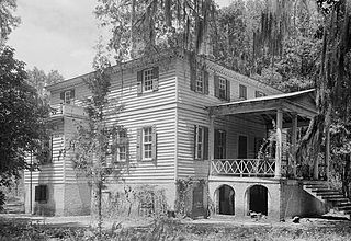
Fairfield Plantation, also known as the Lynch House is a plantation about 5 mi (8 km) east of McClellanville in Charleston County, South Carolina. It is adjacent to the Wedge Plantation and just north of Harrietta Plantation. The plantation house was built around 1730. It is located just off US Highway 17 near the Santee River. It was named to the National Register of Historic Places on September 18, 1975.
<span class="mw-page-title-main">Hampton Park (Charleston)</span>

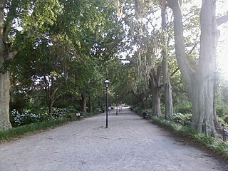
Hampton Park is a public park located in peninsular Charleston, South Carolina, United States. At 60 acres (240,000 m2), it is the largest park on the peninsula. It is bordered by The Citadel to the west, Hampton Park Terrace to the south, North Central to the east, and Wagener Terrace to the north. The park is named in honor of Confederate General Wade Hampton III who, at the time of the Civil War, owned one of the largest collections of slaves in the South. After the Civil War, Hampton became a proponent of the Lost Cause movement, member of the Red Shirts and governor of South Carolina.

<span class="mw-page-title-main">William Seabrook House</span> Historic house in South Carolina, United States

The William Seabrook House, also known as the Seabrook is a plantation house built about 1810 on Edisto Island, South Carolina, United States, southwest of Charleston. It is located off Steamboat Landing Road Extension close to Steamboat Creek about 0.7 mi (1.1 km) from Steam Boat Landing. It was named to the National Register of Historic Places on May 6, 1971.
<span class="mw-page-title-main">Fenwick Hall</span> Historic house in South Carolina, United States

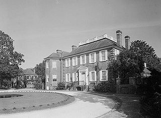
The Fenwick Hall, which is also known as Fenwick Castle, is a plantation house built about 1730 on Johns Island, South Carolina, across the Stono River from James Island and Charleston. It is located between River Road and Penneys Creek. It was named to the National Register of Historic Places on February 23, 1972.

<span class="mw-page-title-main">South Carolina Inter-State and West Indian Exposition</span> American worlds fair

The South Carolina Inter-State and West Indian Exposition, commonly called the Charleston Exposition or the West Indian Exposition, was a multi-county fair and regional trade exposition held in Charleston, South Carolina from December 1, 1901 to June 20, 1902.
<span class="mw-page-title-main">Oakland Plantation House (Mount Pleasant, South Carolina)</span> Historic house in South Carolina, United States

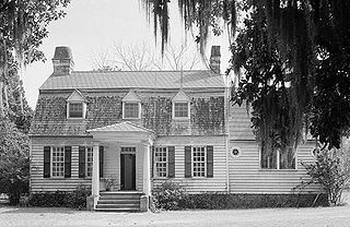
The Oakland Plantation House which is also known as Youghall or Youghal Plantation House, was built about 1750 in Charleston County, South Carolina about 7 mi (11 km) east of Mount Pleasant. It is located about 1 mile (1.6 km) south of U.S. Route 17 on Stratton Place. It was named to the National Register of Historic Places on July 13, 1977.
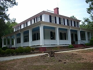
<span class="mw-page-title-main">Ashtabula (Pendleton, South Carolina)</span> Historic house in South Carolina, United States

Ashtabula is a plantation house at 2725 Old Greenville Highway near Pendleton in Anderson County, South Carolina, USA. It has been also known as the Gibbes-Broyles-Latta-Pelzer House or some combination of one or more of these names. It was named in the National Register of Historic Places as a historic district on March 23, 1972. It is considered a significant example of a Lowcountry style plantation house built for a Charleston family in the Upstate in the early 19th century. It also is part of the Pendleton Historic District.

<span class="mw-page-title-main">Brookland Plantation</span> Historic house in South Carolina, United States

Brookland Plantation is a large plantation along Shingle Creek on Edisto Island, South Carolina.

<span class="mw-page-title-main">Grove Plantation</span> Historic house in South Carolina, United States

Grove Plantation is a plantation house in Adams Run, South Carolina.

<span class="mw-page-title-main">Botany Bay Plantation Wildlife Management Area</span> United States historic place

Botany Bay Heritage Preserve & Wildlife Management Area is a state preserve on Edisto Island, South Carolina. Botany Bay Plantation was formed in the 1930s from the merger of the Colonial-era Sea Cloud Plantation and Bleak Hall Plantation. In 1977, it was bequeathed to the state as a wildlife preserve; it was opened to the public in 2008. The preserve includes a number of registered historic sites, including two listed in the National Register of Historic Places: a set of three surviving 1840s outbuildings from Bleak Hall Plantation, and the prehistoric Fig Island shell rings.

<span class="mw-page-title-main">Dr. John B. Patrick House</span> Historic house in South Carolina, United States

Dr. John B. Patrick House also known as the Patrick-Bherman-Smith House and Moultrieville Brothel, is a historic home located at Sullivan's Island, Charleston County, South Carolina. The house was built about 1870, and is a 2+12-story, symmetrical frame residence with a two-tiered, integral wraparound piazza. It features an expansive hipped roof with dormers and stairs that lead to the second tier of the piazza. A small rectangular frame structure, built about 1920 as a general store, is located on the property.

<span class="mw-page-title-main">James Ladson</span> American politician

James Henry Ladson was an American politician, wealthy plantation owner from Charles Town and officer of the American Revolution. He served as the Lieutenant Governor of South Carolina from 1792 to 1794, and was a member of the South Carolina state Senate from 1800 to 1804.
<span class="mw-page-title-main">Wagener Terrace</span>

Wagener Terrace in Charleston, South Carolina is a large neighborhood made property that had been owned by Louis Dunnemann and Capt. F.W. Wagener.

References

  1. 1 2 "National Register Information System". National Register of Historic Places . National Park Service. March 13, 2009.
  2. 1 2 Leiding, Harriette Kershaw (1921). Historic houses of South Carolina. Philadelphia, Pennsylvania: J.B. Lippincott Company. pp. 188–192. ISBN   9780722245705.
  3. 1 2 3 4 5 6 7 8 McNulty, Kappy (December 10, 1971). "Lowndes Grove" (PDF). National Register of Historic Places Inventory – Nomination Form. National Park Service. Retrieved May 20, 2009.
  4. "+32° 48' 6.00", −79° 57' 58.00". Google Maps. Retrieved May 20, 2009.
  5. "Lowndes Grove, Charleston County (260 St. Margaret St., Charleston)". National Register Properties in South Carolina. South Carolina Department of Archives and History. Retrieved May 23, 2009.
  6. "Lowndes Grove". South Carolina Plantations. SCI-way.net. Retrieved May 22, 2009.
  7. "Gibbes Landing" http://www.halseymap.com/Flash/window.asp?HMID=35
  8. Chibbaro, Anthony (2001). The Charleston Exposition. Mount Pleasant, South Carolina: Arcadia Publishing. p. 47. ISBN   0-7385-0682-6.
  9. Pollitzer, Wendy Nilsen (2005). Isle of Palms . Arcadia Publishing. ISBN   9780738518022.
  10. "Lowndes Grove". South Carolina Plantations. SCI-way.net. Retrieved January 29, 2021.
  11. "How an Historic Charleston Home Was Transformed For Netflix's "Outer Banks"". House Beautiful. May 14, 2020. Retrieved June 8, 2020.
  12. "Lowndes Grove (House), Saint Margaret Street & Sixth Avenue, Charleston, Charleston County, SC(Photographs)". Historic American Buildings Survey. National Park Service. Retrieved May 23, 2009.[ permanent dead link ]
  13. Stoney, Samuel Gaillard; Simons, A.; Lapham, Samuel Jr. (1989). Plantations of the Carolina Low Country (7th ed.). Mineola, New York: Courier Dover Publications. pp. 74, 202. ISBN   0-486-26089-5.