Magnolia, Alabama | |
|---|---|
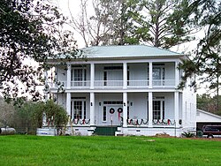 The Mask House (built c. 1861) in Magnolia | |
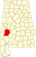
 Magnolia Location within the state of Alabama  Magnolia Magnolia (the United States) | |
| Coordinates: 32°8′9.49″N87°39′34.34″W / 32.1359694°N 87.6595389°W | |
| Country | United States |
| State | Alabama |
| County | Marengo |
| Elevation | 273 ft (83 m) |
| Time zone | UTC-6 (Central (CST)) |
| • Summer (DST) | UTC-5 (CDT) |
| ZIP code | 36754 |
| Area code | 334 |
Magnolia is an unincorporated community in Marengo County, Alabama, United States. [1]