Dayton, Alabama

Last updated

Dayton, Alabama
Boddie Law Office 01.jpg
The Boddie law office, now the Dayton Town Hall, completed in 1858
Marengo County Alabama Incorporated and Unincorporated areas Dayton Highlighted 0119912.svg
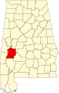
Location in Marengo County, Alabama
Coordinates: 32°20′59″N87°38′28″W / 32.34972°N 87.64111°W / 32.34972; -87.64111
CountryUnited States
State Alabama
County Marengo
Incorporated January 13, 1844 [1]
Area
[2]
  Total1.00 sq mi (2.59 km2)
  Land1.00 sq mi (2.59 km2)
  Water0.00 sq mi (0.00 km2)
Elevation
[3]
243 ft (74 m)
Population
 (2020) [4]
  Total28
  Estimate 
(2022) [5]
27
  Density27.0/sq mi (10.44/km2)
Time zone UTC–6 (Central (CST))
  Summer (DST) UTC–5 (CDT)
ZIP Code
36738
Area code 334
FIPS code 01-19912
GNIS feature ID0117151 [3]

Dayton is a town in Marengo County, Alabama, United States. The population was 28 at the 2020 census. [4]

Contents

History

The Dayton United Methodist Church, completed in November 1850 Dayton Methodist Church.JPG
The Dayton United Methodist Church, completed in November 1850

Dayton began to be settled in the early 19th century, with a town survey done and a "public well" established in 1832. The post office was established in 1837. It was incorporated on January 13, 1844. A devastating tornado hit the town in 1852. By 1860 the town had male and female academies, a hotel, cotton gin, oil mill, blacksmith shop, tavern, cabinet shop, drug store, and several general merchandise stores. The town also had several large homes, though most are now gone. One of the survivors, the William Poole House, is listed on the National Register of Historic Places. The decrease in agricultural activity over the last century has reduced the population to a fraction of what it once was. [6]

Geography

Dayton is located in northeastern Marengo County at 32°20′59″N87°38′28″W / 32.34972°N 87.64111°W / 32.34972; -87.64111 (32.349733, -87.641247). [7] It is 11 miles (18 km) northeast of Linden, the county seat, and 20 miles (32 km) southeast of Demopolis, the largest city in the county.

According to the United States Census Bureau, Dayton has a total area of 1.0 square mile (2.6 km2), all land. [2] The town sits on a ridge that drains southeast to Dry Creek and northwest to Little Dry Creek, both tributaries of Chickasaw Bogue, which flows west across the county to the Tombigbee River.

Demographics

Historical population
CensusPop.Note
1870 426
1880 47311.0%
1890 412−12.9%
1900 4273.6%
1910 382−10.5%
1920 245−35.9%
1930 202−17.6%
1940 153−24.3%
1950 85−44.4%
1960 9916.5%
1970 11516.2%
1980 113−1.7%
1990 77−31.9%
2000 60−22.1%
2010 52−13.3%
2020 28−46.2%
2022 (est.)27 [5] −3.6%
U.S. Decennial Census [8]
2020 Census [4]

2020 census

Dayton town, Alabama – Racial and Ethnic Composition
(NH = Non-Hispanic)
Note: the US Census treats Hispanic/Latino as an ethnic category. This table excludes Latinos from the racial categories and assigns them to a separate category. Hispanics/Latinos may be of any race.
Race / EthnicityPop 2010 [9] Pop 2020 [10] % 2010% 2020
White alone (NH)171032.69%35.71%
Black or African American alone (NH)341865.38%64.29%
Native American or Alaska Native alone (NH)000.00%0.00%
Asian alone (NH)000.00%0.00%
Pacific Islander alone (NH)000.00%0.00%
Some Other Race alone (NH)000.00%0.00%
Mixed Race/Multi-Racial (NH)101.92%0.00%
Hispanic or Latino (any race)000.00%0.00%
Total5228100.00%100.00%

As of the 2020 census, there were 28 people, 7 households, and 4 families residing in the city. [11] There were 12 housing units.

2000 Census

As of the 2000 census, there were 60 people, 20 households, and 15 families residing in the town. There were 28 housing units. The racial makeup of the town was 65% Black or African American and 35% White.

There were 20 households, out of which 20% had children under the age of 18 living with them, 50% were married couples living together, 20% had a female householder with no husband present, and 25% were non-families. 25% of all households were made up of individuals, and 15% had someone living alone who was 65 years of age or older. The average household size was 3.00 and the average family size was 3.27.

In the town, the population was spread out, with 36.7% under the age of 18, 5.0% from 18 to 24, 13.3% from 25 to 44, 26.7% from 45 to 64, and 18.3% who were 65 years of age or older. The median age was 34 years. For every 100 females, there were 76.5 males. For every 100 females age 18 and over, there were 58.3 males.

The median income for a household in the town was $12,500, and the median income for a family was $6,250. Males had a median income of $32,917 versus $30,417 for females. The per capita income for the town was $10,235. There were 66.7% of families and 58.7% of the population living below the poverty line, including 50.0% of under eighteens and 50.0% of those over 64.

Climate

The climate in this area is characterized by hot, humid summers and generally mild to cool winters. According to the Köppen Climate Classification system, Dayton has a humid subtropical climate, abbreviated "Cfa" on climate maps. [12]

Notable people

Related Research Articles

<span class="mw-page-title-main">Chambers County, Alabama</span> County in Alabama, United States

Chambers County is a county located in the east central portion of the U.S. state of Alabama. As of the 2020 census the population was 34,772. Its county seat is LaFayette. Its largest city is Valley. Its name is in honor of Henry H. Chambers, who served as a United States Senator from Alabama.

<span class="mw-page-title-main">Hale County, Alabama</span> County in Alabama, United States

Hale County is a county located in the west central portion of the U.S. state of Alabama. As of the 2020 census, the population was 14,785. Its county seat is Greensboro. It is named in honor of Confederate officer Stephen Fowler Hale.

<span class="mw-page-title-main">Marengo County, Alabama</span> County in Alabama, United States

Marengo County is a county located in the west central portion of the U.S. state of Alabama. As of the 2020 census, the population was 19,323. The largest city is Demopolis, and the county seat is Linden. It is named in honor of the Battle of Marengo near Turin, Italy, where French leader Napoleon Bonaparte defeated the Austrians on June 14, 1800.

<span class="mw-page-title-main">Perry County, Alabama</span> County in Alabama, United States

Perry County is a county located in the Black Belt region in the central part of the U.S. state of Alabama. As of the 2020 census, the population was 8,511. Its county seat is Marion. The county was established in 1819 and is named in honor of Commodore Oliver Hazard Perry of Rhode Island and the United States Navy. As of 2020, Perry County was the only county in Alabama, and one of 40 in the United States, not to have access to any wired broadband connections.

<span class="mw-page-title-main">Forkland, Alabama</span> Town in Alabama, United States

Forkland is a town in Greene County, Alabama, United States. At the 2020 census, the population was 445. It was incorporated around 1974.

<span class="mw-page-title-main">Union, Alabama</span> Town in Alabama, United States

Union is a town in rural Greene County, Alabama, United States. Per the 2020 census, the population was 180. According to the 1980 U.S. Census, it was incorporated in the 1970s.

<span class="mw-page-title-main">Akron, Alabama</span> Town in Alabama, United States

Akron is a town in Hale County, Alabama, United States. In 1906, the owner of a large plantation, Waller Evan Wedgworth, sold part of his land to developers, and a construction boom followed. The town was incorporated in March 1918. At the 2010 census the population was 356, down from 521 at the 2000 census. Akron has one site on the National Register of Historic Places, the Greek Revival cottage known as Tanglewood.

<span class="mw-page-title-main">Moundville, Alabama</span> Town in Alabama, United States

Moundville is a town in Hale and Tuscaloosa counties in the U.S. state of Alabama. It was incorporated on December 22, 1908. From its incorporation until the 1970 census, it was wholly within Hale County. At the 2010 census the population was 2,427, up from 1,809 at the 2000 census. It is part of the Tuscaloosa Metropolitan Statistical Area. Within the town is Moundville Archaeological Site, the location of a prehistoric Mississippian culture political and ceremonial center.

<span class="mw-page-title-main">North Courtland, Alabama</span> Town in Alabama, United States

North Courtland is a town in Lawrence County, Alabama, United States, and is included in the Decatur Metropolitan Area, as well as the Huntsville-Decatur Combined Statistical Area. It incorporated in 1981. At the 2010 census, the population of the town was 632, down from 799 in 2000. Along with Hillsboro, it is one of two majority black communities in Lawrence County out of its six populated communities as of 2010.

<span class="mw-page-title-main">Faunsdale, Alabama</span> Town in Alabama, United States

Faunsdale is a town in Marengo County, Alabama, United States. At the 2020 census the population was 90, down from 98 in 2010. Faunsdale is home to a community of Holdeman Mennonites, the only such community outside of Greensboro, Alabama. The town has the only Holdeman Mennonite Church in the area, Cedarcrest Mennonite Church.

<span class="mw-page-title-main">Linden, Alabama</span> City in Alabama, United States

Linden is a city in and the county seat of Marengo County, Alabama, United States. The population was 1,930 at the 2020 census, down from 2,123 at the 2010 census.

<span class="mw-page-title-main">Myrtlewood, Alabama</span> Town in Alabama, United States

Myrtlewood is a town in Marengo County, Alabama, United States. At the 2020 census the population was 70, down from 130 in 2010.

<span class="mw-page-title-main">Providence, Alabama</span> Town in Alabama, United States

Providence is a town in Marengo County, Alabama, United States. As of the 2020 United States census, the population was 167, down from 223 at the 2010 census. It incorporated sometime in the 1970s.

<span class="mw-page-title-main">Thomaston, Alabama</span> Town in Alabama, United States

Thomaston is a town in Marengo County, Alabama, United States. At the 2020 census the population was 326, down from 417 at the 2010 census.

<span class="mw-page-title-main">Beatrice, Alabama</span> Town in Alabama, United States

Beatrice is a town in Monroe County, Alabama, United States. It incorporated in 1901. At the 2020 census the population was 204, down from 301 in 2010 and 412 in 2000.

<span class="mw-page-title-main">Frisco City, Alabama</span> Town in Alabama, United States

Frisco City is a town in Monroe County, Alabama, United States. The population was 1,170 at the 2020 census.

<span class="mw-page-title-main">Brookwood, Alabama</span> City in Alabama, United States

Brookwood is a city in Tuscaloosa County, Alabama, United States. It incorporated in September 1977. As of the 2020 census, the population of the town is 2,504.

<span class="mw-page-title-main">Oak Hill, Alabama</span> Town in Alabama, United States

Oak Hill is a town in Wilcox County, Alabama, United States. According to the 1940 U.S. Census, it incorporated in 1938. Per the 2020 census, the population was 14. It is the smallest incorporated town in Alabama as of 2020, succeeding McMullen. The smallest unincorporated census-designated place in the state is also located in Wilcox County, that of Catherine, which had 22 residents as of 2010. With a median household income of $9,286, Oak Hill is the poorest community in Alabama.

<span class="mw-page-title-main">Yellow Bluff, Alabama</span> Town in Alabama, United States

Yellow Bluff is a town in Wilcox County, Alabama, United States. It incorporated in 1985. Per the 2020 census, the population was 208.

<span class="mw-page-title-main">Easton, Maine</span> Town in the state of Maine, United States

Easton is a town in Aroostook County, Maine, United States. The population was 1,320 at the 2020 census.

References

  1. "Municipalities of Alabama Incorporation Dates" (PDF). Alabama League of Municipalities. Retrieved March 12, 2024.
  2. 1 2 "2023 U.S. Gazetteer Files". United States Census Bureau. Retrieved March 12, 2024.
  3. 1 2 U.S. Geological Survey Geographic Names Information System: Dayton, Alabama
  4. 1 2 3 "Explore Census Data". United States Census Bureau . Retrieved March 12, 2024.
  5. 1 2 "City and Town Population Totals: 2020–2022". United States Census Bureau. March 12, 2024. Retrieved March 12, 2024.
  6. Marengo County Heritage Book Committee (2000). The heritage of Marengo County, Alabama. Clanton, Alabama: Heritage Publishing Consultants. p. 4. ISBN   1-891647-58-X.
  7. "US Gazetteer files: 2010, 2000, and 1990". United States Census Bureau. February 12, 2011. Retrieved April 23, 2011.
  8. "Census of Population and Housing". United States Census Bureau. Retrieved June 4, 2015.
  9. "P2 HISPANIC OR LATINO, AND NOT HISPANIC OR LATINO BY RACE – 2010: DEC Redistricting Data (PL 94-171) – Dayton town, Alabama". United States Census Bureau .
  10. "P2 HISPANIC OR LATINO, AND NOT HISPANIC OR LATINO BY RACE - 2020: DEC Redistricting Data (PL 94-171) - Dayton town, Alabama". United States Census Bureau .
  11. "US Census Bureau, Table P16: Household Type". United States Census Bureau. Retrieved March 12, 2024.
  12. Climate Summary for Dayton, Alabama
  13. Taylor, Stephanie. "Newcomer will fill Bentley's seat". Tuscaloosa News. Retrieved April 26, 2017.