
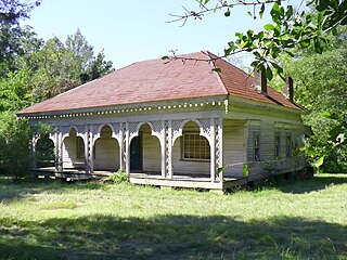
Akron is a town in Hale County, Alabama, United States. In 1906, the owner of a large plantation, Waller Evan Wedgworth, sold part of his land to developers, and a construction boom followed. The town was incorporated in March 1918. At the 2010 census the population was 356, down from 521 at the 2000 census. Akron has one site on the National Register of Historic Places, the Greek Revival cottage known as Tanglewood.

Moundville is a town in Hale and Tuscaloosa counties in the U.S. state of Alabama. It was incorporated on December 22, 1908. From its incorporation until the 1970 census, it was wholly within Hale County. At the 2010 census the population was 2,427, up from 1,809 at the 2000 census. It is part of the Tuscaloosa Metropolitan Statistical Area. Within the town is Moundville Archaeological Site, the location of a prehistoric Mississippian culture political and ceremonial center.

Moulton is a city in Lawrence County, Alabama, and is included in the Decatur Metropolitan Area, as well as the Huntsville-Decatur Combined Statistical Area. Although it incorporated in 1819, along with its rival of Courtland, to compete for the honor of county seat, it did not first appear on the U.S. Census rolls until 1900. As of the 2010 census, the population of the city is 3,471, its record high. The city has been the county seat of Lawrence County since 1820. It has been the largest community in the county since the 1920 U.S. Census.

Dayton is a town in Marengo County, Alabama, United States. The population was 28 at the 2020 census, down from 52 in 2010 and 60 in 2000.
Citronelle is a city on the northern border of Mobile County, Alabama, United States. At the 2020 census, the population was 3,946. It is included in the Mobile metropolitan statistical area. It is about 34 miles from the port of Mobile near the Gulf Coast.

Uniontown is a city in Perry County, Alabama, in west-central Alabama. As of the 2020 census, the population of the city is 2,107, up 18.7% over 2010. Of the 573 cities in Alabama, Uniontown is the 207th most populous.

Oak Hill is a town in Wilcox County, Alabama, United States. According to the 1940 U.S. Census, it incorporated in 1938. The population was 26 at the 2010 census, down from 37 in 2000. It is the second smallest incorporated town in Alabama as of 2010, behind McMullen. However, the smallest unincorporated census-designated place in the state is also located in Wilcox County, that of Catherine, which had 22 residents as of 2010. With a median household income of $9,286, Oak Hill is the poorest community in Alabama.

Yellow Bluff is a town in Wilcox County, Alabama, United States. It incorporated in 1985. At the 2010 census the population was 188, up from 181 in 2000.

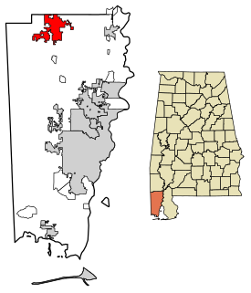
The Black Belt is a region of the U.S. state of Alabama. The term originally referred to the region's rich, black topsoil, much of it in the soil order Vertisols. The term took on an additional meaning in the 19th century, when the region was developed for cotton plantation agriculture, in which the workers were enslaved African Americans. After the American Civil War, many freedmen stayed in the area as sharecroppers and tenant farmers, continuing to comprise a majority of the population in many of these counties.
McKinley is an unincorporated community in Marengo County, Alabama, United States. McKinley had a post office at one time, but it no longer exists. Although a thriving community in its earliest years, it has since dwindled into obscurity.
Alfalfa was an unincorporated community in Marengo County, Alabama, United States. It has since been annexed into the adjacent city of Demopolis. Alfalfa had a post office at one time, but it no longer exists.
Exmoor is an unincorporated community in Marengo County, Alabama, United States. Exmoor had a school and post office at one time. The school was consolidated into Sweet Water High School in the 1920s.
Hoboken is an unincorporated community in Marengo County, Alabama, United States. A post office operated under the name Hoboken from 1877 to 1887.
Pin Hook is an unincorporated community in Marengo County, Alabama, United States.
Rembert, also known as Rembert Hills, is an unincorporated community in Marengo County, Alabama, United States. Rembert had a post office at one time, but it no longer exists.

Alberta is an unincorporated community in Wilcox County, Alabama, United States.
Beaver Creek is an unincorporated community in Marengo County, Alabama, United States. Its name is derived from the nearby Beaver Creek and the local church, Beaver Creek Baptist Church. Beaver Creek had a school at one time, but it was consolidated into Sweet Water High School in the 1920s.

Arcola is a ghost town on the Black Warrior River in what is now Hale County, formerly Marengo County, Alabama. Named to honor the French victory during the Battle of Arcola, it was established in the early 1820s by former French Bonapartists as part of their Vine and Olive Colony, after they were forced to abandon their first town at Demopolis and many found Aigleville unsuitable. The first settler at the site was Frederic Ravesies, who established himself at what later became the Hatch Plantation. Although never more than a village, Arcola became the largest settlement in the colony. Beginning in the 1830s American settlers moved into the area and purchased most of the former French land grants, primarily using Arcola as a river landing. By the 1850s the French settlement had disappeared, replaced by a community of adjoining plantations.


