Major Mackenzie Drive, often shortened to Major Mac,[2][3] is a major east-west arterial road in southern York Region, Ontario, Canada, just north of Toronto. It is a Yorkregional road, numbered as York Regional Road 25, and passes through the three cities of southern York Region: Vaughan, Ontario, Richmond Hill, and Markham. It does not continue outside of York Region as an east-west road, but does cross into Brampton (in Peel Region) as Coleraine Drive which immediately curves sharply at the boundary to head north towards Bolton.
The road is named after Lex MacKenzie, a former local politician and World War I veteran (with Major being a reference to his military rank),[4][5][6] although the road is officially spelled "Major Mackenzie" with a lowercase K.
The section west of Yonge Street was originally known as Maple Side Road (after the community of Maple though which it passed)[4] while the portion east of Yonge was Seventeenth Avenue before being named after Lex Mackenzie, although a bypassed cul-de-sac near Warden Avenue is still named Old '17th Avenue'.[7]
History
The road was laid out by early settlers as a concession road across the original York County to divide the land into farms. Most of the farmland has now been developed (although some remains protected in eastern Markham within the Rouge National Urban Park) as residential development expanded northwards in York Region.
In 2020, a new alignment of Major Mackenzie was constructed in tandem with the northward extension of Highway 427 between Huntington Road and York Road 27 (former Highway 27). The 427 extension opened on September 18, 2021.[8][9]
Communities
Communities Major Mackenzie Drive passes through as it runs across York Region, listed by municipality:
Zoning: Mainly low-density residential in Vaughan and Markham, some developing, medium-density in Richmond Hill,
Speed: Anywhere from 50–80km/h with 60km/h being the most common,
Future
There are plans for a future connection between Major Mackenzie Drive and Mayfield Road in Brampton.[10] The project is part of the Highway 427 Extension Area Transportation Master Plan, which aims to improve traffic flow and connectivity in the area.[11][12] The new roadway is designated as Arterial A2 in the plan and will be a six-lane north-south connection.[13] However, a specific construction timeline has not been announced yet.[14]
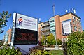
Landmarks
Notable sites along Major Mackenzie from east to west:
This page is based on this Wikipedia article Text is available under the CC BY-SA 4.0 license; additional terms may apply. Images, videos and audio are available under their respective licenses.