U.S. Route 395, also known as U.S. Highway 395, is a north–south United States Numbered Highway that traverses the inland areas of the western states of California, Nevada, Oregon, and Washington. It travels for over 1,300 miles (2,100 km) from a junction in the Mojave Desert at Interstate 15 (I-15) in Hesperia to the Canada–U.S. border near Laurier, Washington. Major cities along its route include Carson City and Reno in Nevada; Kennewick and Pasco in Washington's Tri-Cities region; and Spokane, Washington. US 395 is an auxiliary route of US 95 but never intersects its parent route, which runs further east.

U.S. Route 93 (US 93) is a major north–south 1,359-mile (2,187 km) U.S. Numbered Highway in the western United States, that connects U.S. Route 60 (US 60) in Wickenburg, Arizona, with British Columbia Highway 93 at the Canadian border. The highway passes through Kingman, Arizona; Las Vegas, Nevada; Twin Falls, Idaho; and Missoula, Montana.

Interstate 580 (I-580) is a 35.019-mile (56.358 km) auxiliary Interstate Highway in Western Nevada. It runs concurrently with US Route 395 (US 395) from an intersection with US 50 near the southern boundary of Carson City to the Reno Spaghetti Bowl interchange with I-80 in Reno. The freeway provides a high-speed direct route between Lake Tahoe and Carson City to Reno and I-80.

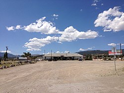
Orovada is a census-designated place in Humboldt County, Nevada. The population was 155 at the 2010 census.

U.S. Route 50 (US 50) is a transcontinental highway in the United States, stretching from West Sacramento, California, in the west to Ocean City, Maryland, on the east coast. The Nevada portion crosses the center of the state and was named "The Loneliest Road in America" by Life magazine in July 1986. The name was intended as a pejorative, but Nevada officials seized it as a marketing slogan. The name originates from large desolate areas traversed by the route, with few or no signs of civilization. The highway crosses several large desert valleys separated by numerous mountain ranges towering over the valley floors, in what is known as the Basin and Range province of the Great Basin.

U.S. Route 95 Truck is a truck route of US 95 in Mineral County, Nevada, in the United States. It serves as a bypass route for trucks taking US 95 past Hawthorne in either direction, as US 95 itself goes through that community. The route is co-designated as State Route 362 (SR 362); however, that designation is unsigned.

State Route 439 (SR 439) is a four-lane state highway in Lyon, Storey and Washoe Counties in Nevada. Better known as USA Parkway, the route connects U.S. Route 50 (US 50) in Silver Springs to Interstate 80 (I-80) in Clark via the Tahoe Reno Industrial Center (TRIC). The northern portion of USA Parkway was initially constructed by the industrial center's developers; however, the Nevada Department of Transportation (NDOT) agreed to assume control of the road after Tesla announced plans to build its Gigafactory at TRIC in 2014. NDOT opened the extension of SR 439 south to US 50 in Lyon County on September 8, 2017.
KXEQ is a radio station broadcasting a Regional Mexican format. Licensed to Reno, Nevada, United States, it serves the Reno area. The station is currently owned by Azteca Broadcasting Corporation.

U.S. Route 395 (US 395) is a United States Numbered Highway, stretching from Hesperia, California to the Canadian border in Laurier, Washington. The California portion of US 395 is a 557-mile (896 km) route which traverses from Interstate 15 (I-15) in Hesperia, north to the Oregon state line in Modoc County near Goose Lake. The route clips into Nevada, serving the cities Carson City and Reno, before returning to California.

U.S. Route 6 (US 6) is a United States Numbered Highway, stretching from Bishop, California in the west to Provincetown, Massachusetts on the East Coast. The Nevada portion crosses the center of the state, serving the cities of Tonopah and Ely, en route to Utah and points further east. Like US 50 to the north, large desolate areas are traversed by the route, with few or no signs of civilization, and the highway crosses several large desert valleys separated by numerous mountain ranges towering over the valley floors in what is known as the Basin and Range Province of the Great Basin.
U.S. Route 95 is a major U.S. highway traversing the U.S. state of Nevada from north to south directly through Las Vegas and providing connections to both Carson City and Reno. US 95 is cosigned with Interstate 80 for 95 miles (153 km) between a junction in Trinity and Winnemucca before heading north into Oregon at McDermitt. At 646.71 miles (1,040.78 km), it is the longest highway in Nevada.
U.S. Route 395 (US 395) is an 85-mile-long (137 km) United States Numbered Highway near Lake Tahoe in the state of Nevada. It traverses the state after entering from California in Topaz Lake and crosses back into California near Hallelujah Junction. US 395 serves the cities of Gardnerville, Minden, Carson City and Reno. All of US 395 north of Carson City is a freeway and is built up to Interstate Highway standards. Part of the freeway section is also designated as Interstate 580 (I-580). US 395 is an important regional highway, serving the communities of Western Nevada, connecting them to other major communities via California, and it is the only major north–south arterial for the geographically isolated region.
In the U.S. state of Nevada, U.S. Route 93 is a major United States Numbered Highway traversing the eastern edge of the state. The highway connects the Las Vegas area to the Great Basin National Park, and provides further connections to Ely and Wells. US 93 also provides the majority of the most direct connection from the major metropolitan areas of Las Vegas and Phoenix to the Boise, Idaho metropolitan area.
Roach is a ghost town and railroad siding in Clark County, Nevada, United States. It is located along the Union Pacific Railroad, between Jean, Nevada and Nipton, California.

Trego Hot Springs is located in the Black Rock Desert at the location of Trego, Nevada, a former station on the Western Pacific Railroad. The name "Trego" dates from the 1910s, just after the railroad was built. Previously, the springs had names like Hot Springs, Kyles Hot Springs (1864), Butte Spring, and Butte Hot Spring.

Lucky Boy is a ghost town in Mineral County, Nevada, approximately 5 mi (8.0 km) southwest of Hawthorne.

Jungo is a ghost town located on Humboldt County Route 55, between Winnemucca, Nevada and Sulphur, Nevada. At one time, Jungo boasted a hotel, store, filling station and blacksmith's shop, though no buildings remain.
Primeaux is an unincorporated community in Eureka County, Nevada, United States.

Dooby Lane is a folk art installation located near Gerlach, Nevada in the Black Rock Desert. Dooby Lane consists of a series of art installations that include aphorisms and the names of local residents carved in to stones. Larger installations such as "Ground Zero", Elvis, Imagination Station – Desert Broadcasting System are also present.