
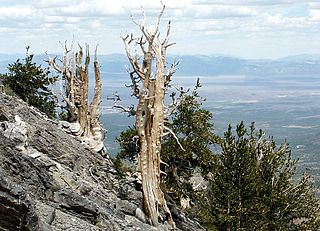
White Pine County is a largely rural, mountain county along the central eastern boundary of the U.S. state of Nevada. As of the 2020 census, the population was 9,080. Its county seat is Ely. The name "(Rocky Mountain) white pine" is an old name for the limber pine, a common tree in the county's mountains. The county boasts dark skies, clean air and millions of acres of unspoiled public land. It is the home of Great Basin National Park, one of America's most remote and least visited national parks. It is also home to no less than 14 federally designated wilderness areas, offering an abundance of terrain available to explore for hikers, backpackers, skiers, hunters and anglers. The Ely Shoshone Indian Reservation is located in the county, on the south side of the City of Ely. The reservation has a land area of 104.99 acres (0.4249 km2) and a 2000 census official resident population of 133 people.

The Humboldt–Toiyabe National Forest (HTNF) is the principal U.S. National Forest in the U.S. state of Nevada, and has a smaller portion further west in Eastern California in the state of California. With an area of 6,289,821 acres (25,454.00 km2), it is the largest U.S. National Forest reservation outside of Alaska, further northwest on the North American continent.

Fort Bridger was originally a 19th-century fur trading outpost established in 1842, on Blacks Fork of the Green River, in what is now Uinta County, Wyoming, United States. It became a vital resupply point for wagon trains on the Oregon, California, and Mormon Trails. The US Army established a military post here in 1858 during the Utah War, until it was finally closed in 1890. A small town, Fort Bridger, Wyoming, remains near the fort and takes its name from it.

The Reese River is a 181-mile-long (291 km) tributary of the Humboldt River, located in central Nevada in the western United States.

The Toiyabe Range is a mountain range in Lander and Nye counties, Nevada, United States. Most of the range is included within the Humboldt-Toiyabe National Forest. The highest point in the range, near its southern end, is Arc Dome, an area protected as the Arc Dome Wilderness. The highest point in Lander County, Bunker Hill, is also located within the Toiyabe Range. The range starts in northwestern Nye County north of Tonopah, Nevada and runs approximately 120 miles (190 km) north-northeast into southern Lander County, making it the second longest range in the state.
The Ruby Mountains are a mountain range, primarily located within Elko County with a small extension into White Pine County, in Nevada, United States. Most of the range is included within the Humboldt-Toiyabe National Forest. The range reaches a maximum elevation of 11,387 feet (3,471 m) on the summit of Ruby Dome. To the north is Secret Pass and the East Humboldt Range, and from there the Rubies run south-southwest for about 80 miles (130 km). To the east lies Ruby Valley, and to the west lie Huntington and Lamoille Valleys. The Ruby Mountains are the only range of an introduced bird, the Himalayan snowcock, in North America. The mountain range was named after the garnets found by early explorers. The central core of the range shows extensive evidence of glaciation during recent ice ages, including U-shaped canyons, moraines, hanging valleys, and steeply carved granite mountains, cliffs, and cirques.
The Snake War (1864–1868) was an irregular war fought by the United States of America against the "Snake Indians," the settlers' term for Northern Paiute, Bannock and Western Shoshone bands who lived along the Snake River. Fighting took place in the states of Oregon, Nevada, and California, and in Idaho Territory. Total casualties from both sides of the conflict numbered 1,762 dead, wounded, or captured.

Western Shoshone comprise several Shoshone tribes that are indigenous to the Great Basin and have lands identified in the Treaty of Ruby Valley 1863. They resided in Idaho, Nevada, California, and Utah. The tribes are very closely related culturally to the Paiute, Goshute, Bannock, Ute, and Timbisha tribes.
The Department of the Pacific or Pacific Department was a major command (Department) of the United States Army from 1853 to 1858. It replaced the Pacific Division, and was itself replaced by the Department of California and the Department of Oregon.

Ruby Valley is a large basin located in south-central Elko and northern White Pine counties in the northeastern section of the state of Nevada in the western United States. From Secret Pass it runs south-southwest for approximately 60 miles (96 km) to Overland Pass. To the west is the steep escarpment of the Ruby Mountains, and to the north is the East Humboldt Range and Clover Valley. The east side of the valley is less well defined, but its maximum width is about 10 miles (16 km) near Franklin Lake. At its south end lies the Ruby Lake National Wildlife Refuge.
The White Pine Range is a group of mountains in southern White Pine County, in eastern Nevada. The range runs for approximately 51 miles (82 km) from Beck Pass in the north to Currant Pass in the south. To the west of the range are the Duckwater (Shoshone) tribal lands and the northern arm of large Railroad Valley. To the east are Jakes Valley and the northern part of the long White River Valley. To the south are the Horse and Grant Ranges.
The Currant Mountain Wilderness is a 47,357-acre (19,165 ha) wilderness area centered on Currant Mountain in the White Pine Range of Nye County and White Pine County, in the eastern section of the state of Nevada in the western United States.
The Treaty of Ruby Valley was a treaty signed with the Western Shoshone in 1863, giving certain rights to the United States in the Nevada Territory. The Western Shoshone did not cede land under this treaty but agreed to allow the U.S. the "right to traverse the area, maintain existing telegraph and stage lines, construct one railroad and engage in specified economic activities. The agreement allows the U.S. president to designate reservations, but does not tie this to land cessions."
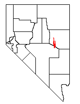
Hobson is a ghost town in White Pine County, Nevada, United States, in or near Ruby Valley. Hobson is the site of Fort Ruby, a National Historic Landmark.

Nevada's entry into statehood in the United States on October 31, 1864, in the midst of the American Civil War, was expedited by Union sympathizers in order to ensure the state's participation in the 1864 presidential election in support of President Abraham Lincoln. Thus Nevada became one of only two states admitted to the Union during the war and earned the nickname that appears on the Nevada state flag today: "Battle Born".
Ruby Mountains National Forest was established as the Ruby Mountains Forest Reserve by the U.S. Forest Service in the Ruby Mountains of northeastern Nevada on May 3, 1906 with 423,660 acres (1,714.5 km2). It became a National Forest on March 4, 1907. On July 1, 1908 the entire forest was added to Humboldt National Forest and the name was discontinued until Ruby National Forest was established from Humboldt in 1912. The lands are presently part of the Ruby Mountain District of Humboldt-Toiyabe National Forest.
Mount Tenabo is the principal peak in the Cortez Mountains. The mountain is of cultural and religious significance to the Western Shoshone people.

The 3rd Regiment California Volunteer Infantry was an infantry regiment in the Union Army during the American Civil War.
During the American Civil War in the early 1860s, the District of Utah was a subordinate district of the U.S. Army's Department of the Pacific. The district was composed of territorial areas that later became parts of the modern U.S. states of Idaho, Nevada, and Utah.
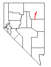
Schellbourne, formerly known as Fort Schellbourne and Schell Creek Station is a ghost town located in the Schell Creek Range in White Pine County in Nevada, United States, located 43 miles (69 km) north of Ely. The town was a stopover along the Central Overland Route, Pony Express and original routing of the Lincoln Highway. It is today Nevada Historical Marker number 51. The site was listed on the National Register of Historic Places in 1972. Its boundaries were increased in 1977.


