Manokin, Maryland | |
|---|---|
 Manokin | |
| Coordinates: 38°06′55″N75°45′21″W / 38.11528°N 75.75583°W | |
| Country | |
| State | |
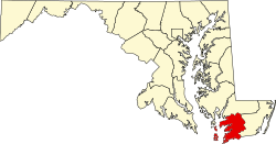
| County | |
| Elevation | 7 ft (2.1 m) |
| Time zone | UTC-5 (Eastern (EST)) |
| • Summer (DST) | UTC-4 (EDT) |
| ZIP Code | 21836 |
| Area codes | 410, 443, and 667 |
| GNIS feature ID | 590728 [1] |
Manokin is an unincorporated community in Somerset County, Maryland, United States. [1] It is located on Maryland Route 361 at the intersection of River Road. The George Maddox Farm, Sudler's Conclusion and Waters' River are listed on the National Register of Historic Places. [2]