Mariana, Humacao, Puerto Rico

Last updated
Mariana
Barrio
Mariana, Humacao, Puerto Rico locator map.png
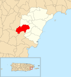
Location of Mariana within the municipality of Humacao shown in red
Caribbean location map.svg
Red pog.svg
Mariana
Location of Puerto Rico
Coordinates: 18°07′34″N65°51′10″W / 18.126161°N 65.8527°W / 18.126161; -65.8527 [1]
Commonwealth Flag of Puerto Rico.svg Puerto Rico
Municipality Flag of Humacao.svg Humacao
Area
[1]
  Total
4.37 sq mi (11.3 km2)
  Land4.37 sq mi (11.3 km2)
  Water0 sq mi (0 km2)
Elevation
[2]
545 ft (166 m)
Population
 (2010)
  Total
3,230
  Density739.1/sq mi (285.4/km2)
 Source: 2010 Census
Time zone UTC−4 (AST)
ZIP Code
00791

Mariana is a barrio in the municipality of Humacao, Puerto Rico. Its population in 2010 was 3,230. [3] [4] [5]

Contents

Festivals The breadfruit festival occurs on the last Friday of August ending on Sunday with a span of three days. It celebrates the fruit, and it is prepared in many ways, people make tostones, ice cream and more with them. Famous salsa singers also perform there, which attracts people from surrounding municipalities like Naguabo and Yabucoa. It is held in La Loma de La Niña Mariana.

History

Mariana was in Spain's gazetteers [6] until Puerto Rico was ceded by Spain in the aftermath of the Spanish–American War under the terms of the Treaty of Paris of 1898 and became an unincorporated territory of the United States. In 1899, the United States Department of War conducted a census of Puerto Rico finding that the population of Mariana barrio was 1,296. [7]

Historical population
CensusPop.Note
1900 1,296
1910 1,58622.4%
1920 1,87818.4%
1930 1,9443.5%
1940 2,73940.9%
1950 2,182−20.3%
1960 2,43911.8%
1970 1,944−20.3%
1980 2,53930.6%
1990 2,97917.3%
2000 3,2378.7%
2010 3,230−0.2%
U.S. Decennial Census
1899 (shown as 1900) [8] 1910-1930 [9]
1930-1950 [10] 1980-2000 [11] 2010 [12]

See also

References

  1. 1 2 "US Gazetteer 2019". US Census. US Government.
  2. U.S. Geological Survey Geographic Names Information System: Mariana barrio
  3. Picó, Rafael; Buitrago de Santiago, Zayda; Berrios, Hector H. Nueva geografía de Puerto Rico: física, económica, y social, por Rafael Picó. Con la colaboración de Zayda Buitrago de Santiago y Héctor H. Berrios. San Juan Editorial Universitaria, Universidad de Puerto Rico,1969.
  4. Gwillim Law (20 May 2015). Administrative Subdivisions of Countries: A Comprehensive World Reference, 1900 through 1998. McFarland. p. 300. ISBN   978-1-4766-0447-3 . Retrieved 25 December 2018.
  5. Puerto Rico: 2010 Population and Housing Unit Counts.pdf (PDF). U.S. Dept. of Commerce, Economics and Statistics Administration, U.S. Census Bureau. 2010.
  6. "Anuario del comercio, de la industria, de la magistratura y de la administración. 1881". Biblioteca Nacional de España (in Spanish). p. 1614. Retrieved 4 April 2023.
  7. Joseph Prentiss Sanger; Henry Gannett; Walter Francis Willcox (1900). Informe sobre el censo de Puerto Rico, 1899, United States. War Dept. Porto Rico Census Office (in Spanish). Imprenta del gobierno. p.  163.
  8. "Report of the Census of Porto Rico 1899". War Department Office Director Census of Porto Rico. Archived from the original on July 16, 2017. Retrieved September 21, 2017.
  9. "Table 3-Population of Municipalities: 1930 1920 and 1910" (PDF). United States Census Bureau. Archived (PDF) from the original on August 17, 2017. Retrieved September 21, 2017.
  10. "Table 4-Area and Population of Municipalities Urban and Rural: 1930 to 1950" (PDF). United States Census Bureau. Archived (PDF) from the original on August 30, 2015. Retrieved September 21, 2014.
  11. "Table 2 Population and Housing Units: 1960 to 2000" (PDF). United States Census Bureau. Archived (PDF) from the original on July 24, 2017. Retrieved September 21, 2017.
  12. Puerto Rico: 2010 Population and Housing Unit Counts.pdf (PDF). U.S. Dept. of Commerce Economics and Statistics Administration U.S. Census Bureau. 2010. Archived (PDF) from the original on 2017-02-20. Retrieved 2019-08-02.