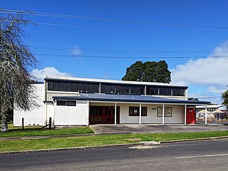
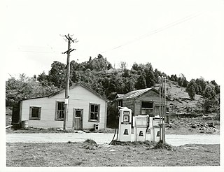
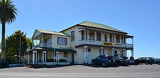
Maungatautari is a rural community in Waipa District, Waikato Region, New Zealand. It is located between Maungatautari Mountain and Lake Karapiro on the Waikato River. Horohora township is to its north west. Pukeatua township is on the southern flank of the volcano overlooked by a south eastern peak called Te Akatarere.
Maungatautari community is in an SA1 statistical area which covers 11.68km2 (4.51sqmi).[1] The SA1 area is part of the larger Maungatautari statistical area.
Historical population of the community and surrounds
The SA1 area had a population of 135 at the 2018 New Zealand census, an increase of 12 people (9.8%) since the 2013 census, and an increase of 18 people (15.4%) since the 2006 census. There were 51 households, comprising 69 males and 69 females, giving a sex ratio of 1.0 males per female. The median age was 35.4 years (compared with 37.4 years nationally), with 27 people (20.0%) aged under 15 years, 30 (22.2%) aged 15 to 29, 57 (42.2%) aged 30 to 64, and 18 (13.3%) aged 65 or older.[citation needed]
Ethnicities were 91.1% European/Pākehā, 17.8% Māori, 2.2% Pacific peoples, and 2.2% other ethnicities. People may identify with more than one ethnicity.
Although some people chose not to answer the census's question about religious affiliation, 46.7% had no religion, 48.9% were Christian, and 2.2% had Māori religious beliefs.
Of those at least 15 years old, 18 (16.7%) people had a bachelor's or higher degree, and 21 (19.4%) people had no formal qualifications. The median income was $36,900, compared with $31,800 nationally. 18 people (16.7%) earned over $70,000 compared to 17.2% nationally. The employment status of those at least 15 was that 69 (63.9%) people were employed full-time, 12 (11.1%) were part-time, and 3 (2.8%) were unemployed.[2]
Maungatautari statistical area
Maungatautari statistical area covers 113.00km2 (43.63sqmi)[1] and had an estimated population of 950 as of June 2023,[5] with a population density of 8.4 people per km2.
Maungatautari statistical area had a population of 822 at the 2018 New Zealand census, an increase of 72 people (9.6%) since the 2013 census, and an increase of 105 people (14.6%) since the 2006 census. There were 303 households, comprising 414 males and 408 females, giving a sex ratio of 1.01 males per female. The median age was 39.0 years (compared with 37.4 years nationally), with 165 people (20.1%) aged under 15 years, 165 (20.1%) aged 15 to 29, 390 (47.4%) aged 30 to 64, and 102 (12.4%) aged 65 or older.[citation needed]
Ethnicities were 89.1% European/Pākehā, 12.0% Māori, 1.1% Pacific peoples, 3.3% Asian, and 1.5% other ethnicities. People may identify with more than one ethnicity.
The percentage of people born overseas was 18.6, compared with 27.1% nationally.[citation needed]
Although some people chose not to answer the census's question about religious affiliation, 54.4% had no religion, 36.5% were Christian, 1.8% had Māori religious beliefs, 0.4% were Hindu, 0.7% were Buddhist and 1.5% had other religions.[citation needed]
Of those at least 15 years old, 141 (21.5%) people had a bachelor's or higher degree, and 87 (13.2%) people had no formal qualifications. The median income was $41,200, compared with $31,800 nationally. 138 people (21.0%) earned over $70,000 compared to 17.2% nationally. The employment status of those at least 15 was that 381 (58.0%) people were employed full-time, 96 (14.6%) were part-time, and 15 (2.3%) were unemployed.[6]
Education
Maungatautari School was a primary school established in 1903[7] and closed in 2011.[8]
Students now attend Horahora School, a co-educational state primary school,[9][10] with a roll of 41 as of February 2024.[11] The school was established in 1909.[12]
Related Research Articles
Waikato Tainui, Waikato or Tainui is a group of Māori iwi based in Waikato Region, in the western central region of New Zealand's North Island. It is part of the larger Tainui confederation of Polynesian settlers who arrived to New Zealand on the Tainui waka. The tribe is named after the Waikato River, which plays a large part in its history and culture.
Te Poi is a small village in rural Waikato, New Zealand, established in 1912 at the base of the Kaimai Range. Te Poi is part of a thriving farming area, particularly for dairying, thoroughbred horse breeding and cropping.
Matauri Bay is a bay in New Zealand, situated 30 km north of Kerikeri, in Whangaroa county, just north of the Bay of Islands. It has over a kilometre of white sand and crystal clear water, making it a popular summer destinations for surfers, divers, fishers and holidaymakers.
Arapuni is a rural town centre on the Waikato river in the South Waikato District of New Zealand. The town sits next to the Arapuni Dam, a hydroelectric dam at Lake Arapuni commissioned in 1929. The Arapuni Power Station consists of eight turbines which give a total output of 196 MW, the largest of the power stations on the Waikato river. The Arapuni hydro station is owned and operated by Mercury Energy.
Kaeo is a township in the Far North District of New Zealand, located some 22 km (14 mi) northwest of Kerikeri. The town's name comes from the Māori-language name of the New Zealand freshwater mussel, which is found in nearby rivers.
Tautoro is a locality about 8 km south-southeast of Kaikohe in Northland, New Zealand. Further to the south is the Awarua rural community.
Pukepoto is a town in Northland, New Zealand. It lies south west of Kaitaia and north east of Ahipara. The Herekino Forest lies to the south east.
Waikare is a locality in Northland, New Zealand. The Waikare River flows from the Russell Forest past Waikare and into the Waikare Inlet, which leads into the Bay of Islands.
Kennedy Bay is a locality in the north eastern Coromandel Peninsula of New Zealand. The Harataunga and Omoho Streams flow from the Coromandel Range past the settlement and into the bay to the east.
Karetu is a community in the Northland Region of the North Island of New Zealand. Kawakawa is to the west, and Waikare is northeast. The Karetu River flows from the Russell Forest in the southeast through Karetu, and joins the Kawakawa River shortly before it flows into the Bay of Islands.
Motatau or Mōtatau is a locality in the Northland Region of the North Island of New Zealand. Maromaku is to the east. The Taikirau Stream flows from east through Motatau and then runs northwest to join the Waiharakeke Stream. The North Auckland Line runs through Motatau.
Onewhero is a village and rural community in the Waikato District and Waikato region of New Zealand's North Island.
Tahuna is a small rural settlement located 18 km north of Morrinsville. In the Māori language Tahuna means sandbank, likely to refer to the sandbanks along the nearby Piako River, where a Māori settlement started. Tahuna is seen as the upper limit for navigatable travel on the Piako River. The settlement has a rugby club, a lawn bowls club, a golf course and various shops.
Mokai is a rural community in the Taupō District and Waikato region of New Zealand's North Island.
Rangiriri is a rural community in the Waikato District and Waikato region of New Zealand's North Island. It is located on the Waikato River near Lake Waikare in the Waikato District. State Highway 1 now bypasses Rangiriri.
Ngāti Korokī Kahukura is a Māori iwi of the Maungatautari area of the Waikato in New Zealand. It was formed by the coming together of two related hapū, Ngāti Korokī and Ngāti Kahukura. It has historic affiliations with Ngāti Raukawa and Ngāti Hauā – some members identify as Ngāti Raukawa. It is associated with the Tainui canoe.
Pokuru is a rural community in the Waipa District and Waikato region of New Zealand's North Island.
Oruanui is a rural community in the Taupō District and Waikato region of New Zealand's North Island, located northwest of Wairakei on State Highway 1.
Waikeria is a rural community in the Otorohanga District and Waikato region of New Zealand's North Island.
Takahue is a rural community in the Far North District and Northland Region of New Zealand's North Island, south of Kaitaia.
This page is based on this Wikipedia article Text is available under the CC BY-SA 4.0 license; additional terms may apply. Images, videos and audio are available under their respective licenses.