Te Pahu

Last updated

Te Pahu (tee-pa-hoo-ee)
Village
Te Pahu and Kakepuku from Karamu Walkway.jpg
Te Pahu and Kakepuku from Karamu Walkway
Te Pahu
Coordinates: 37°56′07″S175°10′22″E / 37.935145°S 175.172865°E / -37.935145; 175.172865
CountryNew Zealand
Region Waikato
District Waipa District
WardPirongia Ward
Electorates
Government
  Territorial Authority Waipa District Council
  Regional council Waikato Regional Council
Area
[1]
  Territorial33.20 km2 (12.82 sq mi)
Elevation
50 m (160 ft)
Population
 (2018 Census) [2]
  Territorial468
  Density14/km2 (37/sq mi)
Time zone UTC+12 (NZST)
  Summer (DST) UTC+13 (NZDT)

Te Pahu is a rural community in the Waipa District and Waikato region of New Zealand's North Island, located just north of Cambridge across State Highway 1.

Contents

It is located north of Pirongia and south of Ngāhinapōuri just off State Highway 39.

Karamu Walkway runs along the Kapamahunga Range to the north of the village. It is part of Te Araroa long-distance walkway. [3]

History

Early history

The first recorded settlers of the area are descendants of the Tainui waka, led by Māhanga, who established Purakau Pā at the junction of the Kaniwhaniwha stream and the Waipā River and settled the lower valley in the late sixteenth century. [4] Māhanga's son Tonganui suffered a major defeat to Kawhia Māori. The tribe suffered a major defeat to Europeans during the Invasion of the Waikato; their land was confiscated and they were forced to relocate to the north. [5]

In 1879 peace negotiations Prime Minister Grey said Harapepe was excluded from the proposal to return Waikato lands to King Tāwhiao, even though former Minister of Native Affairs, Donald McLean, had included it in his offer of terms. A Waitangi Tribunal report says, "This was, it seems, the first official public admission that not all Crown lands were to be made available to return to the Kīngitanga. In particular, the Grey Government planned to exclude the blocks that McLean had repurchased specifically to include them in the package of lands ringfenced for return, which were mostly in the Harapepe district around Pirongia. But Grey did say that some Harapepe lands would be set aside as an endowment for a school at which Kīngitanga children could be educated." [6]

European settlement

The first European settler in the area was John Vittoria Cowell, a Kawhia trader, [7] who was given about 40,000 acres (16,000 ha) by Ngāti Apakura in October 1839. [8] He was the son of John Cowell, a lay missionary, who came to work with Samuel Marsden. [9] After the 1864 invasion, John Cowell lost all his lands under the Confiscation Act and died in poverty. [10] His Homewood house, on Rosborough Road, [11] to the south of Te Pahu, may date from 1841 and be the oldest surviving building in Waikato. [12]

During the war the area was settled by British militia, who were banned from leaving the area but often too poor to buy crops to continue living there. Many lots were abandoned; settlers who continued living there constantly feared attack from local Māori and often sought shelter in a blockhouse. A local industry of flax milling, and mixed cow and pig farming. [5]

The limeworks opened in 1917. The staithe in the foreground looks like it might have been part of the original quarry. The limeworks opened in 1917. The staithe in the foreground looks like it might have been part of the original quarry.jpg
The limeworks opened in 1917. The staithe in the foreground looks like it might have been part of the original quarry.

Te Pahu remained extremely isolated for many years, with settlers relying on supplies delivered by the Waipā River. A pub and general store were established in the 1860s, followed by a post office in 1866 and a school house in 1877. The school house was used for monthly Presbyterian church services; it closed briefly and reopened before burning down in 1891; another school opened nearby in 1889 and took in the remaining students. [5]

A bridge was built over the river in 1881, reducing the community's isolation. [5]

The area was struck by major flooding in 1907 and February 1958, leaving the community again cut off from Te Awamutu and Hamilton. [5]

A limeworks was built on Limeworks Loop Rd in 1917. [13]

Harapepe

The name Harapepe remains on the modern map, [14] 1.2 km (0.75 mi) south of Te Pahu Road corner, though it has lost all but a few houses. It was originally the main military settlement in the area, with –

  • a blockhouse (in a 1943 aerial photo it was c. 20 m (66 ft) square on a long ridge, but is now only a slight mound),
  • a redoubt (built in February 1865 by the Forest Rangers, but no longer visible), [15]
  • a store,
  • Settlers Arms Hotel,
  • Harapepe School (1877–91), [16]
  • a Post Office [17] (1867–1930) [18]

The importance of Harapepe seems to have declined after Harapepe dairy was built at Te Pahu in 1897 [19] and was joined in 1909 [18] by neighbouring Te Pahu Post Office. [20] A daily mail service to both post offices started in 1913 [21] and was taking passengers in 1914. [22] Te Pahu Hall also opened nearby in 1911. [23] The hall was renovated and extended between 1979 and 1981. [24]

As late as 1935 the name Harapepe was still being used to describe a proposed extension of electric power supplies. [25]

Modern history

Te Pahu Community Hall Te Pahu Hall.jpg
Te Pahu Community Hall

In the 1920s and 1930s Robertson, [26] then Hodgson's, Motors ran a daily bus from Pirongia to Hamilton via Te Pahu. [27]

A new garage and general store was established in 1952. A limeworks opened in 1972. [5] The Post Office was among many closed by Richard Prebble on 5 February 1988. [28]

In 2019, Waikato Regional Council reported a surge of complaints about farm effluent discharges from farms at several Waikato locations including Te Pahu. [29]

Demographics

Te Pahu settlement is in three SA1 statistical areas which also include Harapepe and cover 33.20 km2 (12.82 sq mi). [1] The SA1 areas are part of the larger Te Pahu statistical area.

Historical population of Te Pahu and surrounds
YearPop.±% p.a.
2006387    
2013399+0.44%
2018468+3.24%
Source: [2]

The SA1 areas had a population of 468 at the 2018 New Zealand census, an increase of 69 people (17.3%) since the 2013 census, and an increase of 81 people (20.9%) since the 2006 census. There were 159 households, comprising 243 males and 231 females, giving a sex ratio of 1.05 males per female, with 117 people (25.0%) aged under 15 years, 72 (15.4%) aged 15 to 29, 237 (50.6%) aged 30 to 64, and 42 (9.0%) aged 65 or older.

Ethnicities were 89.1% European/Pākehā, 10.3% Māori, 1.9% Pacific peoples, 1.9% Asian, and 5.1% other ethnicities. People may identify with more than one ethnicity.

Although some people chose not to answer the census's question about religious affiliation, 58.3% had no religion, 30.1% were Christian, 0.6% were Buddhist and 2.6% had other religions.

Of those at least 15 years old, 87 (24.8%) people had a bachelor's or higher degree, and 48 (13.7%) people had no formal qualifications. 69 people (19.7%) earned over $70,000 compared to 17.2% nationally. The employment status of those at least 15 was that 198 (56.4%) people were employed full-time, 57 (16.2%) were part-time, and 18 (5.1%) were unemployed. [2]

Te Pahu statistical area

Te Pahu statistical area covers 158.16 km2 (61.07 sq mi) [1] and had an estimated population of 1,590 as of June 2022, [30] with a population density of 10.1 people per km2.

Historical population for the statistical area
YearPop.±% p.a.
20061,194    
20131,269+0.87%
20181,428+2.39%
Source: [31]

The statistical area had a population of 1,428 at the 2018 New Zealand census, an increase of 159 people (12.5%) since the 2013 census, and an increase of 234 people (19.6%) since the 2006 census. There were 507 households, comprising 744 males and 684 females, giving a sex ratio of 1.09 males per female. The median age was 39.1 years (compared with 37.4 years nationally), with 318 people (22.3%) aged under 15 years, 228 (16.0%) aged 15 to 29, 735 (51.5%) aged 30 to 64, and 150 (10.5%) aged 65 or older.

Ethnicities were 91.2% European/Pākehā, 10.1% Māori, 1.3% Pacific peoples, 2.3% Asian, and 4.4% other ethnicities. People may identify with more than one ethnicity.

The percentage of people born overseas was 15.1, compared with 27.1% nationally.

Although some people chose not to answer the census's question about religious affiliation, 56.1% had no religion, 32.8% were Christian, 0.2% were Buddhist and 2.3% had other religions.

Of those at least 15 years old, 270 (24.3%) people had a bachelor's or higher degree, and 165 (14.9%) people had no formal qualifications. The median income was $40,300, compared with $31,800 nationally. 246 people (22.2%) earned over $70,000 compared to 17.2% nationally. The employment status of those at least 15 was that 633 (57.0%) people were employed full-time, 195 (17.6%) were part-time, and 33 (3.0%) were unemployed. [31]

YearPopulationAverage ageHouseholdsMedian incomeNational median income
2001111033.9363$28,000$18,500
2006119436.2411$29,000$24,100
2013126941.3462$36,500$27,900
2018142839.1507$40,300$31,800

Education

Te Pahu School is a co-educational state primary school for Year 1 to 8 students, [32] with a roll of 105 as of April 2023. [33] The school opened in 1911. [34]

Notable people

See also

Related Research Articles

<span class="mw-page-title-main">Raglan, New Zealand</span> Minor urban area in Waikato, New Zealand

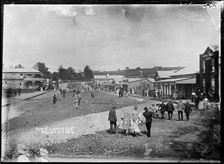
Raglan is a small beachside town located 48 km west of Hamilton, New Zealand on State Highway 23. It is known for its surfing, and volcanic black sand beaches.

<span class="mw-page-title-main">Ngāruawāhia</span> Town in Waikato, New Zealand

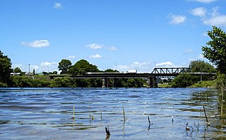
Ngāruawāhia is a town in the Waikato region of the North Island of New Zealand. It is located 20 kilometres (12 mi) north-west of Hamilton at the confluence of the Waikato and Waipā Rivers, adjacent to the Hakarimata Range. Ngāruawāhia is in the Hamilton Urban Area, the fourth largest urban area in New Zealand. The location was once considered as a potential capital of New Zealand.

<span class="mw-page-title-main">Te Awamutu</span> Town in Waikato, New Zealand

Te Awamutu is a town in the Waikato region in the North Island of New Zealand. It is the council seat of the Waipa District and serves as a service town for the farming communities which surround it. Te Awamutu is located some 30 kilometres (19 mi) south of Hamilton on State Highway 3, one of the two main routes south from Auckland and Hamilton.

<span class="mw-page-title-main">Waipā River</span> River in New Zealand

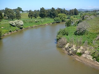
The Waipā River is in the Waikato region of the North Island of New Zealand. The headwaters are in the Rangitoto Range east of Te Kuiti. It flows north for 115 kilometres (71 mi), passing through Ōtorohanga and Pirongia, before flowing into the Waikato River at Ngāruawāhia. It is the Waikato's largest tributary. The Waipā's main tributary is the Puniu River.

<span class="mw-page-title-main">Waikato District</span> Territorial authority district in Waikato, New Zealand

Waikato District is a territorial authority of New Zealand, in the northern part of Waikato region, North Island. Waikato District is administered by the Waikato District Council, with headquarters in Ngāruawāhia.

<span class="mw-page-title-main">Waipā District</span> Territorial authority district in Waikato, New Zealand

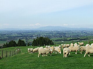
Waipa District is a municipality in the Waikato region of New Zealand that is administered by the Waipa District Council. Its most populous town is Cambridge. The seat of the council is at the second most populous town, Te Awamutu. The district is south and south-east of the city of Hamilton. It has five wards: Te Awamutu, Cambridge, Pirongia, Maungatautari and Kakepuku.

<span class="mw-page-title-main">Ōtorohanga</span> Town in Waikato, New Zealand

Ōtorohanga is a north King Country town in the Waikato region in the North Island of New Zealand. It is located 53 kilometres (33 mi) south of Hamilton and 18 kilometres (11 mi) north of Te Kūiti, on the Waipā River. It is a service town for the surrounding dairy-farming district. It is recognised as the "gateway" to the Waitomo Caves and as the "Kiwiana Town" of New Zealand. Until 2007, Ōtorohanga held a yearly 'Kiwiana Festival.'

<span class="mw-page-title-main">Kawhia Harbour</span> Harbour and settlement in Waikato, New Zealand

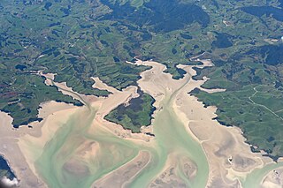
Kawhia Harbour is one of three large natural inlets in the Tasman Sea coast of the Waikato region of New Zealand's North Island. It is located to the south of Raglan Harbour, Ruapuke and Aotea Harbour, 40 kilometres southwest of Hamilton. Kawhia is part of the Ōtorohanga District and is in the King Country. It has a high-tide area of 68 km2 (26 sq mi) and a low-tide area of 18 km2 (6.9 sq mi). Te Motu Island is located in the harbour.

<span class="mw-page-title-main">Pirongia</span> Settlement in Waikato, New Zealand

Pirongia is a small town in the Waipa District of the Waikato region of New Zealand's North Island. It is 12 kilometres to the west of Te Awamutu, on the banks of the Waipā River, close to the foot of the 962 metre Mount Pirongia, which lies in Pirongia Forest Park to the west of the town.

<span class="mw-page-title-main">Mount Pirongia</span> Extinct volcano in Waikato district of New Zealand

Mount Pirongia is an extinct stratovolcano located in the Waikato region of New Zealand's North Island. It rises to 959 m (3,146 ft) and is the highest peak in the Waikato region. Pirongia's many peaks are basaltic cones created by successive volcanic eruptions between the late Pliocene and early Pleistocene, about 2.5 million years ago. In the adjacent picture, the characteristic profile of the mountain can be seen, along with a prominent accessory cone to the right.

<span class="mw-page-title-main">Ōpārau River</span> River in New Zealand

The Ōpārau River is a river of the Waikato Region of New Zealand's North Island in the area occupied by Ngāti Hikairo. It flows southwest from its sources in the Pirongia Forest Park, the highest being The Cone, and flows into the Kawhia Harbour, 5 kilometres (3 mi) east of Kawhia. The river has about 171 km (106 mi) of tributaries.

<span class="mw-page-title-main">Whatawhata</span> Town in Waikato, New Zealand

Whatawhata, previously also spelt Whata Whata, is a small town in the Waikato region on the east bank of the Waipā River, at the junction of State Highways 23 and 39, 12 km (7.5 mi) from Hamilton. Te Araroa tramping route passes through Whatawhata.

<span class="mw-page-title-main">Te Kawa</span> Settlement in Waikato, New Zealand

Te Kawa is a rural community in the Ōtorohanga District and Waikato region of New Zealand's North Island. It lies just to the south of the volcanic hills of Kakepuku and Te Kawa. Until the swamp was drained in the 1900s, Te Kawa was well known for its eels.

State Highway 39 (SH 39) is a New Zealand state highway that forms a western bypass of the city of Hamilton. Gazetted in 1999, it is a generally quicker route to get between Auckland and New Plymouth as well as connecting to the Waitomo Caves, just south of the SH 39 southern terminus. The southernmost 14 km section has a concurrency with SH 31, as this highway has existed for much longer.

<span class="mw-page-title-main">State Highway 31 (New Zealand)</span> Road in New Zealand

State Highway 31 (SH 31) is a New Zealand state highway in the Waikato region. It provides a link to the harbour town of Kawhia on the west coast of the North Island.

<span class="mw-page-title-main">Te Uku</span> Settlement in Waikato, New Zealand

Te Uku is a small, mainly farming, settlement on SH23 in the North Island of New Zealand, located 34 km (21 mi) from Hamilton and 11 km (6.8 mi) from Raglan. It has a 4-Square shop, church, coffee stall and art gallery, filling station, hall, school and Xtreme Zero Waste recycle bins.

<span class="mw-page-title-main">Rangiaowhia</span> Former Village in Waikato region, New Zealand

Rangiaowhia was, for over 20 years, a thriving village on a ridge between two streams in the Waikato region, about 4 km (2.5 mi) east of Te Awamutu. From 1841 it was the site of a very productive Māori mission station until the Invasion of the Waikato in 1864. The station served Ngāti Hinetu and Ngāti Apakura. Only a church remains from those days, the second oldest Waikato building.

<span class="mw-page-title-main">Te Ākau</span> Settlement in Waikato, New Zealand

Te Ākau is a small farming settlement in the North Island of New Zealand, located 62 km (39 mi) north west of Hamilton, 39 km (24 mi) south west of Huntly, 45 km (28 mi) south of Port Waikato and 47 km (29 mi), or 19 km (12 mi) by ferry and road, north of Raglan. It has a hall and a school.

<span class="mw-page-title-main">Waitetuna</span> Village in Waikato region, New Zealand

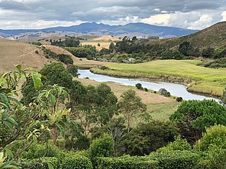
Waitetuna is a rural community in the Waikato District and Waikato region of New Zealand's North Island. It is located on the valley of the Waitetuna River, upstream from the Raglan Harbour.

<span class="mw-page-title-main">Te Rore</span> Locality in Waikato region, New Zealand

Te Rore was in the 1850s an important transhipment point on New Zealand's Waipā River, between the agriculture of the Waikato basin and its Auckland market. That was ended in 1864 by the Invasion of the Waikato, when Te Rore was, for a few months, part of the supply route to four redoubts set up nearby. It is now a rural community in the Waipa District, 6 km (3.7 mi) north of Pirongia and roughly the same distance south of Ngāhinapōuri on State Highway 39.

References

  1. 1 2 3 "ArcGIS Web Application". statsnz.maps.arcgis.com. Retrieved 22 October 2022.
  2. 1 2 3 "Statistical area 1 dataset for 2018 Census". Statistics New Zealand. March 2020. 7012646–7012648.
  3. "Karamu Walkway". www.doc.govt.nz. Retrieved 16 March 2020.
  4. Jones & Biggs 2004, pp. 118–119.
  5. 1 2 3 4 5 6 Clark, N (1986). "Te Pahu School 75th Jubilee Book". tepahu.co.nz. Te Pahu School.
  6. "Te Mana Whatu Ahuru Waitangi Tribunal Report 2018" (PDF).
  7. "(Enclosure in No. 409.) — Conveyance from Te Kiwi to J. V. Cowell, of Kawhia". nzetc.victoria.ac.nz. 11 January 1840. Retrieved 25 June 2021.
  8. Boulton, Leanne (March 2011). "HAPU AND IWI LAND TRANSACTIONS WITH THE CROWN AND EUROPEANS IN TE ROHE POTAE INQUIRY DISTRICT, C. 1840–1865" (PDF). Waitangi Tribunal.
  9. Hart, Philip (2016). "Te Aroha Mining District Working Papers No. 96" (PDF). University of Waikato.
  10. Boulton, Leanne (March 2011). "HAPU AND IWI LAND TRANSACTIONS WITH THE CROWN AND EUROPEANS IN TE ROHE POTAE INQUIRY DISTRICT, C. 1840–1865" (PDF). Waitangi Tribunal.
  11. "139 Rosborough Rd". Google Maps. Retrieved 9 July 2021.
  12. "Homewood". www.heritage.org.nz. Retrieved 19 June 2021.
  13. "THE WAIPA FARMERS' LIMECRUSHING COMPANY". paperspast.natlib.govt.nz. 2 April 1917. Retrieved 16 March 2020.
  14. "Harapepe, Waikato". NZ Topo Map. Retrieved 20 March 2020.
  15. Prickett, Nigel (May 2016). "Fortifications of the New Zealand Wars – 4. Waikato" (PDF). Department of Conservation. ISBN   978-0-478-15069-8.
  16. "Local History | Te Pahu Community Website" . Retrieved 20 March 2020.
  17. "Harapepe Post Office". Te Awamutu Museum Collection Online. Retrieved 20 March 2020.
  18. 1 2 "Post Offices | Te Pahu Community Website" . Retrieved 20 March 2020.
  19. "Waipa Heritage Trail" (PDF). Waipa District Council. 2008. ISBN   978-0-473-14254-4.
  20. "CORRESPONDENCE HARAPEPE POST OFFICE. WAIKATO ARGUS". paperspast.natlib.govt.nz. 9 October 1913. Retrieved 20 March 2020.
  21. "MAIL NOTICES. WAIKATO ARGUS". paperspast.natlib.govt.nz. 3 November 1913. Retrieved 20 March 2020.
  22. "Page 3 Advertisements Column 4 WAIKATO ARGUS". paperspast.natlib.govt.nz. 25 March 1914. Retrieved 11 April 2020.
  23. "OPENING THE TE PAHU HALL. WAIKATO ARGUS". paperspast.natlib.govt.nz. 11 March 1911. Retrieved 20 March 2020.
  24. "Hall | Te Pahu Community Website" . Retrieved 20 March 2020.
  25. "ELECTRIC SUPPLY. WAIPA POST". paperspast.natlib.govt.nz. 21 October 1935. Retrieved 20 March 2020.
  26. "Page 5 Advertisements Column 1 NEW ZEALAND HERALD". paperspast.natlib.govt.nz. 11 June 1926. Retrieved 20 March 2020.
  27. "Page 2 Advertisements Column 4 WAIKATO TIMES". paperspast.natlib.govt.nz. 28 August 1933. Retrieved 20 March 2020.
  28. "List of P.O. closings and modifications. Press". paperspast.natlib.govt.nz. 16 October 1987. Retrieved 11 September 2023.
  29. "Surge of complaints over effluent discharges". The New Zealand Herald . Radio New Zealand. 15 October 2019.
  30. "Population estimate tables - NZ.Stat". Statistics New Zealand . Retrieved 25 October 2022.
  31. 1 2 "Statistical area 1 dataset for 2018 Census". Statistics New Zealand. March 2020. Te Pahu (181400). 2018 Census place summary: Te Pahu
  32. Education Counts: Te Pahu School
  33. "Education Review Office Report". ero.govt.nz. Education Review Office.
  34. "1911-1961 : Te Pahu School jubilee, October, 1961 (collection record)". National Library. Retrieved 31 October 2020.

Sources