Maysville, Colorado | |
---|---|
The Maysville School in Maysville. | |
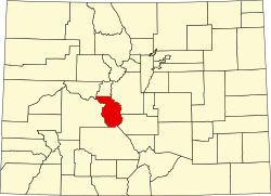
![]() Location of the Maysville CDP in Chaffee County, Colorado. | |
Location of the Maysville CDP in the United States. | |
Coordinates: 38°31′35″N106°14′30″W / 38.52639°N 106.24167°W [1] | |
Country | ![]() |
State | ![]() |
County | Chaffee County |
Area | |
• Total | 12.433 sq mi (32.201 km2) |
• Land | 12.420 sq mi (32.167 km2) |
• Water | 0.013 sq mi (0.034 km2) |
Elevation | 9,512 ft (2,899 m) |
Population | |
• Total | 173 |
• Density | 14/sq mi (5.4/km2) |
Time zone | UTC-7 (MST) |
• Summer (DST) | UTC-6 (MDT) |
ZIP Code [4] | Salida 81201 |
Area code | 719 |
GNIS feature [5] | 2583265 [1] |
Maysville is an unincorporated community and a census-designated place (CDP) located in and governed by Chaffee County, Colorado, United States. The population of the Maysville CDP was 173 at the United States Census 2020. [3] The Salida post office (Zip Code 81201) serves the area. [4]
The Maysville CDP has an area of 7,957 acres (32.201 km2), including 8.4 acres (0.034 km2) of water. [2]
The United States Census Bureau initially defined the Maysville CDP for the United States Census 2010.
Year | Pop. | ±% |
---|---|---|
2010 | 135 | — |
2020 | 173 | +28.1% |
Source: United States Census Bureau |
Todd Creek is an unincorporated community and a census-designated place (CDP) located in and governed by Adams County, Colorado, United States. The CDP is a part of the Denver–Aurora–Lakewood, CO Metropolitan Statistical Area. The population of the Todd Creek CDP was 5,028 at the United States Census 2020. The Todd Creek Village Metropolitan District and the Todd Creek Village Park and Recreation District provide services to the community, which lies in ZIP Code 80602.
Welby is an unincorporated community and a census-designated place (CDP) located in and governed by Adams County, Colorado, United States. The CDP is a part of the Denver–Aurora–Lakewood, CO Metropolitan Statistical Area. The population of the Welby CDP was 15,553 at the United States Census 2020.
Coal Creek, commonly known as Coal Creek Canyon, is a census-designated place (CDP) located in and governed by Jefferson, Boulder, and Gilpin counties in Colorado, United States, but primarily Jefferson County. The population of the Coal Creek CDP was 2,494 at the United States Census 2020. The Golden post office serves the area.
Aspen Park is an unincorporated community and a census-designated place (CDP) located in Jefferson County, Colorado, United States. The CDP is a part of the Denver–Aurora–Lakewood, CO Metropolitan Statistical Area. The population of the Aspen Park CDP was 810 at the United States Census 2020. The Aspen Park Metropolitan District provides services. The Conifer post office serves the area.
Aristocrat Ranchettes is an unincorporated community and a census-designated place (CDP) located in and governed by Weld County, Colorado, United States. The population of the Aristocrat Ranchettes CDP was 1,715 at the United States Census 2020. The Fort Lupton post office (Zip Code 80621) serves the area. The CDP is a part of the Greeley, CO Metropolitan Statistical Area.
Johnson Village is an unincorporated community and a census-designated place (CDP) located in and governed by Chaffee County, Colorado, United States. The population of the Johnson Village CDP was 299 at the United States Census 2020. The Buena Vista post office serves the area.
Nathrop is an unincorporated town, a post office, and a census-designated place (CDP) located in and governed by Chaffee County, Colorado, United States. The population was 288 at the 2020 census. The Nathrop post office has the ZIP code 81236.
Ellicott is an unincorporated community and a census-designated place (CDP) located in and governed by El Paso County, Colorado, United States. The CDP is a part of the Colorado Springs, CO Metropolitan Statistical Area. The population of the Ellicott CDP was 1,248 at the United States Census 2020. The Calhan post office serves the area.
Altona is an unincorporated community and a census-designated place (CDP) located in and governed by Boulder County, Colorado, United States. The CDP is a part of the Boulder, CO Metropolitan Statistical Area. The population of the Altona CDP was 512 at the United States Census 2020. The Boulder post office serves the area.
Fairmount is an unincorporated community and a census-designated place (CDP) in Jefferson County, Colorado, United States. The CDP is a part of the Denver–Aurora–Lakewood, CO Metropolitan Statistical Area. The population of the Fairmount CDP was 9,324 at the United States Census 2010. ZIP code 80403 applies to addresses in Fairmount.
Lazy Acres is an unincorporated community and a census-designated place (CDP) located in and governed by Boulder County, Colorado, United States. The CDP is a part of the Boulder, CO Metropolitan Statistical Area. The population of the Lazy Acres CDP was 957 at the United States Census 2020. The Boulder post office serves the area.
Paragon Estates is an unincorporated community and a census-designated place (CDP) located in and governed by Boulder County, Colorado, United States. The CDP is a part of the Boulder, CO Metropolitan Statistical Area. The population of the Paragon Estates CDP was 975 at the United States Census 2020. The Boulder post office serves the area.
Pine Brook Hill is an unincorporated community and a census-designated place (CDP) located in and governed by Boulder County, Colorado, United States. The CDP is a part of the Boulder, CO Metropolitan Statistical Area. The population of the Pine Brook Hill CDP was 975 at the United States Census 2020. The Boulder post office serves the area.
Garfield is an unincorporated community and a census-designated place (CDP) located in and governed by Chaffee County, Colorado, United States. The population of the Garfield CDP was 27 at the United States Census 2020. The Salida post office serves the area.
Smeltertown is an unincorporated community and a census-designated place (CDP) located in and governed by Chaffee County, Colorado, United States. The population of the Smeltertown CDP was 88 at the United States Census 2020. The Salida post office serves the area.
Midland is an unincorporated community and a census-designated place (CDP) located in and governed by Teller County, Colorado, United States. The CDP is a part of the Colorado Springs, CO Metropolitan Statistical Area. The population of the Midland CDP was 182 at the United States Census 2020. The Divide post office (Zip Code 80814) serves the area.
Shaw Heights is an unincorporated community and a census-designated place (CDP) located in and governed by Adams County, Colorado, United States. The CDP is part of the Denver–Aurora–Lakewood, CO Metropolitan Statistical Area. The population of the Shaw Heights CDP was 5,185 at the United States Census 2020. The Westminster post office serves the area.
Stepping Stone is an unincorporated community and a census-designated place (CDP) located in and governed by Douglas County, Colorado, United States. The population was 2,780 at the 2020 census. The CDP is a part of the Denver–Aurora–Lakewood, CO Metropolitan Statistical Area. The unincorporated community lies in ZIP code 80134.
Park Center is a census-designated place (CDP) in and governed by Fremont County, Colorado, United States. The CDP is a part of the Cañon City, CO Micropolitan Statistical Area. The population of the Park Center CDP was 2,953 at the United States Census 2020. The Cañon City post office serves the area.
Brook Forest is an unincorporated community and a census-designated place (CDP) located in and governed by Jefferson and Clear Creek counties, Colorado, United States. The population was 622 at the 2020 census. The CDP is a part of the Denver–Aurora–Lakewood, CO Metropolitan Statistical Area. The Evergreen Post Office serves the area.