Mbarara–Ishaka Road

Last updated

Mbarara–Ishaka Road
Route information
Length 38 mi (61 km)
Major junctions
East end Mbarara
  Kabwohe
Bushenyi
West end Ishaka
Highway system
Roads in Uganda

Mbarara–Ishaka Road is a road in the Western Region of Uganda, connecting the towns of Mbarara in Mbarara District with Ishaka in Bushenyi District.

Western Region, Uganda Region in Western, Uganda

The Western region is one of four regions in the country of Uganda. As of Uganda's 2014 census, the region's population was 8,874,862.

Uganda republic in East Africa

Uganda, officially the Republic of Uganda, is a landlocked country in East-Central Africa. It is bordered to the east by Kenya, to the north by South Sudan, to the west by the Democratic Republic of the Congo, to the south-west by Rwanda, and to the south by Tanzania. The southern part of the country includes a substantial portion of Lake Victoria, shared with Kenya and Tanzania. Uganda is in the African Great Lakes region. Uganda also lies within the Nile basin, and has a varied but generally a modified equatorial climate.

Mbarara Place in Western Region, Uganda

Mbarara is a city in the South Western part of Uganda. It is the main municipal, administrative, and commercial centre of Mbarara District and the site of the district headquarters.

Contents

Location

The road starts in Mbarara, the largest city in Western Uganda, extending westwards through Kabwohe and Bushenyi to end at Ishaka, a distance of about 61 kilometres (38 mi). [1] The coordinates of the road near Kabwohe are 0°34'46.0"S, 30°23'31.0"E (Latitude:-0.579453; Longitude:30.391942). [2]

Bushenyi Place in Western Uganda, Uganda

Bushenyi is a town in Western Uganda. It is the 'chief town' of Bushenyi District and the district headquarters are located there. The district is named after the town, in keeping with the practice in most of the districts in the country.

Overview

This road is a major transport corridor in the sub-region and for traffic from the sub-region to the urban centers of Mbarara and further east, Masaka and Kampala. This road was last renovated between September 1987 and December 1994, with loans from the World Bank. [3]

Masaka Place in Central Uganda, Uganda

Masaka is a large town in the Central Region of Uganda, west of Lake Victoria. The headquarters of the Masaka District are in the town.

Kampala Place in Uganda

Kampala is the capital and largest city of Uganda. The city is divided into five boroughs that oversee local planning: Kampala Central Division, Kawempe Division, Makindye Division, Nakawa Division, and Rubaga Division. Surrounding Kampala is the rapidly growing Wakiso District, whose population more than doubled between 2002 and 2014 and as of 2014 Wakiso was reported to stand at over 2 million.

The World Bank is an international financial institution that provides loans to countries of the world for capital projects. It comprises two institutions: the International Bank for Reconstruction and Development (IBRD), and the International Development Association (IDA). The World Bank is a component of the World Bank Group.

See also

Related Research Articles

Bushenyi District District in Uganda

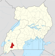
Bushenyi District is a district in Western Uganda. Like many other Ugandan districts, it is named after its chief town, Bushenyi, where the district headquarters are located.

Kiruhura, Uganda Place

Kiruhura is a town in the Western Region of Uganda. It is the largest town in Kiruhura District and the site of the district headquarters.

Sheema Place in Western Uganda, Uganda

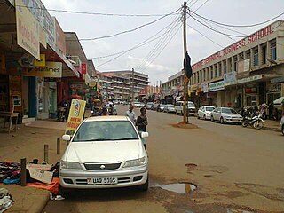
Sheema, also Sheema Municipality, is an urban centre in the Western Region of Uganda. It is the largest municipality in Sheema District.

Rushere, Uganda Place in Ankole sub-region, Western Region

Rushere is a town in Kiruhura District in the Western Region of Uganda.

Ishaka Place in Uganda

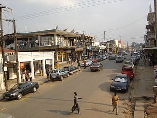
Ishaka is a town in the Western Region of Uganda. It is one of the municipalities in Bushenyi District.

Rubirizi Ugandan town

Rubirizi, sometimes spelled Rubiriizi, is a town in Rubirizi District, Ankole sub-region, Western Uganda. The town is the main municipal, administrative and commercial center of Rubirizi District. The district is named after the town.

Buhweju District District in Uganda

Buhweju District is a district in Western Uganda. It is one of the districts that constitute the Ankole sub-region. Its 'chief town', is Nsiika.

Mitooma in Western Region of Uganda, Uganda

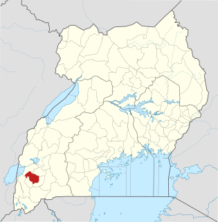
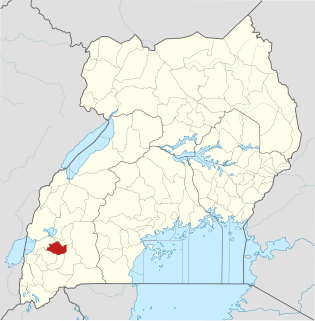
Mitooma is a town in the Western Region of Uganda. It is the main municipal, administrative, and commercial center of Mitooma District.

Kibingo, Uganda in Western Uganda, Uganda

Kibingo is a town in Western Uganda. It is the location of the district headquarters of Sheema District.

Kitagata, Uganda in Uganda


Kitagata is a town in Western Uganda. It is one of the urban centers in Sheema District.

Ishaka Adventist Hospital (IAH), is a hospital in Uganda. The hospital is located in the town of Ishaka, Bushenyi District, Western Uganda. It is located immediately north of the junction of the Ntungamo-Kasese Road with the Mbarara-Ishaka Road. Its location is approximately 77 kilometres (48 mi), by road, west of Mbarara, the largest city in the sub-region. This location lies approximately360 kilometres (224 mi), by road, southwest of Kampala, the capital of Uganda and the largest city in that country.

Katunguru, Uganda

Katunguru, is a small town in Rubirizi District, Ankole sub-region, in the Western Region of Uganda.

The Ishaka–Kagamba Road is a road in the Western Region of Uganda, connecting the town of Kagamba in Ntungamo District with Ishaka in Bushenyi District.

Kagamba in Western Region of Uganda, Uganda

Kagamba is a town in the Ntungamo District of the Western Region of Uganda.

Nyakahita Place

Nyakahita is a sparsely populated settlement in the Western Region of Uganda.

Kikorongo

Kikorongo, also Kikorongo Junctiom, is a settlement in Kasese District, in the Western Region of Uganda.

Kikorongo–Ishaka Road is a road in the Western Region of Uganda, connecting the towns of Kikorongo in Kasese District with Ishaka in Bushenyi District.

Bugongi, Sheema, Uganda Place in Western Uganda, Uganda

Bugongi is a town in the Western Region of Uganda. It is an urban center in Sheema District.

The Mbarara–Kisangani Road is a road in Uganda and the Democratic Republic of the Congo, connecting the cities of Mbarara and Mpondwe in Uganda to Kasindi, Beni, Komanda and Kisangani in the Democratic Republic of the Congo.

References

Coordinates: 00°34′46″S30°23′31″E / 0.57944°S 30.39194°E / -0.57944; 30.39194

Geographic coordinate system Coordinate system

A geographic coordinate system is a coordinate system that enables every location on Earth to be specified by a set of numbers, letters or symbols. The coordinates are often chosen such that one of the numbers represents a vertical position and two or three of the numbers represent a horizontal position; alternatively, a geographic position may be expressed in a combined three-dimensional Cartesian vector. A common choice of coordinates is latitude, longitude and elevation. To specify a location on a plane requires a map projection.