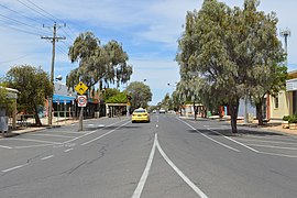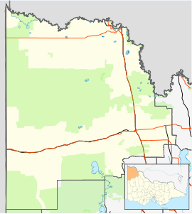
The Rural City of Mildura is a local government area in Victoria, Australia, located in the north-western part of the state. It covers an area of 22,083 square kilometres (8,526 sq mi) being the largest LGA in the state. In August 2021 the area had a population of 56,972. It includes the city of Mildura and the towns of Merbein, Red Cliffs, Irymple, Ouyen, Werrimull, Murrayville, Walpeup and Hattah. It was formed in 1995 from the amalgamation of the City of Mildura, Shire of Mildura and Shire of Walpeup.

Mildura is a regional city in north-west Victoria, Australia. Located on the Victorian side of the Murray River, Mildura had a population of 34,565 at the 2021 census. When nearby Wentworth, Irymple, Nichols Point, Merbein and Red Cliffs are included, the combined urban area had a population of 58,914 in 2021, having grown marginally at an average annual rate of 1.3% year-on-year over the preceding five years.
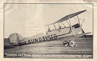
Sunraysia is a region located in northwestern Victoria and southwestern New South Wales in Australia. The region is renowned for its sunshine, intensive horticulture including grapes and oranges. Its main centre is Mildura, Victoria.

Robinvale is a town on the south bank of the Murray River in north western Victoria, Australia. It is connected by a bridge to Euston on the other side of the river in New South Wales. At the 2021 census, Robinvale had a population of 3,740, however a population study conducted by the Rural City of Swan Hill that was undertaken in 2019 identified Robinvale had an estimated population of between 7,000 in November and 8,800 in March each year.

William Benjamin Chaffey, CMG was a Canadian engineer and irrigation planner who with his older brother George Chaffey developed what became the cities of Etiwanda, California, Ontario, California, and Upland, California in the United States of America, as well as the cities of Mildura, Victoria and the town of Renmark, South Australia, in Australia.

The Riverland is a region of South Australia. It covers an area of 9,386 square kilometres (3,624 sq mi) along the River Murray from where it flows into South Australia from New South Wales and Victoria downstream to Blanchetown. The major town centres are Renmark, Berri, Loxton, Waikerie, Barmera and Monash, and many minor townships. The population is approximately 35,000 people.

Berri is a town in the Riverland region of South Australia. It is 238 kilometres north-east of Adelaide, the capital of the state of South Australia and a few kilometres west of the SA-Victoria border. It is primarily an agricultural and viticultural town on the north bank of the Murray River. It is the original home of the juice company, Berri Ltd..

The Goulburn Valley is a sub-region, part of the Hume region of the Australian state of Victoria. The sub-region consists of those areas in the catchment of the Goulburn River and other nearby streams, and is part of the Murray-Darling Basin. The Goulburn Valley is bordered on the south by the Great Dividing Range and to the north by the Murray River, the state border with New South Wales. The sub-region is one of Australia's most productive and intensively farmed areas and is predominantly irrigated.
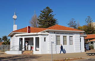
Red Cliffs is a town in Victoria, Australia in the Sunraysia region. It is located on the Calder Highway, 16 km south of Mildura and 544 km north-west of Melbourne.
The Millewa is a region of north western Victoria in Australia.
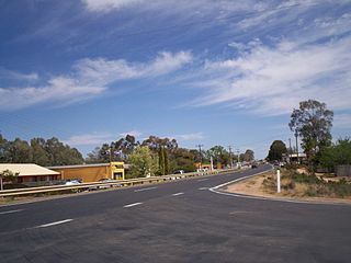
Gol Gol is a small country town in the Wentworth Shire, in the far western region of New South Wales, Australia. It is situated on the banks of the Murray River, within the Sunraysia region. In the fifteen years from 2006 to 2021, the population of Gol Gol increased from 663 to 1,956.

Mildura was the passenger terminus for the Mildura railway line in Victoria, Australia. Located in the city of Mildura it is located on the eastern side of the town centre, alongside the Murray River. Although there has not been a passenger rail service since 1993, the Victorian Labor Government has promised to return the service in 1999, though it has yet to return as of 2024.
The Mildura railway line is a heavy rail line in northwestern Victoria, Australia. The line runs from Yelta station to Ballarat station via the settlements of Mildura, Ouyen and Maryborough in an approximate south-southeasterly direction. Initial sections of the line opened from Ballarat in 1874 and the line reached Mildura in 1903.
Woorinen South is a town in Victoria, Australia. It is situated within the Rural City of Swan Hill within the Mallee region of north-west Victoria. At the 2011 census, Woorinen South had a population of 311. The town is located 350 kilometres (217 mi) north-west of Melbourne and 10 kilometres (6 mi) km north-west of the regional centre Swan Hill. The town contains a number of small businesses and is in the centre of a prosperous and diverse agricultural area which produces wine, stone fruit, vegetables, wool, and cereal crops. The town hosts the annual Vintage Steam Rally.

Irrigation is a widespread practice required in many areas of Australia, the driest inhabited continent, to supplement low rainfall with water from other sources to assist in growing crops and pasture. Overuse or poor management of irrigation is held responsible by some for environmental problems such as soil salinity and loss of habitat for native flora and fauna.

The Renmark Paringa Council is a local government area located adjacent to the Victorian border, in the Riverland, South Australia. The area is known for its various fruit production, and is heavily dependent on the River Murray as a water source. The council seat is at Renmark.

Mourquong is a locality in New South Wales, Australia on the Murray River just over the bridge from Mildura, Victoria, near Buronga.
Murray Darling is a wine region and Australian Geographical Indication which spans the Murray River and its confluence with the Darling River in northwestern Victoria and southwestern New South Wales. It was registered as a protected name on 16 June 1997.
The Sunraysia Football and Netball League, also known simply as the SFNL is an Australian rules league in the Sunraysia district of north-west Victoria and south-west New South Wales. Nine clubs – Mildura, South Mildura, Imperials, Irymple, Red Cliffs, Merbein, Robinvale–Euston, Ouyen United and Wentworth – participate in the competition, which includes senior and junior grades of football and netball. The SFNL is considered a major country league. The league's grand final was traditionally played at City Oval in Mildura, however from 2022 it is played at the newly-opened Mildura Sporting Precinct in Mildura's South.
The Mildura Cultivator (1888–1920) was a weekly newspaper, the second newspaper to be published in Mildura, Victoria.
