Mexican Hat, Utah | |
---|---|
Mexican Hat Lodge | |
Location in San Juan County and the state of Utah. | |
Coordinates: 37°9′54″N109°51′56″W / 37.16500°N 109.86556°W Coordinates: 37°9′54″N109°51′56″W / 37.16500°N 109.86556°W | |
Country | United States |
State | Utah |
County | San Juan |
Area | |
• Total | 8.5 sq mi (22 km2) |
• Land | 8.2 sq mi (21 km2) |
• Water | 0.3 sq mi (0.8 km2) |
Elevation | 4,244 ft (1,294 m) |
Population (2010) | |
• Total | 31 |
• Density | 3.8/sq mi (1.5/km2) |
Time zone | UTC-7 (Mountain (MST)) |
• Summer (DST) | UTC-6 (MDT) |
ZIP code | 84531 |
Area code(s) | 435 |
FIPS code | 49-49380 [1] |
GNIS feature ID | 1430248 [2] |
Mexican Hat is a census-designated place (CDP) on the San Juan River on the northern edge of the Navajo Nation's borders in south-central San Juan County, Utah, United States. The population was 31 at the 2010 census, a sharp decline from the previous two censuses.
The name "Mexican Hat" comes from a curiously sombrero-shaped rock outcropping on the northeast edge of town; the rock measures 60-foot (18 m) wide by 12-foot (3.7 m). The "Hat" has two rock climbing routes ascending it. Mexican Hat has frequently been noted on lists of unusual place names. [3]
In 2016, the U.S. Route 163 bridge crossing the San Juan River on the south border of the town was renamed the "Jason R. Workman Memorial Bridge" after a member of SEAL Team Six who was killed in action in Afghanistan on August 6, 2011. Workman was a 1997 graduate of the nearby San Juan High School. [4]
The CDP is on U.S. Route 163, just 3 miles (5 km) south of the junction with State Route 261, and is just outside the northern boundary of both the Navajo Nation and Monument Valley. Goosenecks State Park is located 9 miles (14 km) west-northwest, Alhambra Rock is 6 miles (10 km) west-southwest, and the Valley of the Gods is to the north on U.S. 163.
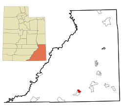
According to the United States Census Bureau, the CDP has a total area of 8.5 square miles (22 km2), of which 8.2 square miles (21 km2) is land (96%) and 0.3 square miles (0.78 km2) is water (4%).
According to the Köppen Climate Classification system, Mexican Hat has a semi-arid climate, abbreviated "BSk" on climate maps. [5]
Historical population | |||
---|---|---|---|
Census | Pop. | %± | |
1990 | 259 | — | |
2000 | 88 | −66.0% | |
2010 | 31 | −64.8% | |
source: [6] [7] |
As of the census [1] of 2010, there were 31 people in 17 households residing in the CDP. The population density was 3.8 people per square mile (1.5/km2). There were 23 housing units at an average density of 2.8/sq mi (1.1/km2). The racial make-up of the CDP was 9.7% Native American and 90.3% White.
There were 17 households, out of which 5.9% had children under the age of 18 living with them, 29.4% were married couples living together, 17.6% had a female householder with no husband present, and 47.1% were non-families. 64.7% of all households were made up of individuals, and 5.9% had someone living alone who was 65 years of age or older. The average household size was 1.82 and the average family size was 2.56.
In the CDP, the population skewed older since the last census, with 6.4% under the age of 15, zero residents aged 15 to 24, 25.8% from 25 to 44, 25.9% from 45 to 64, and 42% who were 65 years of age or older. The median age was 54.5 years.
As of 2012, the median income for a household in the CDP was $80,767, and there were no families or individuals living below the poverty line. [8]
San Juan County is a county in the southeastern portion of the U.S. state of Utah. As of the 2010 United States Census, the population was 14,746. Its county seat is Monticello, while its most populous city is Blanding. The county was named by the Utah State Legislature for the San Juan River, itself named by Spanish explorers.
Apache County is located in the northeast corner of the U.S. state of Arizona. As of the 2010 census its population was 71,518. The county seat is St. Johns.
San Juan County is a county in the U.S. state of New Mexico. As of the 2010 census, the population was 130,044, making it the fifth-most populous county in New Mexico. Its county seat is Aztec. The county was created in 1887.
Window Rock is a census-designated place that serves as the seat of government and capital of the Navajo Nation, the largest territory of a sovereign American Indian nation in North America. It lies within the boundaries of the St. Michaels Chapter, adjacent to the Arizona and New Mexico state line. Window Rock hosts the Navajo Nation governmental campus which contains the Navajo Nation Council, Navajo Nation Supreme Court, the offices of the Navajo Nation President and Vice President, and many Navajo government buildings.
Crownpoint is a census-designated place (CDP) in McKinley County, New Mexico, United States founded in 1912. The population was 2,500 at the 2018 census.
Yah-ta-hey is a census-designated place (CDP) in McKinley County, New Mexico, United States. As of the 2000 census, the CDP population was 580. The English name for this place is an approximation of a Navajo greeting, though the actual Navajo name means "like the devil", in reference to J.B. Tanner, who operated the trading post located here; the same name is used for Aneth, Utah, where Tanner also worked.
Beclabito is a census-designated place (CDP) in San Juan County, New Mexico, United States. The population was 317 at the 2010 census. It is part of the Farmington Metropolitan Statistical Area.
Huerfano is a census-designated place (CDP) in San Juan County, New Mexico, United States. The population was 104 at the 2000 census. It is part of the Farmington Metropolitan Statistical Area. Huerfano is named after El Huerfano Mountain, located a mile to the northeast.
Naschitti is a census-designated place (CDP) in San Juan County, New Mexico, United States. The population was 360 at the 2000 census. It is part of the Farmington Metropolitan Statistical Area. The town was established in 1886, when Tom Bryan set up a trading post east of the Chuska Mountains. With a Navajo name, Naschitti means "badger springs."
Nenahnezad is a census-designated place (CDP) in San Juan County, New Mexico, United States. The population was 726 at the 2000 census. Nenahnezad is a Chapter community just to the south of Fruitland, between the towns of Farmington and Shiprock. It is part of the Farmington Metropolitan Statistical Area.
Sheep Springs is a census-designated place (CDP) in San Juan County, New Mexico, United States. The population was 237 at the 2000 census. It is part of the Farmington Metropolitan Statistical Area.
Shiprock is a census-designated place (CDP) in San Juan County, New Mexico, United States, on the Navajo reservation. The population was 8,156 at the 2000 census. It is part of the Farmington Metropolitan Statistical Area.
Upper Fruitland is a census-designated place (CDP) in San Juan County, New Mexico, United States. The population was 1,664 at the 2000 census. It is part of the Farmington Metropolitan Statistical Area.
Aneth is a census-designated place (CDP) in San Juan County, Utah, United States. The population was 598 at the 2000 census. The origin of the name Aneth is obscure.
Bluff is a town in San Juan County, Utah, United States. The population was 320 at the 2000 census. Bluff incorporated in 2018.
La Sal is a census-designated place (CDP) in northeastern San Juan County, Utah, United States. The population was 339 at the 2000 census. The name comes from the La Sal Mountains which means in Spanish "The Salt".
Montezuma Creek is a census-designated place (CDP) in San Juan County, Utah, United States. The population was 335 at the 2010 census, a decrease from the 2000 figure of 507.
Navajo Mountain is a census-designated place (CDP) in San Juan County, Utah, United States. The population was 379 at the 2000 census.
Tselakai Dezza is a census-designated place (CDP) in San Juan County, Utah, United States. The population was 103 at the 2000 census.
Crystal is a census-designated place (CDP) in McKinley and San Juan counties in the U.S. state of New Mexico. The population was 311 at the 2010 census. It is located at the western end of the Narbona Pass.
Wikimedia Commons has media related to Mexican Hat, Utah . |