Windorah is a town and a locality in the Shire of Barcoo, Queensland, Australia. It is one of only three towns in the Shire of Barcoo in Central West Queensland. In the 2021 census, the locality of Windorah had a population of 104 people.

Boulia is an outback town and locality in the Shire of Boulia, Queensland, Australia. In the 2016 census, Boulia had a population of 301 people.

Winton is a town and locality in the Shire of Winton in Central West Queensland, Australia. It is 177 kilometres (110 mi) northwest of Longreach. The main industries of the area are sheep and cattle raising. The town was named in 1876 by postmaster Robert Allen, after his place of birth, Winton, Dorset. Winton was the first home of the airline Qantas. In the 2021 census, the locality of Winton had a population of 856 people.

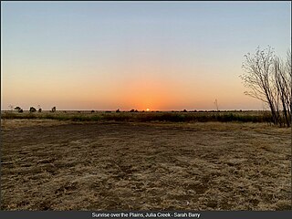
Julia Creek is an outback town and locality in the Shire of Mckinlay, Queensland, Australia. In the 2016 census, the locality of Julia Creek had a population of 511 people.

Richmond is a rural town and locality in the Shire of Richmond, Queensland, Australia. In the 2016 census, the locality of Richmond had a population of 648 people.

The Shire of McKinlay is a local government area in outback north-western Queensland, Australia.
Kynuna is an outback town in the Shire of McKinlay and a locality split between the Shire of McKinlay and the Shire of Winton in Queensland, Australia. In the 2016 census the locality of Kynuna had a population of 55 people.

McKinlay is an outback town and locality in McKinlay Shire, Queensland, Australia. In the 2016 census, the locality of McKinlay had a population of 178 people.

Elderslie Station, also known as Elderslie, is a pastoral lease that operates as a sheep and cattle station in Queensland, Australia.
Collingwood is a former town in the Channel Country in Central West Queensland, Australia, in the Shire of Winton. Collingwood was founded in the 1870s, and it was hoped that the town would thrive and grow into a regional centre that would foster the development of pastoral activity in the Diamantina region, an industry of great local importance to this day. However, Collingwood ultimately failed as a town and was given up after only about two decades of existence.

Amaroo is an outback locality split between the Shire of Boulia and the Shire of Diamantina, both in Central Western Queensland, Australia. In the 2016 census, Amaroo had a population of 22 people.
Buckingham is an outback locality in the Shire of Boulia, Queensland, Australia. In the 2016 census, Buckingham had a population of 0 people.

Carrandotta is a locality in the Shire of Boulia, Queensland, Australia. It is on the border with the Northern Territory. In the 2021 census, Carrandotta had a population of 5 people.

Georgina is an outback locality in the Shire of Boulia, Queensland, Australia. In the 2021 census, Georgina had a population of 21 people.

Min Min is an uninhabited outback locality in the Shire of Boulia, Queensland, Australia. The locality is most notable for the Min Min light, an unexplained aerial phenomenon reported throughout Australia's outback that was first observed by Europeans at Min Min. The settlement is now a ghost town. In the 2016 census, Min Min had a population of 0 people.
Sturt is an outback locality split between the Shire of Boulia and in the Shire of Diamantina, both in Queensland, Australia. It is on the border with the Northern Territory. In the 2016 census, Sturt had a population of 0 people.
Toko is a rural outback locality in the Shire of Boulia, Queensland, Australia. It is on the border with the Northern Territory. In the 2016 census, Toko had a population of 4 people.
Warburton is a locality in the Shire of Boulia, Queensland, Australia. In the 2016 census, Warburton had a population of 0 people.
Warenda is an outback locality in the Shire of Boulia, Queensland, Australia. In the 2016 census, Warenda had a population of 0 people.
Wills is an outback locality in the Shire of Boulia, Queensland, Australia. In the 2016 census, Wills had a population of 14 people.


