Miera | |
|---|---|
 Miera | |
| Coordinates: 36°5′28″N103°33′8″W / 36.09111°N 103.55222°W | |
| Country | United States |
| State | New Mexico |
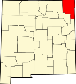
| County | Union |
| Elevation | 4,902 ft (1,494 m) |
| Time zone | UTC-7 (Mountain (MST)) |
| • Summer (DST) | UTC-6 (MDT) |
| Area code | 575 |
| GNIS feature ID | 898573 [1] |
Miera is a ghost town in Union County, New Mexico, United States. [2] The settlement was established in 1875 and a post office operated there from 1887 to 1927. In the 1900 United States census, it had a population of 450. [3] It was located nearby Tramperos Creek. [2]