Milton (CDP), New Hampshire

Last updated

Milton, New Hampshire
USA New Hampshire location map.svg
Red pog.svg
Milton
Usa edcp location map.svg
Red pog.svg
Milton
Coordinates: 43°24′34″N70°59′18″W / 43.40944°N 70.98833°W / 43.40944; -70.98833
Country United States
State New Hampshire
County Strafford
Town Milton
Area
[1]
  Total0.81 sq mi (2.10 km2)
  Land0.81 sq mi (2.09 km2)
  Water0.00 sq mi (0.00 km2)
Elevation
440 ft (130 m)
Population
 (2020)
  Total593
  Density733.91/sq mi (283.37/km2)
Time zone UTC-5 (Eastern (EST))
  Summer (DST) UTC-4 (EDT)
ZIP code
03851
Area code 603
FIPS code 33-48580
GNIS feature ID2629728

Milton is a census-designated place (CDP) and the primary village in the town of Milton, Strafford County, New Hampshire, United States. The population of the CDP was 593 at the 2020 census, [2] out of 4,482 in the entire town.

Contents

Geography

The CDP is in the southeastern part of the town of Milton, on the west side of the Salmon Falls River, which forms the New Hampshire–Maine state line. The CDP extends north (upriver) to the outlet of Milton Pond, and south (downriver) to the head of Spaulding Pond. The western limit of the CDP follows a power line that passes through forest just west of the village. [3]

New Hampshire Route 125 is the main road through the CDP, leading north 6 miles (10 km) to its terminus at Union and south 7 miles (11 km) to the center of Rochester. New Hampshire Route 75 has its eastern terminus in the southern part of the CDP and leads west 4 miles (6 km) to Farmington. New Hampshire Route 16 (the Spaulding Turnpike) passes just west of the CDP, with access from Exit 17 (Route 75). Route 16 leads north 55 miles (89 km) to North Conway and south 30 miles (48 km) to Portsmouth.

According to the U.S. Census Bureau, the Milton CDP has a total area of 0.81 square miles (2.1 km2), of which 1.09 acres (4,419 m2) are water, comprising 0.21% of the CDP. [4] Via the Salmon Falls River, Milton is part of the Piscataqua River watershed, reaching the Atlantic Ocean at Portsmouth.

Demographics

Historical population
CensusPop.Note
2010 575
2020 5933.1%
U.S. Decennial Census [5]

As of the census of 2010, there were 575 people, 226 households, and 148 families residing in the CDP. There were 261 housing units, of which 35, or 13.4%, were vacant. The racial makeup of the CDP was 96.2% white, 0.9% African American, and 3.0% from two or more races. 1.2% of the population were Hispanic or Latino of any race. [6]

Of the 226 households in the CDP, 38.5% had children under the age of 18 living with them, 43.4% were headed by married couples living together, 12.4% had a female householder with no husband present, and 34.5% were non-families. 27.0% of all households were made up of individuals, and 6.2% were someone living alone who was 65 years of age or older. The average household size was 2.54, and the average family size was 3.07. [6]

28.2% of residents in the CDP were under the age of 18, 8.3% were from age 18 to 24, 27.3% were from 25 to 44, 27.5% were from 45 to 64, and 8.7% were 65 years of age or older. The median age was 35.9 years. For every 100 females, there were 109.0 males. For every 100 females age 18 and over, there were 100.5 males. [6]

For the period 2011–15, the estimated median annual income for a household was $50,813, and the median income for a family was $58,281. The per capita income for the CDP was $18,159. 16.7% of the population and 8.1% of families were below the poverty line, along with 14.8% of people under the age of 18 and 0.0% of people 65 or older. [7]

Related Research Articles

<span class="mw-page-title-main">Suncook, New Hampshire</span> Census-designated place in New Hampshire, United States

Suncook is a census-designated place (CDP) in Merrimack County, New Hampshire, United States. The population was 5,501 at the 2020 census. Approximately two-thirds of Suncook is located in the town of Pembroke, with the remainder in Allenstown.

<span class="mw-page-title-main">Milton, New Hampshire</span> Town in New Hampshire, United States

Milton is a town in Strafford County, New Hampshire, United States. The population was 4,482 at the 2020 census. A manufacturing, resort and residential town, Milton includes the village of Milton Mills. The primary village in town, where 593 people resided at the 2020 census, is defined as the Milton census-designated place (CDP), and is located along New Hampshire Route 125 and the Salmon Falls River, just north of Route 75.

<span class="mw-page-title-main">Winchester (CDP), New Hampshire</span> Census-designated place in New Hampshire, United States

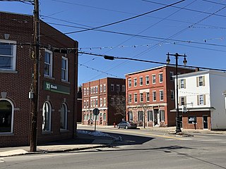
Winchester is a census-designated place (CDP) and the main village in the town of Winchester in Cheshire County, New Hampshire, United States. The population of the CDP was 1,606 at the 2020 census, compared to 4,150 in the entire town.

Whitefield is a census-designated place (CDP) and the main village in the town of Whitefield in Coos County, New Hampshire, United States. The population of the CDP was 1,460 at the 2020 census, out of 2,490 people in the entire town of Whitefield.

Hanover is a census-designated place (CDP) and the main village in the town of Hanover in Grafton County, New Hampshire, United States. The population of the CDP was 9,078 at the 2020 census, out of 11,870 in the entire town. The CDP includes the campus of Dartmouth College.

<span class="mw-page-title-main">Plymouth (CDP), New Hampshire</span> Census-designated place in New Hampshire, United States

Plymouth is a census-designated place (CDP) and the main village in the town of Plymouth in Grafton County, New Hampshire, United States. Its population was 4,730 at the 2020 census, out of 6,682 in the entire town. The CDP includes the campus of Plymouth State University.

<span class="mw-page-title-main">Greenville (CDP), New Hampshire</span> Census-designated place in New Hampshire, United States

Greenville is a census-designated place (CDP) and the main village in the town of Greenville in Hillsborough County, New Hampshire, United States. The population of the CDP was 1,074 at the 2020 census, out of 1,974 in the entire town.

<span class="mw-page-title-main">Hillsborough (CDP), New Hampshire</span> Census-designated place in New Hampshire, United States

Hillsborough is a census-designated place (CDP) and the main village in the town of Hillsborough in Hillsborough County, New Hampshire, United States. The population of the CDP was 2,156 at the 2020 census, out of 5,939 in the entire town.

<span class="mw-page-title-main">Milford (CDP), New Hampshire</span> Census-designated place in New Hampshire, United States

Milford is a census-designated place (CDP) and the main village in the town of Milford, Hillsborough County, New Hampshire, United States. The population of the CDP was 9,212 at the 2020 census, out of 16,131 in the entire town.

<span class="mw-page-title-main">Hampton (CDP), New Hampshire</span> Census-designated place in New Hampshire, United States

Hampton is a census-designated place (CDP) comprising the town center and surrounding developed areas of the town of Hampton, Rockingham County, New Hampshire, United States. The population of the CDP was 9,597 at the 2020 census, out of 16,214 in the entire town.

<span class="mw-page-title-main">Londonderry (CDP), New Hampshire</span> Census-designated place in New Hampshire, United States

Londonderry is a census-designated place (CDP) within the town of Londonderry in Rockingham County, New Hampshire, United States. The population of the CDP was 11,645 at the 2020 census, out of 25,826 in the entire town.

<span class="mw-page-title-main">Durham (CDP), New Hampshire</span> Census-designated place in New Hampshire, United States

Durham is a census-designated place (CDP) and the main village in the town of Durham in Strafford County, New Hampshire, United States. The population of the CDP was 11,147 at the 2020 census, out of 15,490 in the entire town. The CDP is home to the University of New Hampshire.

<span class="mw-page-title-main">Farmington (CDP), New Hampshire</span> Census-designated place in New Hampshire, United States

Farmington is a census-designated place (CDP) and the main village in the town of Farmington, Strafford County, New Hampshire, United States. The population of the CDP was 3,824 at the 2020 census, out of 6,722 in the entire town.

<span class="mw-page-title-main">Union, New Hampshire</span> Census-designated place in New Hampshire, United States

Union is a village and census-designated place (CDP) in the town of Wakefield, Carroll County, New Hampshire, United States. It had a population of 196 at the 2020 census.

<span class="mw-page-title-main">Sanbornville, New Hampshire</span> Census-designated place in New Hampshire, United States

Sanbornville is a census-designated place (CDP) and the primary village in the town of Wakefield, Carroll County, New Hampshire, United States. It had a population of 963 at the 2020 census.

<span class="mw-page-title-main">Milton Mills, New Hampshire</span> Census-designated place in New Hampshire, United States

Milton Mills is a small village and census-designated place in the town of Milton, Strafford County, New Hampshire, United States. It had a population of 313 at the 2020 census. Milton Mills has a separate ZIP code (03852) from the rest of the town of Milton.

<span class="mw-page-title-main">West Stewartstown, New Hampshire</span> Census-designated place in New Hampshire, United States

West Stewartstown is a census-designated place in the town of Stewartstown in Coös County, New Hampshire, United States. It had a population of 263 at the 2020 census, down from 386 at the 2010 census.

<span class="mw-page-title-main">Newfields (CDP), New Hampshire</span> Census-designated place in New Hampshire, United States

Newfields is a census-designated place (CDP) and the main village within the town of Newfields, Rockingham County, New Hampshire, United States. The population of the CDP was 378 at the 2020 census, out of 1,769 in the entire town.

<span class="mw-page-title-main">Ashland (CDP), New Hampshire</span> Census-designated place in New Hampshire, United States

Ashland is a census-designated place (CDP) and the main village in the town of Ashland in Grafton County, New Hampshire, United States. The population of the CDP was 1,082 at the 2020 census, out of 1,938 in the entire town.

<span class="mw-page-title-main">Colebrook (CDP), New Hampshire</span> Census-designated place in New Hampshire, United States

Colebrook is a census-designated place (CDP) and the main village in the town of Colebrook, Coös County, New Hampshire, United States. The population of the CDP was 1,201 at the 2020 census, out of 2,084 in the entire town. The CDP population had dropped from 1,394 at the 2010 census.

References

  1. "ArcGIS REST Services Directory". United States Census Bureau. Retrieved September 20, 2022.
  2. "Milton CDP, New Hampshire: 2020 DEC Redistricting Data (PL 94-171)". U.S. Census Bureau. Retrieved January 6, 2022.
  3. "TIGERweb: Milton CDP, New Hampshire". Geography Division, U.S. Census Bureau. Retrieved October 5, 2017.
  4. "2021 U.S. Gazetteer Files – New Hampshire". United States Census Bureau. Retrieved January 6, 2022.
  5. "Decennial Census Official Publications". Census.gov. Retrieved March 4, 2024.
  6. 1 2 3 "Profile of General Population and Housing Characteristics: 2010 Census Summary File 1 (DP-1): Milton CDP, New Hampshire". American Factfinder. U.S. Census Bureau. Archived from the original on February 13, 2020. Retrieved October 5, 2017.
  7. "Selected Economic Characteristics: 2011-2015 American Community Survey 5-Year Estimates (DP03): Milton CDP, New Hampshire". American Factfinder. U.S. Census Bureau. Archived from the original on February 13, 2020. Retrieved October 5, 2017.