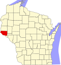
Moeville, Wisconsin

Last updated
Moeville, Wisconsin
USA Wisconsin location map.svg
Red pog.svg
Moeville, Wisconsin
Usa edcp location map.svg
Red pog.svg
Moeville, Wisconsin
Coordinates: 44°41′19″N92°31′39″W / 44.68861°N 92.52750°W / 44.68861; -92.52750 Coordinates: 44°41′19″N92°31′39″W / 44.68861°N 92.52750°W / 44.68861; -92.52750
Country Flag of the United States.svg  United States
State Flag of Wisconsin.svg  Wisconsin
County Pierce
Elevation
301 m (988 ft)
Time zone UTC-6 (Central (CST))
  Summer (DST) UTC-5 (CDT)
Area code(s) 715 & 534
GNIS feature ID1569634 [1]

Moeville is an unincorporated community located in the towns of Trenton and Trimbelle, in Pierce County, Wisconsin, United States. [1]

Notes

  1. 1 2 "Moeville, Wisconsin". Geographic Names Information System . United States Geological Survey.

Related Research Articles

Wisconsin State in the upper Midwest region of the United States

Wisconsin is a state in the Upper Midwest region of the United States, bordered by Minnesota to the west; Iowa to the southwest; Illinois to the south; Lake Michigan to the east; Michigan to the northeast; and Lake Superior to the north. Wisconsin is the 23rd-largest state by total area and the 20th-most populous.

Crawford County, Wisconsin U.S. county in Wisconsin

Crawford County is a county in the southwest part of the U.S. state of Wisconsin. As of the 2010 census, the population was 16,644. Its county seat is Prairie du Chien.

Wisconsin Territory Territory of the US between 1836-1848

The Territory of Wisconsin was an organized incorporated territory of the United States that existed from July 3, 1836, until May 29, 1848, when an eastern portion of the territory was admitted to the Union as the State of Wisconsin. Belmont was initially chosen as the capital of the territory. In 1837, the territorial legislature met in Burlington, just north of the Skunk River on the Mississippi, which became part of the Iowa Territory in 1838. In that year, 1838, the territorial capital of Wisconsin was moved to Madison.

1934 United States House of Representatives elections House elections for the 74th U.S. Congress

The 1934 United States House of Representatives elections were held in the middle of President Franklin D. Roosevelt's first term. The Democratic Party continued its progress, gaining another 9 net seats from the opposition Republican Party, who also lost seats to the Progressive Party. The Republicans were reduced below one-fourth of the chamber for the first time since the creation of the party. The Wisconsin Progressive Party, a liberal group which allied with the Democrats, also became a force in Wisconsin politics.

United States District Court for the Eastern District of Wisconsin United States federal trial court of limited jurisdiction

The United States District Court for the Eastern District of Wisconsin is a federal trial court of limited jurisdiction. The court is under the auspices of the United States Court of Appeals for the Seventh Circuit, although patent claims and claims against the federal government under the Tucker Act are appealed to the United States Court of Appeals for the Federal Circuit. The Eastern District was established on June 30, 1870.

The University of Wisconsin Law School is the professional school for the study of law at the University of Wisconsin–Madison located in Madison, Wisconsin, in the United States.

National Register of Historic Places listings in Wisconsin Wikimedia list article

This is a list of properties and districts listed on the National Register of Historic Places in Wisconsin. There are over 2,400 listed sites in Wisconsin. Each of the state's 72 counties has at least one listing on the National Register.

Wisconsins 1st congressional district

Wisconsin's 1st congressional district is a congressional district of the United States House of Representatives in southeastern Wisconsin, covering Kenosha County, Racine County, and most of Walworth County, as well as portions of Rock County, Waukesha County, and Milwaukee County. The district's current Representative is Republican Bryan Steil.

Wisconsins 2nd congressional district U.S. House district in southern Wisconsin

Wisconsin's 2nd congressional district is a congressional district of the United States House of Representatives in southern Wisconsin, covering Dane County, Iowa County, Lafayette County, Sauk County and Green County, as well as portions of Richland County and Rock County. The district includes Madison, the state's capital, its suburbs and some of the surrounding areas.

Wisconsins 3rd congressional district

Wisconsin's 3rd congressional district covers most of the Driftless Area in southwestern and western Wisconsin. The district includes the cities of La Crosse, Eau Claire and Stevens Point, as well as most of the Wisconsin side of the Minneapolis-St. Paul metropolitan area. It borders the states of Minnesota, Iowa, and Illinois. Democrat Ron Kind has represented the district since 1997.

Wisconsins 4th congressional district

Wisconsin's 4th congressional district is a congressional district of the United States House of Representatives in Wisconsin, encompassing a part of Milwaukee County and including all of the city of Milwaukee and its working-class suburbs of Cudahy, St. Francis, South Milwaukee, and West Milwaukee. Recent redistricting has added the Milwaukee County North Shore communities of Glendale, Shorewood, Whitefish Bay, Fox Point, Bayside, and Brown Deer to the district. It is currently represented by Gwen Moore, a Democrat.

Wisconsins 5th congressional district

Wisconsin's 5th congressional district is a congressional district of the United States House of Representatives in Wisconsin, covering most of Milwaukee's northern and western suburbs. It presently covers all of Washington and Jefferson counties, most of Waukesha County, and portions of Dodge, Milwaukee and Walworth counties. It is currently represented by Republican Scott Fitzgerald.

Wisconsins 7th congressional district

Wisconsin's 7th congressional district is a congressional district of the United States House of Representatives in northwestern and central Wisconsin; it is the largest congressional district in the state geographically, covering 20 counties, for a total of 18,787 sq mi. The district contains the following counties: Ashland, Barron, Bayfield, Burnett, St. Croix, Chippewa (partial), Clark, Douglas, Florence, Forest, Iron, Jackson (partial), Juneau (partial), Langlade, Lincoln, Marathon, Monroe (partial) Oneida, Polk, Price, Rusk, Sawyer, Taylor, Vilas, Washburn, and Wood (partial).

Wisconsin Air National Guard

The Wisconsin Air National Guard is the aerial militia of the State of Wisconsin, United States of America. It is, along with the Wisconsin Army National Guard, an element of the Wisconsin National Guard.

2016 United States presidential election in Wisconsin Election in Wisconsin

The 2016 United States presidential election in Wisconsin was held on November 8, 2016, as part of the 2016 United States presidential election. Wisconsin voters chose electors to represent them in the Electoral College via a popular vote pitting Republican Party nominee Donald Trump against Democratic Party nominee Hillary Clinton.