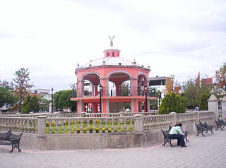
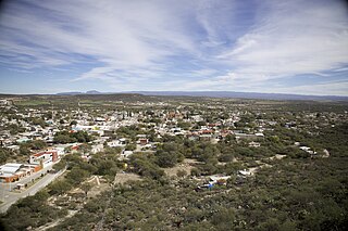
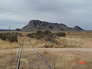
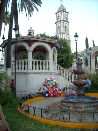
El Plateado de Joaquín Amaro or Joaquín Amaro, also known as El Plateado and as General Joaquín Amaro, is a municipality and community in Zacatecas, Mexico, located 105 km (65 mi) SW of Zacatecas City. It is bordered by the municipal divisions of Villanueva, Tabasco, Momax, and Tlaltenango de Sánchez Román.

Jerez is a town and municipality in the Mexican state of Zacatecas. To distinguish the two, the town is officially called Jerez de García Salinas reformer, in honor of a 19th-century reformer. The town of Jerez governs 128 other communities, which comprise a rural area known for its production of fruit trees and dairy. Jerez was designated a Pueblo Mágico to promote tourism, as it is in close proximity to the state capital of Zacatecas and offers handcrafts, traditional food, and architecture."

Chalchihuites is a municipality in the Mexican state of Zacatecas. The archaeological site of Altavista, at Chalchihuites, is located 137 miles (220 km) to the northwest of the city of Zacatecas and 102 miles (164 km) southeast of the city of Durango. Located to the west of Sombrerete in the northwestern corner of the state of Zacatecas, it is believed that the site was a cultural oasis that was occupied more or less continuously from AD 100 to AD 1400.

Zacatecas, officially the Free and Sovereign State of Zacatecas, is one of the 31 states of Mexico. It is divided into 58 municipalities and its capital city is Zacatecas.

Huejúcar is a town and municipality, in Jalisco in central-western Mexico. The municipality covers an area of 309.2 km2.

Cosio is a municipality and town in the Mexican state of Aguascalientes. It stands at 22°22′N102°18′W. The municipal seat is the town of Cosío. As of 2020, the town of Cosío had a population of 17,000.

Mazapil is a municipality in the Mexican state of Zacatecas and the state's largest municipality by area. The Peñasquito mine, Mexico's largest gold mine, is located in this sparsely populated municipality.

Río Grande is a municipality in the Mexican state of Zacatecas.

General Francisco R. Murguía is a municipality in the Mexican state of Zacatecas, located approximately 140 kilometres (87 mi) north of the state capital of Zacatecas City. Its municipal seat is located in Nieves.

Sain Alto is a municipality in the Mexican state of Zacatecas, located approximately 110 kilometres (68 mi) northwest of the state capital of Zacatecas City.

Morelos is a semi-urban municipality in the Zacatecas metropolitan area in the Mexican state of Zacatecas.
General Pánfilo Natera is a municipality in the Mexican state of Zacatecas, located approximately 50 kilometres (31 mi) east of the state capital. It is named after Pánfilo Natera, commander of the Central Division of the Constitutional Army in the Mexican Revolution, and governor of Zacatecas in 1915 and from 1940 to 1944.

Villa González Ortega is a municipality in the Mexican state of Zacatecas, located approximately 70 kilometres (43 mi) southeast of the state capital of Zacatecas City. It is named after Jesús González Ortega.

Noria de Ángeles is a municipality in the Mexican state of Zacatecas, located approximately 75 kilometres (47 mi) southeast of the state capital of Zacatecas City.

Santa María de la Paz is a municipality in the Mexican state of Zacatecas, located approximately 165 kilometres (103 mi) southwest of the state capital of Zacatecas City.

Juchipila is a municipality in the Mexican state of Zacatecas, located approximately 160 kilometres (99 mi) southwest of the state capital Zacatecas City.
Genaro Codina is a municipality in the Mexican state of Zacatecas, located approximately 30 kilometres (19 mi) southwest of the state capital at the city of Zacatecas. It is named after Genaro Codina, musician and composer of the state anthem, the "March of Zacatecas".

Mezquital del Oro is a municipality in the Mexican state of Zacatecas, located approximately 190 kilometres (120 mi) southwest of Zacatecas City, the state capital.

Susticacán is a municipality in the Mexican state of Zacatecas, located approximately 55 kilometres (34 mi) west of Zacatecas City, the state capital.


