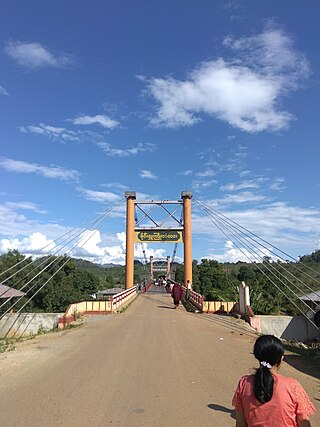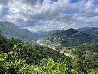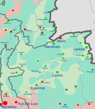
The Shan people, also known as the Tai Long or Thai Yai, are a Tai ethnic group of Southeast Asia. The Shan are the biggest minority of Burma (Myanmar) and primarily live in the Shan State of this country, but also inhabit parts of Mandalay Region, Kachin State, Kayah State, Sagaing Region and Kayin State, and in adjacent regions of China, Laos, Assam and Meghalaya, Cambodia, Vietnam and Thailand. Though no reliable census has been taken in Burma since 1935, the Shan are estimated to number 4–6 million, with CIA Factbook giving an estimate of five million spread throughout Myanmar which is about 10% of the overall Burmese population.
Mong-Yu is a town in northern Shan State in Myanmar near the Chinese border. Mong-Yu is the location of the 105th mile trade zone. In 2019, it had a population of 1,730.
Mong Kung, Mongkung, Mongkaung or Möngkung is a town in Shan State some 100 kilometres (62 mi) east of Mandalay. It is the capital of Mong Kung Township, Myanmar.
Mong Ton also known historically as Möngtung and Maington, is a town and seat of Mong Ton Township in Mong Hsat District, Shan State in eastern Myanmar near the border with Thailand. Mong is equivalent to [Township or land]."Ton"is equivalent to [Royal City]. It is located in the Daen Lao Range, in the eastern part of the Shan State, east of the Salween River. Mong Ton lies on the National Highway 22 and connected to NarrkgMuu and Ponparkyin, is also connected to Mong Hsat by National Highway 49 which begins to the north-east of the town.

Myanmar has been embroiled in armed conflict since 1948, when the country, then known as Burma, gained independence from the United Kingdom. The conflict has largely been ethnic-based, with ethnic armed organisations fighting Myanmar's armed forces, the Tatmadaw, for self-determination. Despite numerous ceasefires and the creation of autonomous self-administered zones in 2008, armed groups continue to call for independence, increased autonomy, or the federalisation of Myanmar. It is the world's longest ongoing civil war, spanning almost eight decades.

The Shan State Army, also known as the Shan State Army - South (SSA-S), is the armed wing of the Restoration Council of Shan State (RCSS) and one of the largest insurgent groups in Myanmar (Burma). The RCSS/SSA was led by Lieutenant General Yawd Serk until his resignation on 3 February 2014. Yawd Serk was reelected chairman of the RCSS shortly after his resignation and has remained chairman since.

Mong Hsu Township is a township of Loilen District in the Shan State of Myanmar. The principal town is Mong Hsu. Om-pu waterfall on Nam Parng River of Mong Hsu is the second largest waterfall of Shan State. The nearest commercial airport to Mong Hsu is Lashio Airport.

Kyethi Township is a township of Loilem District in the Shan State of Burma. The main town is Kesi.

Tangyan Township is a township of Lashio District in the Shan State of eastern Burma. The principal town is Tangyan. Tangyan emerged as an important centre for Panthay people in the mid-20th century, especially after the destruction of Panglong during World War II.

Mong Ton Township is a Township in the Eastern Shan State of Myanmar. The capital town is Mong Ton. It borders are Mong Pying Township to the north, Mong Hsat Township to the east, Mong Nai Township and Mong Pan Township to the west and Thailand to the south. Loi Hkilek mountain is located in the area. It has two towns. They are Ponparkyin and Mong Hta. At Mong Ton township, live in Shan, Lahu, Lisu, Wa, Burma, and Chinese.

The Mong Tai Army, was an insurgent group consisting of soldiers from the Shan minority in Myanmar, founded in 1985 by Khun Sa. It had up to 20,000 armed troops at its peak, and was one of the largest forces opposing the government of Myanmar at its time. It was also involved in drug trafficking in Southeast Asia.

The Kachin conflict or the Kachin War is one of the multiple conflicts which are collectively referred to as the internal conflict in Myanmar. Kachin insurgents have been fighting against the Tatmadaw since 1961, with only one major ceasefire being brokered between them, which lasted from 1994 to 2011, a total of 17 years.

The Shan State National Army was a Shan nationalist insurgent group that fought against the then ruling State Peace and Development Council military regime of Myanmar (Burma). The commander of the SSNA was Colonel Kan Yod.

The Shan State Army, also known as Shan State Army – North (SSA-N) or Shan State Army/Special Region 3 (SSA/SR-3) is a Shan nationalist insurgent group in Myanmar (Burma). It is the armed wing of the Shan State Progress Party (SSPP).

The Ta'ang National Liberation Army is a political organization and armed group in Myanmar. It is the armed wing of the Palaung State Liberation Front (PSLF).
The Muse offensive, also known as the Mong Ko offensive, was a joint military operation by members of the Northern Alliance, consisting of the Arakan Army (AA), the Kachin Independence Army (KIA), the Myanmar National Democratic Alliance Army (MNDAA) and the Ta'ang National Liberation Army (TNLA). The groups targeted towns and border posts along the China–Myanmar border in Muse Township, Myanmar.

The People's Defence Force is the armed wing of the National Unity Government in Myanmar. The armed wing was formed by the NUG from youths and pro-democracy activists on 5 May 2021 in response to the coup d'état that occurred on 1 February 2021 that put the military junta and their armed wing the Tatmadaw in power. The military junta designated it as a terrorist organisation on 8 May 2021. In October 2021, NUG's Ministry of Defence announced that it had formed a central committee to coordinate military operations across the country.

The Myanmar Civil War, also known as the Burmese Civil War, Burmese Spring Revolution, or People's Defensive War, is an ongoing civil war since 2021. It began following Myanmar's long-running insurgencies, which escalated significantly in response to the 2021 military coup d'état and the subsequent violent crackdown on anti-coup protests. The exiled National Unity Government and major ethnic armed organisations repudiated the 2008 Constitution and called instead for a democratic federal state. Besides engaging this alliance, the ruling government of the State Administration Council, or SAC, also contends with other anti-SAC forces in areas under its control. Hannah Beech of The New York Times observed the insurgents are apportioned into hundreds of armed groups scattered across the country.

Operation 1027 is an ongoing military offensive conducted by the Three Brotherhood Alliance, a military coalition composed of three ethnic armed organisations in Myanmar: the Arakan Army (AA), Myanmar National Democratic Alliance Army (MNDAA), and Ta'ang National Liberation Army (TNLA), allied with other rebel forces in the country, against the Tatmadaw, Myanmar's ruling military junta.
Operation 1111 is an ongoing military operation in Myanmar launched by Karenni Ethnic Armed Organisations (EAOs) including the Karenni Army (KA), Karenni Nationalities Defence Force (KNDF) and Karenni National People's Liberation Front (KNPLF). The operation was launched concurrently with Operation 1107, with the goal to capture Kayah State's capital city of Loikaw.


