Stone County is located in the Ozark Mountains in the U.S. state of Arkansas. The county is named for rugged, rocky area terrain of the Ozarks. Created as Arkansas's 74th county on April 21, 1873, Stone County has two incorporated cities: Mountain View, the county seat and most populous city, and Fifty-Six. The county is also the site of numerous unincorporated communities and ghost towns.

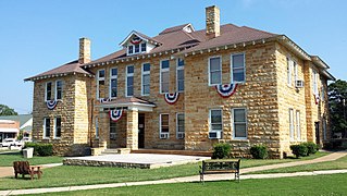
Baxter County is a county in the U.S. state of Arkansas. As of the 2020 census, the county's population was 41,627. The county seat is Mountain Home. It is Arkansas's 66th county, formed on March 24, 1873, and named for Elisha Baxter, the tenth governor of Arkansas.

Lakeview is a city in Baxter County, Arkansas, United States. The population was 741 at the 2010 census.

Mountain Home is a city in and the county seat of Baxter County, Arkansas, United States, in the southern Ozark Mountains near the northern state border with Missouri. As of the 2010 census, the city had a population of 12,448. A total of 41,307 persons lived within the city and micropolitan area combined, which encompasses the majority of Baxter County.

Salesville is a city in Baxter County, Arkansas, United States. The population was 450 in 2010.

Batesville is the county seat and largest city of Independence County, Arkansas, United States, 80 miles (183 km) northeast of Little Rock, the state capital. According to the 2010 Census, the population of the city was 10,268. The city serves as a regional manufacturing and distribution hub for the Ozark Mountain region and Northeast Arkansas.

Yellville is a city in and county seat of Marion County, Arkansas, United States. Yellville is located in the Ozark Mountains along the banks of Crooked Creek, and neighbors the small town of Summit to the north. The population was 1,178 at the 2020 census. The town's original name is preserved in the Shawnee Town Branch, a local creek. The town also holds an annual Turkey Trot Festival.

The Buffalo River, located in Northern Arkansas, was the first National River to be designated in the United States. The Buffalo River is 153 miles (246 km) long. The lower 135 miles (217 km) flow within the boundaries of an area managed by the National Park Service, where the stream is designated the Buffalo National River. The river flows through Newton, Searcy, Marion, and Baxter Counties, from west to east. The river originates in the highest part of the Boston Mountains of the Ozarks, flows out onto the Springfield Plateau near the historic community of Erbie, and finally crosses a portion of the Salem Plateau just before joining the White River. The Park is home to the state's only elk herd. The upper section of the river in the Ozark National Forest is managed by the U.S. Forest Service and is designated as a National Scenic River and a National Wild River; that section is not part of the area managed as a park by the Park Service but is managed as a part of the Ozark National Forest.

U.S. Route 412 is an east–west United States highway, first commissioned in 1982. U.S. 412 overlaps expressway-grade Cimarron Turnpike from Tulsa west to Interstate 35 and the Cherokee Turnpike from 5 miles (8.0 km) east of Chouteau, Oklahoma, to 8 miles (13 km) west of the Arkansas state line. It runs the entire length of the Oklahoma Panhandle and traverses the Missouri Bootheel. Despite its numbering it is not associated with U.S. Route 12.

Highway 5 is a designation for three state highways in Arkansas. The southern segment of 40.20 miles (64.70 km) runs from Highway 7 in Hot Springs north to Interstate 430 (I-430) and US Highway 70 (US 70) in Little Rock.

Highway 101 is a designation for two north–south state highways in north central Arkansas. A western route of 11.17 miles (17.98 km) runs north from US Route 62/US Route 412 (US 62/US 412) to Missouri Route 101 at the Missouri state line. A second route of 7.13 miles (11.47 km) begins at Hand Valley and runs north to US 62/US 412.
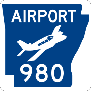
Highway 980 is a state highway designation for all state maintained airport roads in Arkansas.

Highway 178 is a designation for two east–west state highways in the Ozark Mountains. One segment begins near Flippin and runs east across Bull Shoals Dam to downtown Mountain Home. A second segment begins in eastern Mountain Home and runs east to Lake Norfork. Both highways are maintained by the Arkansas Department of Transportation (ArDOT).

Highway 126 is a designation for two north–south state highways in Baxter County, Arkansas. A southern route of 11.66 miles (18.76 km) runs from Buffalo City north to US Route 62/US Route 412 (US 62/US 412) near Mountain Home. A second route of 7.03 miles (11.31 km) begins at US 62/US 412 in Gassville and runs north to Highway 5/Highway 178 at Midway.

Highway 341 is a designation for two north–south state highways in Baxter County. One segment of 26.15 miles (42.08 km) runs from Highway 14 north to Highway 5 in Salesville. A second segment of 1.91 miles (3.07 km) runs northeast from Highway 5 near Briarcliff to Tracy Ferry Road/Rocky Ridge Road near Norfork Lake.

Highway 201 is a north–south state highway in Baxter County, Arkansas. The route runs 24.05 miles (38.70 km) from Arkansas Highway 341 in Salesville north to the Missouri state line through Mountain Home, the county seat of Baxter County.

Sixteen special routes of U.S. Route 62 currently exist. Seven of them lie within the state of Arkansas. Three existed in the past but have since been decommissioned.
Midway is a census-designated place in Baxter County, Arkansas, United States. Midway is 5.5 miles (8.9 km) northwest of Mountain Home. Per the 2020 census, the population was 1,036. Midway has a post office with ZIP code 72651. Long home to a rural trading post, Midway became a boomtown during the construction of the Bull Shoals Dam, and later evolved to serve tourists and retirees attracted to the lake.
Gamalielgə-MAIL-ee-ə is an unincorporated community and census-designated place (CDP) in Baxter County, Arkansas, United States. Gamaliel is located along Arkansas Highway 101, 12 miles (19 km) northeast of Mountain Home and 3 mi (4.8 km) south of the Arkansas—Missouri border. Gamaliel has a post office with ZIP code 72537.
Three Brothers is an unincorporated community in northwestern Baxter County, Arkansas, United States.


