Cotter, Arkansas

Last updated

Cotter, Arkansas
Cotter Bridge, Baxter County, Arkansas.JPG
Cotter Bridge over the White River
Motto: 
"Trout capital U.S.A."
Baxter County Arkansas Incorporated and Unincorporated areas Cotter Highlighted 0515490.svg
Location of Cotter in Baxter County, Arkansas.
Coordinates: 36°16′55″N92°31′16″W / 36.28194°N 92.52111°W / 36.28194; -92.52111 [1]
Country United States
State Arkansas
County Baxter
IncorporatedNovember 23, 1905
Government
  Type Mayor–council
  MayorMac Caradine
Area
[2]
  Total2.45 sq mi (6.34 km2)
  Land2.45 sq mi (6.34 km2)
  Water0.00 sq mi (0.00 km2)
Elevation
[1]
640 ft (200 m)
Population
 (2020)
  Total886
  Density362.08/sq mi (139.78/km2)
Time zone UTC-6 (Central (CST))
  Summer (DST) UTC-5 (CDT)
ZIP code
72626
Area code 870
FIPS code 05-15490
GNIS feature ID2404136 [1]
Website www.cotterweb.com

Cotter is a city in Baxter County, Arkansas, United States. The population was 886 at the 2020 census.

Contents

History

The Cotter Bridge was critical in the development of The Ozarks. Cotter Bridge Spanning White River wide.jpg
The Cotter Bridge was critical in the development of The Ozarks.

Native American Bluff Dwellers were the original inhabitants of the area now known as Cotter for centuries before settlers arrived. When Native Americans were moved westward on the Trail of Tears, approximately 1000 Cherokees crossed just a short distance upriver from the current location of Downtown Cotter. [3]

Exploration and settlement

In 1819, Henry Schoolcraft was exploring the Ozarks and spent a night in the Cotter area. He said of the area, [4]

White River is one of the most beautiful and enchanting streams, and by far the most transparent, which discharge their waters into the Mississippi ... We here behold the assembled tributaries flowing in a smooth, broad. deep, and majestic current ... skirted at a short distance by mountains of the most imposing grandeur.... [The] extreme limpidity and want of colour ... was early seized upon by the French traders on first visiting this stream, in calling it "La Rivière Blanche" (White River).

In 1868, Jonathan Cunningham homesteaded 300 acres on a peninsula of the White River. In 1883, he sold it to L.P. Kemp. During that time, there was a ferry landing about 100 yards downriver called Lake's Ferry. The only power to operate the ferry was the current of the river. At the time, it was the only means of transportation across. Families would travel from Mountain Home and Yellville to visit the area, picnic, fish, and enjoy the nearby spring that was created naturally via the caves under the ground. [5]

Future president, Herbert Hoover, spent the summer of 1892 helping Geologist John C. Branner survey the northern Ozarks. By the early 1900s, there were many mining companies active in both Baxter and Marion Counties. Cotter quickly became a central point where minerals could be shipped via steamboat to much larger cities in central Arkansas or southern Missouri.

In 1902, the city opened a post office. In 1903, L.P. Kemp sold the 300 acres to the Red Bud Realty Company for an unknown amount. Red Bud's principles, W.V. Powell, Jerry South, and Thomas Combs all ended up having avenues named in their honor. A school opened in 1904. On July 7, 1904, 36 of the community's leaders petitioned to incorporate the town and on November 23, 1905, the city officially opened.

White River Line

Seeking to capitalize on the growing trade in the area, the Missouri-Pacific Railroad announced plans to open the White River Line which would run through the area and would connect with the main line in Lake's Landing. In 1905, the Missouri Pacific Railroad bought the area and sold over one thousand lots, mostly to railroad employees. [6] The city was incorporated in 1905 as Cotter, Arkansas. [7] By that time, the population was over 600. The town was named after William Cotter, an official for the Missouri Pacific Railway System. The materials required to build the town and railroad had to be brought in by steamboats down the White River. Once the railroad was completed, the use of steamboats on the rivers of Arkansas decreased and eventually ceased altogether. In 1906, the first passenger train arrived, and the tourist era began.

Expulsion of African Americans

The construction of the railroad brought many laborers, including African Americans, to the area. However, once the work was completed the sentiment among white residents turned against them. The anti-Black attitude was encouraged by a visit from Arkansas Governor Jeff Davis, who gave a racist speech in Cotter in 1904, and by the local newspaper, the Cotter Courier. In April 1906 the Courier ran an editorial titled "Too Many Negroes", which said that local residents had a "feeling...that the negroes should move on." In and around August 1906, all of Cotter's African Americans were run out of town, except for one family of three, the Masons. In the 1950s advertisements for Cotter boasted that it was "100 per cent white", and the 1960 census recorded no African American residents. [8]

Cotter Bridge

The mercurial White River caused many motorists problems, as the nearest crossing was over 100 miles (160 km) to the north in Branson, Missouri. An inconvenient ferry system made the need for a bridge apparent. Locals wanted a bridge, but they strongly opposed a toll bridge. [9] Arkansas did not have a central highway body at the time, and was instead a patchwork of "road districts", which made the bridge-building efforts even more difficult. Without a toll, funding wasn't available until Arkansas Highway 12 was redesignated U.S. Route 62 in 1930. The Cotter Bridge was constructed through the area using a unique rainbow arch design.

Geography

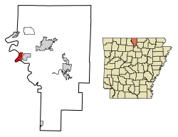
According to the United States Census Bureau, the city has a total area of 2.5 square miles (6.5 km2), all land.

Government

Mayor–City Council

Cotter operates within the mayor–city council form of government. The mayor is elected by a citywide election to serve as the Chief Executive Officer (CEO) of the city by presiding over all city functions, policies, rules and laws. Once elected, the mayor also allocates duties to city employees. Mayors serve two-year terms and can serve unlimited terms. The city council is the unicameral legislative of the City, consisting of six aldermen. Also included in the council's duties is balancing the city's budget and passing ordinances. The body also controls the representatives of specialized city commissions underneath their jurisdiction. Two aldermen are elected from each of the city's four wards.

Current Mayor and Council

MAYOR: McGeorge "Mac" Caradine
Ward 1 Position 1: Carolyn Gill
Ward 1 Position 2: Sheila Wingard
Ward 2 Position 1: Charles "Chuck" Sugg
Ward 2 Position 2: Linda McCarthy
Ward 3 Position 1: Mertice Kray
Ward 3 Position 2: Vacant

List of Mayors

Cotter Mayors
MayorYears ServedYears Lived
1Charles B. Eaton1909-19221861-1923
2Roderick M. Ruthven1922-19351885-1962
3Hiram C. Lonon1935-19431884-1970
4B.R. Pratt1943-1947-1949
5Hiram C. Lonon1947-19531884-1970
6R.Howell Freeman1953-19631903-1964
7Frank G. Wallick1963-1964Unknown
8Rex S. Bayless1964-19871918-2010
9Lewis Dennis1987-1990Unknown
10Rex S. Bayless1990-19951918-2010
11W.R. "Bill" Jennings1995-1999Unknown
12J.D. Pratt1999-2003Unknown
13W.R. "Bill" Jennings2003-2005Unknown
14Elwood "Mo" Monsley2005-2007Unknown
15David J. McNair2007-2010Unknown
16Steven Raines2010-2010Unknown
17Peggy Hammack2011-2019Living
18McGeorge "Mac" Caradine2019-PresentLiving

Demographics

Historical population
CensusPop.Note
1910 894
1920 884−1.1%
1930 1,06420.4%
1940 903−15.1%
1950 1,08920.6%
1960 683−37.3%
1970 85825.6%
1980 9207.2%
1990 867−5.8%
2000 9216.2%
2010 9705.3%
2020 886−8.7%
U.S. Decennial Census [10]

2020 census

Cotter racial composition [11]
RaceNumberPercentage
White (non-Hispanic)78488.49%
Black or African American (non-Hispanic)10.11%
Native American 70.79%
Asian 40.45%
Other/Mixed 687.67%
Hispanic or Latino 222.48%

As of the 2020 United States census, there were 886 people, 419 households, and 271 families residing in the city.

2010 census

As of the census [12] of 2010, there were 1,078 people, 472 households and 293 families residing in the city. The population density was 373.6 inhabitants per square mile (144.2/km2). There were 501 housing units at an average density of 203.2 per square mile (78.5/km2). The racial makeup of the city was 97.07% White, 0.87% Native American, 0.22% Asian, and 1.85% from two or more races. 1.52% of the population were Hispanic or Latino of any race.

There were 545 [13] households, out of which 20.8% had children under the age of 18 living with them, 48.5% were married couples living together, 8.6% had a female householder with no husband present, and 40.0% were non-families. 35.4% of all households were made up of individuals, and 16.7% had someone living alone who was 65 years of age or older. The average household size was 2.08 and the average family size was 2.67.

In the city, the population was spread out, with 19.7% under the age of 18, 8.7% from 18 to 24, 24.8% from 25 to 44, 26.7% from 45 to 64, and 20.2% who were 65 years of age or older. The median age was 43 years. For every 100 females, there were 97.2 males. For every 100 females age 18 and over, there were 99.5 males.

The median income for a household in the city was $22,857, and the median income for a family was $34,375. Males had a median income of $26,298 versus $17,266 for females. The per capita income for the city was $15,893. About 11.9% of families and 16.8% of the population were below the poverty line, including 18.3% of those under age 18 and 13.3% of those age 65 or over.

Education

Formal education in Cotter began with Miss Cora Patterson teaching 40 students under a tent on January 4, 1904. [14] In 1915, Cotter schools merged with the East Cotter School District, with the Gassville and Whiteville districts merging into Cotter in 1948.

Today, public education is provided by the Cotter School District including Cotter High School (grades 7 through 12) and Amanda Gist Elementary School (kindergarten through grade 6). [15]

Media

Cotter and Baxter County are within the Springfield, Missouri TV market.

The city has been home to five newspapers over the years, the longest lasting being the Cotter Courier (1903-c. 1918) [16] and The Cotter Record (1911-1937). [17] Publications lasting only a year or so include The White River Headlight, [16] The Screech Owl, and the Bull Shoals Gazette. [17] Today, Cotter news is covered by The Baxter Bulletin .

Infrastructure

List of highways

Railroads

Cotter has one local railroad, the Missouri and Northern Arkansas Railroad. The MNA leases the track from Newport to Kansas City, Missouri, from the Union Pacific. The regular train traffic are empty coal trains from The Independence power plant, as well as a north and south local out of Cotter. Additionally, there is a small railyard and crew change point

Airports

Cotter is accessible to two separate commercial airports, Ozark Regional Airport (Baxter County) and Flippin Municipal Airport (Marion County). There is also a rural air field, Valley Airport, located on Denton Ferry Road that serves small planes owned by residents.

Related Research Articles

<span class="mw-page-title-main">Ozark County, Missouri</span> County in Missouri, United States

Ozark County is a county in the southern portion of the U.S. state of Missouri. As of the 2020 census, the population was 8,553. The largest city and county seat is Gainesville. The county was organized as Ozark County, named after the Ozark Mountains, on January 29, 1841. It was renamed Decatur County, after Commodore Stephen Decatur, from 1843 to 1845, after which the name Ozark County was restored.

<span class="mw-page-title-main">Stone County, Arkansas</span> County in Arkansas, United States

Stone County is located in the Ozark Mountains in the U.S. state of Arkansas. The county is named for rugged, rocky area terrain of the Ozarks. Created as Arkansas's 74th county on April 21, 1873, Stone County has two incorporated cities: Mountain View, the county seat and most populous city, and Fifty-Six. The county is also the site of numerous unincorporated communities and ghost towns.

<span class="mw-page-title-main">Marion County, Arkansas</span> County in Arkansas, United States

Marion County is located in the Ozark Mountains in the U.S. state of Arkansas. The county is named for Francis Marion, the famous "Swamp Fox" of the Revolutionary War. Created as Arkansas's 35th county in 1836, Marion County is home to one incorporated town and four incorporated cities, including Yellville, the county seat. The county is also the site of numerous unincorporated communities and ghost towns. The county included part of what is now Searcy County, Arkansas, with many opposing to dividing them, which helped fueled the bloody Tutt-Everett War between 1844 and 1850.

<span class="mw-page-title-main">Crawford County, Arkansas</span> County in Arkansas, United States

Crawford County is a county located in the Ozarks region of the U.S. state of Arkansas. As of the 2020 census, the population was 60,133. The county seat and largest city is Van Buren. Crawford County was formed on October 18, 1820, from the former Lovely County and Indian Territory, and was named for William H. Crawford, the United States Secretary of War in 1815.

<span class="mw-page-title-main">Benton County, Arkansas</span> County in Arkansas, United States

Benton County is a county within the Northwest Arkansas region with a culture, economy, and history that have transitioned from rural and agricultural to suburban and white collar since the growth of Walmart, which is headquartered in Benton County. Created as Arkansas's 35th county on September 30, 1836, Benton County contains thirteen incorporated municipalities, including Bentonville, the county seat, and Rogers, the most populous city. The county was named after Thomas Hart Benton, a U.S. Senator from Missouri influential in Arkansas statehood.

<span class="mw-page-title-main">Baxter County, Arkansas</span> County in Arkansas, United States

Baxter County is a county in the U.S. state of Arkansas. As of the 2020 census, the county's population was 41,627. The county seat is Mountain Home. It is Arkansas's 66th county, formed on March 24, 1873, and named for Elisha Baxter, the tenth governor of Arkansas.

<span class="mw-page-title-main">Gassville, Arkansas</span> City in Arkansas, United States

Gassville is a city in Baxter County, Arkansas, United States. According to the 2020 census, the city population was 2,171.

<span class="mw-page-title-main">Mountain Home, Arkansas</span> City in Arkansas, United States

Mountain Home is a city in and the county seat of Baxter County, Arkansas, United States, in the southern Ozark Mountains near the northern state border with Missouri. As of the 2010 census, the city had a population of 12,448. A total of 41,307 persons lived within the city and micropolitan area combined, which encompasses the majority of Baxter County.

<span class="mw-page-title-main">Lead Hill, Arkansas</span> Town in Arkansas, United States

Lead Hill is a town in Boone County, Arkansas, United States. The population was 271 at the 2010 census. It is part of the Harrison Micropolitan Statistical Area.

<span class="mw-page-title-main">Altus, Arkansas</span> City in Arkansas, United States

Altus is a city in Franklin County, Arkansas, United States. Located within the Arkansas River Valley at the edge of the Ozark Mountains, the city is within the Fort Smith metropolitan area. The epicenter of the Altus American Viticultural Area (AVA) within Arkansas Wine Country, the city is home to four wineries. Although founded as a coal mining community, the wine industry has driven the Altus economy since the first vineyards were planted in 1872. The population was 758 at the 2010 census, down from 817 at the 2000 census. In 2020, the population was 669 and was estimated as unchanged in 2021 and 2022.

<span class="mw-page-title-main">Ozark, Arkansas</span> City in Arkansas, United States

Ozark is a city in Franklin County, Arkansas, United States and one of the county's two seats of government. The community is located along the Arkansas River in the Arkansas River Valley on the southern edge of the Ozark Mountains. As of the 2010 census it had a population of 3,684.

<span class="mw-page-title-main">Salem, Fulton County, Arkansas</span> City in Arkansas, United States

Salem is the county seat of Fulton County, Arkansas, United States. Salem was first incorporated in 1900. As of the 2010 census the population stood at 1,635.

<span class="mw-page-title-main">Batesville, Arkansas</span> City in Arkansas, United States

Batesville is the county seat and largest city of Independence County, Arkansas, United States, 80 miles (183 km) northeast of Little Rock, the state capital. According to the 2010 Census, the population of the city was 10,268. The city serves as a regional manufacturing and distribution hub for the Ozark Mountain region and Northeast Arkansas.

<span class="mw-page-title-main">Gilbert, Arkansas</span> Town in Arkansas, United States

Gilbert is a town in Searcy County, Arkansas, United States. The population was 26 at the 2020 census, ranking it as the smallest municipality in the state and one of the smallest in the nation. Over the years, Gilbert has gained a reputation as one of the coldest locations in Arkansas.

<span class="mw-page-title-main">St. Joe, Arkansas</span> Town in Arkansas, United States

St. Joe or Saint Joe is a town in Searcy County, Arkansas, United States. The population was 132 at the 2010 census.

<span class="mw-page-title-main">Hardy, Arkansas</span> City in Sharp and Fulton counties, US

Hardy is the 2nd oldest city in Sharp and Fulton counties in the U.S. state of Arkansas. The population was 765 in 2020.

<span class="mw-page-title-main">Baxter Springs, Kansas</span> City in Cherokee County, Kansas

Baxter Springs is a city in Cherokee County, Kansas, United States, and located along Spring River. As of the 2020 census, the population of the city was 3,888.

<span class="mw-page-title-main">Cassville, Missouri</span> City in Missouri, United States

Cassville is a city in Flat Creek Township, Barry County, Missouri, United States. According to the 2020 census, the population of Cassville was 3,190. Cassville is one of the primary markets and job centers for an estimated 14,000 people living in the surrounding area. It is the county seat of Barry County.

<span class="mw-page-title-main">Sparta, Missouri</span> City in Missouri, United States

Sparta is a city in north central Christian County, Missouri, United States. The population was 1,756 at the 2010 census.

<span class="mw-page-title-main">Cotter Bridge</span> Bridge in Cotter, Arkansas

The Cotter Bridge, also known as the R. M. Ruthven Bridge and the White River Concrete Arch Bridge, carries U.S. Route 62 Business across the White River west of the city of Cotter in Baxter County, Arkansas. Upon completion, the bridge opened a part of the Ozarks previously inaccessible to motorists. Constructed in 1930, it is the only bridge built by the Marsh Engineering Company of Des Moines, Iowa, in the state of Arkansas.

References

  1. 1 2 3 U.S. Geological Survey Geographic Names Information System: Cotter, Arkansas
  2. "2020 U.S. Gazetteer Files". United States Census Bureau. Retrieved October 29, 2021.
  3. "Cotter, Arkansas, history: Anne Ramey". Archived from the original on January 15, 2011. Retrieved August 20, 2010.
  4. Scenes and Adventures in the Semi-Alpine Regions of the Ozark of Missouri and Arkansas (1853) pg 120-121
  5. "Early History of Cotter, Arkansas, site of the Railroad Workers Memorial". Archived from the original on August 21, 2013. Retrieved April 10, 2013.
  6. Bennett, Lola and Smith, Corinne. "Historic American Engineering Record Cotter Bridge (R.M. Ruthven Bridge)." 1988.History. Archived December 13, 2010, at the Wayback Machine Page 3. Retrieved August 20, 2010.
  7. Ramey, Ann. "Cotter Historical Briefs." History. Archived January 15, 2011, at the Wayback Machine Retrieved August 20, 2010.
  8. Lancaster, Guy. "Cotter Expulsion of 1906". CALS Encyclopedia of Arkansas. Central Arkansas Library System. Retrieved September 28, 2020.
  9. Bennett, Lola and Smith, Corinne. "Historic American Engineering Record Cotter Bridge (R.M. Ruthven Bridge)." 1988. History. Archived December 13, 2010, at the Wayback Machine Page 6. Retrieved August 20, 2010.
  10. "Census of Population and Housing". Census.gov. Retrieved June 4, 2015.
  11. "Explore Census Data". data.census.gov. Retrieved January 1, 2022.
  12. "U.S. Census website". United States Census Bureau . Retrieved January 31, 2008.
  13. "2010 Census Results" . Retrieved April 9, 2011.
  14. McClelland, Frances Shiras (December 1982). History of Baxter County, Arkansas: from the beginning to 1939 (2nd printing ed.). Saint Louis University. p. 52. OCLC   733695700.
  15. School District Reference Map (2010 Census) Baxter County, AR (PDF) (Map). US Census Bureau. Retrieved July 12, 2011.
  16. 1 2 Allsopp, Frederick W. (1922). History of the Arkansas Press for a Hundred Years and More (PDF) (Reprint ed.). Little Rock, Ark: Parke-Harper Pub. Co. p. 60. ISBN   9780893080730. OCLC   3576168 via Southern Historical Press.
  17. 1 2 Meriwether, Robert W. (1974). A Chronicle of Arkansas Newspapers Published Since 1922 and of the Arkansas Press Association, 1930-1972. Little Rock, Ark: Arkansas Press Association. p. 5. OCLC   2146483.