Baxter County is a county in the Ozark Mountains of Arkansas. Created as Arkansas's 66th county on March 24, 1873, the county has eight incorporated municipalities, including Mountain Home, its largest city and county seat. The county is named for Elisha Baxter, the tenth governor of Arkansas. It is coterminal with the Mountain Home Micropolitan Statistical Area.

Cotter is a city in Baxter County, Arkansas, United States. The population was 886 at the 2020 census.

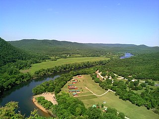
The Buffalo National River, in Northern Arkansas, was the first National River to be designated in the United States. The Buffalo River is 153 miles (246 km) long. The lower 135 miles (217 km) flow within the boundaries of an area managed by the National Park Service, where the stream is designated the Buffalo National River. The river flows through Newton, Searcy, Marion, and Baxter Counties, from west to east. The river originates in the highest part of the Boston Mountains of the Ozarks, flows out onto the Springfield Plateau near the historic community of Erbie, and finally crosses a portion of the Salem Plateau just before joining the White River. The Park is home to the state's only elk herd. The upper section of the river in the Ozark National Forest is managed by the U.S. Forest Service and is designated as a National Scenic River and a National Wild River.

U.S. Route 412 is an east–west United States highway, first commissioned in 1982. U.S. 412 overlaps expressway-grade Cimarron Turnpike from Tulsa west to Interstate 35 and the Cherokee Turnpike from 5 miles (8.0 km) east of Chouteau, Oklahoma, to 8 miles (13 km) west of the Arkansas state line. It runs the entire length of the Oklahoma Panhandle and traverses the Missouri Bootheel.

Norfork Dam impounds the North Fork River in the U.S. state of Arkansas, creating Norfork Lake. The large reservoir is maintained by the United States Army Corps of Engineers and spans Baxter County, Arkansas, Fulton County, Arkansas and Ozark County, Missouri. The dam is located in the city of Salesville in Baxter County, within the Ozark Mountains.

Arkansas Highway 16 is a designation for three state highways in Arkansas. One segment of 24.13 miles (38.83 km) runs from U.S. Route 412 in Siloam Springs east to Interstate 49 (I-49) in Fayetteville. A second segment of 71.67 miles (115.34 km) runs from I-49 in Fayetteville east to Highway 7 in the Ozark National Forest. A third segment of 132.69 miles (213.54 km) runs from Highway 7 at Sand Gap east to US 67B in Searcy. Highway 16 was created during the 1926 Arkansas state highway numbering, and much of the highway winds through the Ozarks, including the Ozark National Forest, where a portion of it is designated as an Arkansas Scenic Byway. The route has two spur routes in Northwest Arkansas; in Fayetteville and Siloam Springs.

Arkansas Highway 21 is a north–south state highway in north central Arkansas. The route runs 99.14 miles (159.55 km) from U.S. Route 64 (US 64) in Clarksville north across US 62 to the Missouri state line. The route is a two-lane highway with the exception of a brief concurrency with US 62, a four-lane highway, in Berryville.

The Frankford Avenue Bridge, also known as the Pennypack Creek Bridge, the Pennypack Bridge, the Holmesburg Bridge, and the King's Highway Bridge, erected in 1697 in the Holmesburg section of Northeast Philadelphia, in the U.S. state of Pennsylvania, is the oldest surviving roadway bridge in the United States. The three-span, 73-foot-long (22 m) twin stone arch bridge carries Frankford Avenue, just north of Solly Avenue, over Pennypack Creek in Pennypack Park.
The Jenkins' Ferry Battleground State Park, also known as the Jenkins' Ferry Battlefield, is a battlefield in Grant County, Arkansas. The Arkansas state park commemorates the Battle of Jenkins' Ferry fought on Saturday, April 30, 1864, during the Red River campaign of the American Civil War.

Arkansas Highway 14 is a designation for two state highways in Arkansas. One segment of 208.12 miles (334.94 km) begins east of Table Rock Lake and runs east to Interstate 555 (I-555) at Payneway. A second segment of 19.23 miles (30.95 km) runs from Highway 140 in Lepanto east to Mississippi CR S449 at Golden Lake. Segments of the highway are part of two Arkansas Scenic Byways: Sylamore Scenic Byway in the Ozark National Forest and the Crowley's Ridge Parkway atop Crowley's Ridge.

Highway 178 is a designation for two east–west state highways in the Ozark Mountains. One segment begins near Flippin and runs east across Bull Shoals Dam to downtown Mountain Home. A second segment begins in eastern Mountain Home and runs east to Lake Norfork. Both highways are maintained by the Arkansas Department of Transportation (ArDOT).

Highway 126 is a designation for two north–south state highways in Baxter County, Arkansas. A southern route of 11.66 miles (18.76 km) runs from Buffalo City north to US Route 62/US Route 412 (US 62/US 412) near Mountain Home. A second route of 7.03 miles (11.31 km) begins at US 62/US 412 in Gassville and runs north to Highway 5/Highway 178 at Midway.

Highway 341 is a designation for two north–south state highways in Baxter County. One segment of 26.15 miles (42.08 km) runs from Highway 14 north to Highway 5 in Salesville. A second segment of 1.91 miles (3.07 km) runs northeast from Highway 5 near Briarcliff to Tracy Ferry Road/Rocky Ridge Road near Norfork Lake.

Highway 345 is a north–south state highway in Baxter County, Arkansas. The route runs 3.36 miles (5.41 km) between U.S. Route 62 Business in Cotter and US 62/US 412 in Gassville.

U.S. Route 62 is a U.S. highway running from El Paso, Texas northeast to Niagara Falls, New York. In the U.S. state of Arkansas, the route runs 329.9 miles from the Oklahoma border near Summers east to the Missouri border in St. Francis, serving the northern portion of the state. The route passes through several cities and towns, including Fayetteville, Springdale, Bentonville, Harrison, Mountain Home, Pocahontas, and also Piggott. US 62 runs concurrent with several highways in Arkansas including Interstate 49 and U.S. Route 71 between Fayetteville and Bentonville, U.S. Route 412 through much of the state, U.S. Route 65 in the Harrison area, and with U.S. Route 63 and U.S. Route 67 in northeast Arkansas.

The Zion – Mount Carmel Highway is a 25-mile (40 km) long road in Washington and Kane counties in southern Utah, United States, that is listed on the National Register of Historic Places and is a National Historic Civil Engineering Landmark.
Sixteen special routes of U.S. Route 62 currently exist. Seven of them lie within the state of Arkansas. Three existed in the past but have since been decommissioned.

The Red River Bridge was a truss bridge crossing the Red River at Garland, Arkansas. It carried vehicular traffic from 1931 to 1990 and has since been demolished.

The Baxter County Courthouse is a courthouse in Mountain Home, Arkansas, United States, the county seat of Baxter County, built in 1941. It was listed on the National Register of Historic Places in 1995. The building replaced another courthouse on the same site which was deemed unsafe in 1939.

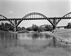
The North Fork Bridge carries Arkansas Highway 5 over the North Fork River, or the North Fork of the White River, in Norfork, Arkansas, United States. It is a modern steel girder bridge, replacing a 1937 Warren deck truss bridge, which was the first road crossing of the North Fork River in Norfork. The 1937 bridge, demolished in 2014, was listed on the U.S. National Register of Historic Places in 1990, but was delisted in 2015.