Lakeview, Arkansas

Last updated

Lakeview, Arkansas
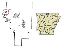
Baxter County Arkansas Incorporated and Unincorporated areas Lakeview Highlighted 0538050.svg
Location of Lakeview in Baxter County, Arkansas.
Coordinates: 36°22′38″N92°32′07″W / 36.37722°N 92.53528°W / 36.37722; -92.53528
CountryUnited States
State Arkansas
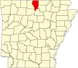
Counties Baxter
Area
[1]
  Total1.04 sq mi (2.69 km2)
  Land1.04 sq mi (2.69 km2)
  Water0.00 sq mi (0.00 km2)
Elevation
[2]
787 ft (240 m)
Population
 (2020)
  Total775
  Density745.19/sq mi (287.66/km2)
FIPS code 05-38050
GNIS feature ID2404876 [2]
Website cityoflakeview.com

Lakeview is a city in Baxter County, Arkansas, United States. The population was 741 at the 2010 census.

Contents

Geography

According to the United States Census Bureau, the city has a total area of 1.1 square miles (2.8 km2), all land.

The community is located along Arkansas Highway 178 Arkansas 178.svg .

School District

Lakeview is in the Mountain Home School District. [3] The site of the proposed town was first settled in the mid-1880s and was called Trimble Flat, for the Trimble family, first settlers on the flat fertile plateau overlooking the White River. When the school, Baxter County District No. 25, and the post office were established, they were called Amos. The community, church and cemetery remained Trimble Flat.

Demographics

Historical population
CensusPop.Note
1960 103
1980 512
1990 485−5.3%
2000 76357.3%
2010 741−2.9%
2020 7754.6%
U.S. Decennial Census [4]

2020 census

Lakeview, Arkansas – Racial and ethnic composition
Note: the US Census treats Hispanic/Latino as an ethnic category. This table excludes Latinos from the racial categories and assigns them to a separate category. Hispanics/Latinos may be of any race.
Race / Ethnicity (NH = Non-Hispanic)Pop 2000 [5] Pop 2010 [6] Pop 2020 [7] % 2000% 20102020
White alone (NH)74671872397.77%96.90%93.29%
Black or African American alone (NH)0000.00%0.00%0.00%
Native American or Alaska Native alone (NH)3290.39%0.27%1.16%
Asian alone (NH)4440.52%0.54%0.52%
Pacific Islander alone (NH)0000.00%0.00%0.00%
Some Other Race alone (NH)0010.00%0.00%0.13%
Mixed Race or Multi-Racial (NH)06250.00%0.81%3.23%
Hispanic or Latino (any race)1011131.31%1.48%1.68%
Total763741775100.00%100.00%100.00%

As of the census [8] of 2010, there were 883 people, 402 households, and 282 families residing in the city. The population density was 664.4 inhabitants per square mile (256.5/km2). There were 426 housing units at an average density of 371.0 per square mile (143.2/km2). The racial makeup of the city was 98.95% White, 0.39% Native American, 0.52% Asian, 0.13% from other races. 1.31% of the population were Hispanic or Latino of any race.

There were 372 households, out of which 14.0% had children under the age of 18 living with them, 64.2% were married couples living together, 2.2% had a female householder with no husband present, and 32.0% were non-families. 28.2% of all households were made up of individuals, and 15.9% had someone living alone who was 65 years of age or older. The average household size was 2.05 and the average family size was 2.45.

In the city, the population was spread out, with 13.6% under the age of 18, 3.5% from 18 to 24, 14.3% from 25 to 44, 30.4% from 45 to 64, and 38.1% who were 65 years of age or older. The median age was 60 years. For every 100 females, there were 102.9 males. For every 100 females age 18 and over, there were 101.5 males.

The median income for a household in the city was $31,667, and the median income for a family was $38,482. Males had a median income of $27,750 versus $25,313 for females. The per capita income for the city was $16,667. About 7.9% of families and 12.1% of the population were below the poverty line, including 19.6% of those under age 18 and 4.1% of those age 65 or over.
See also

Related Research Articles

<span class="mw-page-title-main">Catoosa County, Georgia</span> County in Georgia, United States

Catoosa County is a county located in the northwestern part of the U.S. state of Georgia. As of the 2020 census, the population was 67,872. The county seat is Ringgold. The county was created on December 5, 1853. The meaning of the Cherokee language name "Catoosa" is obscure: "Catoosa" may come from the Cherokee words gatusi or gatu'gitse.

<span class="mw-page-title-main">North Crossett, Arkansas</span> CDP in Arkansas, United States

North Crossett is a census-designated place (CDP) in Ashley County, Arkansas, United States. Per the 2020 census, the population was 2,756.

<span class="mw-page-title-main">West Crossett, Arkansas</span> CDP in Arkansas, United States

West Crossett is a census-designated place (CDP) in Ashley County, Arkansas, United States. Per the 2020 census, the population was 1,144.

<span class="mw-page-title-main">Gassville, Arkansas</span> City in Arkansas, United States

Gassville is a city in Baxter County, Arkansas, United States. According to the 2020 census, the city population was 2,171.

<span class="mw-page-title-main">Norfork, Arkansas</span> City in Arkansas, United States

Norfork is a city in Baxter County, Arkansas, United States. The population was 550 at the 2010 census.

<span class="mw-page-title-main">Harrell, Arkansas</span> Town in Arkansas, United States

Harrell is a town in Calhoun County, Arkansas, United States. The population was 254 at the 2010 census. It is part of the Camden Micropolitan Statistical Area.

<span class="mw-page-title-main">Anthonyville, Arkansas</span> Town in Arkansas, United States

Anthonyville is a town in Crittenden County, Arkansas, United States. The population was 161 at the 2010 census, down from 250 in 2000.

<span class="mw-page-title-main">Edmondson, Arkansas</span> Town in Arkansas, United States

Edmondson is a town in Crittenden County, Arkansas, United States. The population was 427 at the 2010 census.

<span class="mw-page-title-main">Gilmore, Arkansas</span> City in Arkansas, United States

Gilmore is a city in Crittenden County, Arkansas, United States. Per the 2020 census, the population was 176.

<span class="mw-page-title-main">Turrell, Arkansas</span> City in Arkansas, United States

Turrell is a city in Crittenden County, Arkansas, United States. Per the 2020 census, the population was 517.

<span class="mw-page-title-main">Carthage, Arkansas</span> Town in Arkansas, United States

Carthage is a town in Dallas County, Arkansas, United States. The population was 343 at the 2010 census.

<span class="mw-page-title-main">Bradley, Arkansas</span> City in Arkansas, United States

Bradley is a city in Lafayette County, Arkansas, United States. The population was 628 at the 2010 census.

<span class="mw-page-title-main">Haynes, Arkansas</span> Town in Arkansas, United States

Haynes is a town in Lee County, Arkansas, United States. The population was 150 at the 2010 census, down from 214 at the 2000 census.

<span class="mw-page-title-main">Rondo, Arkansas</span> Town in Arkansas, United States

Rondo is a town in Lee County, Arkansas, United States. The population was 198 at the 2010 census, down from 237 at the 2000 census.

<span class="mw-page-title-main">Bluff City, Arkansas</span> Town in Arkansas, United States

Bluff City is an unincorporated town in Nevada County, Arkansas, United States. The population was 158 at the 2000 census. It is part of the Hope Micropolitan Statistical Area.

<span class="mw-page-title-main">Lake View, Arkansas</span> Place in Arkansas, United States

Lake View is a city in Phillips County, Arkansas, United States. The population was 443 at the 2010 census. Because there is also a Lakeview in Baxter County. The original settlement name was "Turkey Scratch" from the 1850s to the official declaration of the town's namesake was in the 1920s. When the town was re-established in 1937, Lake View became one of three communities in Arkansas to be reserved for black farm families by the Resettlement Administration. It is one of the few communities in the U.S. with an African-American percentage at over 90 percent of the populations.

<span class="mw-page-title-main">Fredonia (Biscoe), Arkansas</span> City in Arkansas, United States

Fredonia (Biscoe) is a city in Prairie County, Arkansas, United States. The population was 363 at the 2010 census.

<span class="mw-page-title-main">Tildenville, Florida</span> Census-designated place in Florida, United States

Tildenville is a census-designated place (CDP) and an unincorporated area in Orange County, Florida, United States. The population was 511 at the 2010 census, most of them African American. It is part of the Orlando–Kissimmee Metropolitan Statistical Area. Generally speaking, Tildenville is a narrow area alongside Orange County Road 545, south of Florida State Road 50 and north of the Stoneybrook West planned unit development. Residents utilize Winter Garden, Florida for mail delivery. The CDP takes its name from Luther F. Tilden, a prominent pioneer and citrus magnate who greatly contributed to the community. Historically, Tildenville referred to an area larger than the modern CDP. Landmarks such as Tildenville Elementary School, Tildenville Marketplace, and Meadow Marsh are now located within the city limits of Winter Garden.

<span class="mw-page-title-main">Lakeview, Georgia</span> Place in Georgia, United States

Lakeview is an unincorporated community and census-designated place (CDP) in Catoosa and Walker counties in the U.S. state of Georgia. The population was 4,820 at the 2000 census and 4,777 at the 2020 census. It is part of the Chattanooga, TN–GA Metropolitan Statistical Area.

<span class="mw-page-title-main">Lakeview, New York</span> Hamlet and Census-designated place in New York, United States

Lakeview is a hamlet and census-designated place (CDP) in the Town of Hempstead in Nassau County, on Long Island, in New York, United States. The population was 6,077 at the 2020 census.

References

  1. "2020 U.S. Gazetteer Files". United States Census Bureau. Retrieved October 29, 2021.
  2. 1 2 U.S. Geological Survey Geographic Names Information System: Lakeview, Arkansas
  3. School District Reference Map (2010 Census) Baxter County, AR (PDF) (Map). US Census Bureau. Retrieved July 12, 2011.
  4. "Census of Population and Housing". Census.gov. Retrieved June 4, 2015.
  5. "P004 Hispanic or Latino, and Not Hispanic or Latino by Race – 2000: DEC Summary File 1 – Lakeview city, Arkansas". United States Census Bureau .
  6. "P2 Hispanic or Latino, and Not Hispanic or Latino by Race – 2010: DEC Redistricting Data (PL 94-171) – Lakeview city, Arkansas". United States Census Bureau .
  7. "P2 Hispanic or Latino, and Not Hispanic or Latino by Race – 2010: DEC Redistricting Data (PL 94-171) – Lakeview city, Arkansas". United States Census Bureau .
  8. "U.S. Census website". United States Census Bureau . Retrieved January 31, 2008.