Monte delle Figne is a mountain in Liguria, northern Italy, part of the Ligurian Apennines. It lies at an altitude of 1172 metres.

Monte Frontè is a mountain in Liguria, northern Italy, part of the Alps. It is located in the province of province of Imperia. It lies at an altitude of 2,152 metres. After Monte Saccarello it is the second highest peak in the Ligurian region.

Monte Galero is a mountain in Liguria, northern Italy, part of the Alps. It is located in the provinces of Savona and Cuneo. It lies at an altitude of 1708 metres and, after Monte Armetta, is the second highest summit of the Ligurian Prealps.
Monte Leco is a mountain in Liguria, northern Italy, part of the Ligurian Apennines. It is located in the provinces of Genoa and Alessandria. It lies at an altitude of 1072 metres.

Piani di Praglia is a mountain in Liguria, northern Italy, part of the Ligurian Apennines.

Monte Reixa is a mountain in Liguria, northern Italy, part of the Ligurian Apennines.

Monte Ramaceto is a mountain in Liguria, northern Italy, part of the Ligurian Apennines.

Monte Saccarello (Italian) or Mont Saccarel (French) is a mountain located on the French-Italian border between Liguria, Piedmont and Provence-Alpes-Côte d'Azur.

Monte Taccone is a mountain located between Liguria and Piedmont in north-western Italy. It is part of the Ligurian Apennines.

Colle di Nava at 934 metres (3,064 ft) is a mountain pass in the Province of Imperia in Italy. It is located on the main chain of the Alps and connects Ormea and the Tanaro Valley (CN) with Pieve di Teco and Imperia, the latter on the coast of Ligurian Sea. According both to the SOIUSA and the CAI, the pass marks the Western border of the Ligurian Prealps.

Colle San Bernardo (957 m) is a mountain pass in the Province of Cuneo (Italy).

The Alta Via dei Monti Liguri is a long-distance waymarked hiking trail in the Italian region of Liguria. In about 440 kilometres (270 mi) and 44 day hikes, it runs through the arc formed by Ligurian Alps and Ligurian Apennines from Ventimiglia to Ceparana.

Cima Garlenda is a 2,141 m (7,024 ft) mountain of the Ligurian Alps, in Italy. After Monte Saccarello and Monte Frontè it is the third Ligurian summit.

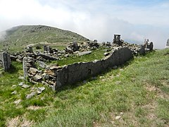
Rifugio Sanremo is a refuge in the Ligurian Alps in Italy. Located at 2,054 m, is the highest mountain hut in Liguria.
Monte Armetta is a mountain in Piedmont, northern Italy, part of the Alps. At an altitude of 1,739 metres it is the highest summit of the Ligurian Prealps.

The Regional Natural Park of the Ligurian Alps is a natural park in Province of Imperia. It was established in 2007 by the legge regionale nr.34 of 15/11/2007.
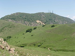
The Beigua Natural Regional Park is a natural park located in province of Savona and the Metropolitan City of Genoa, both in Liguria (Italy). It's the largest protected area of the region. It gets the name from the highest mountain of the area, Monte Beigua.

Bric del Dente is a 1107 metres high mountain of the Apennines located in the Italian region of Liguria.

Monte Monega is a 1,882-metre (6,175 ft) mountain of the Ligurian Alps, in Italy.

Monte Alpesisa is a 989 metres high mountain in the Ligurian Apennines, in Italy.