
The Ligurian Alps are a mountain range in northwestern Italy. A small part is located in France. They form the south-western extremity of the Alps, separated from the Apennines by the Colle di Cadibona. The Col de Tende separates them from the Maritime Alps. They form the border between Piedmont in the north and Liguria in the south.

Fascia is a comune (municipality) in the Metropolitan City of Genoa in the Italian region Liguria, located about 30 kilometres (19 mi) northeast of Genoa.

Monte Prelà is a mountain in Liguria, northern Italy, part of the Ligurian Appennines.
Monte Buio is a mountain in Liguria, northern Italy, part of the Ligurian Appennines. It is located between the provinces of Genoa and Alessandria. It lies at an altitude of 1400 metres.
Monte Castello is a mountain in Liguria, northern Italy, part of the Ligurian Appennines. It is located in the provinces of Genoa and Alessandria. It lies at an altitude of 1092 metres.

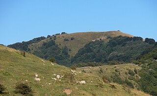
Monte Frontè is a mountain in Liguria, northern Italy, part of the Alps. It is located in the province of province of Imperia. It lies at an altitude of 2,152 metres. After Monte Saccarello it is the second highest peak in the Ligurian region.
Monte Rama is a mountain in Liguria, northern Italy, part of the Ligurian Appennines.
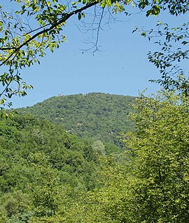
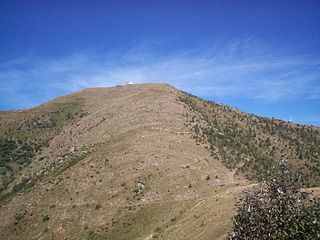
Monte Reale is a mountain of the Ligurian Apennines. It is located in the Province of Genoa along the watershed between the basin of the Scrivia Torrent and that of the Vobbia, its tributary to the right. It is situated in the more western part of the Regional Natural Park of Antola between the municipal territories of Ronco Scrivia and Isola del Cantone.

Rocche del Reopasso is a mountain in Liguria, northern Italy, part of the Ligurian Appennines.

Monte Saccarello (Italian) or Mont Saccarel (French) is a mountain located on the French-Italian border between Liguria, Piedmont and Provence-Alpes-Côte d'Azur.
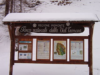
The nature park Parco naturale Val Troncea is located in Val Chisone, municipality of Pragelato in the Metropolitan City of Turin. The park was created in 1980 to preserve the natural environment.

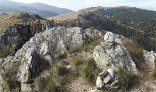
The Alta Via dei Monti Liguri is a long-distance waymarked hiking trail in the Italian region of Liguria. In about 440 kilometres (270 mi) and 44 day hikes, it runs through the arc formed by Ligurian Alps and Ligurian Apennines from Ventimiglia to Ceparana.

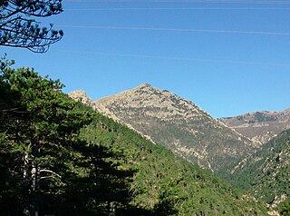
Cima Garlenda is a 2141 m mountain of the Ligurian Alps, in Italy. After Monte Saccarello and Monte Frontè it is the third Ligurian summit.
Cima Fontanaccia is a 1153 metres high mountain in the Ligurian Apennines, in Italy.

The Alpi Liguri Natural Regional Park is a natural park in Province of Imperia. It was established in 2007 by the legge regionale nr.34 of 15/11/2007.
The Beigua Natural Regional Park is a natural park located in province of Savona and the Metropolitan City of Genoa, both in Liguria (Italy). It's the largest protected area of the region. It gets the name from the highest mountain of the area, Monte Beigua.
The Antola Natural Regional Park is a natural park in Metropolitan City of Genoa. It gets the name from the highest mountain of the area, Monte Antola.
Monte Tobbio is a 1092 metres high mountain of the Apennines, located in the Italian region of Piedmont.

The Capanne di Marcarolo Natural Regional Park is a natural park in the province of Alessandria. It gets the name from a small village in the protected area, Capanne di Marcarolo.

The Monte Mongioie is a mountain of the Ligurian Alps located in Piedmont.

