
Arenzano is a coastal town and comune in the Metropolitan City of Genoa, Liguria, northern Italy, facing the Ligurian Sea. As of 2017, it has a population of 11,445. This varies during the holiday seasons due to tourist flow.

Sassello is a comune (municipality) in the Province of Savona in the Italian region Liguria, located about 58 kilometres (36 mi) west of Genoa and about 26 kilometres (16 mi) north of Savona in the northern side of the Ligurian Apennines. It is the birthplace of Blessed Chiara Badano.
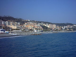
Cogoleto is a comune (municipality) in the Metropolitan City of Genoa in the Italian region Liguria, located about 25 kilometres (16 mi) west of Genova. Its territory extends from the sea to the Ligurian Apennines; it is part of the Natural Regional Park of Monte Beigua.

Tiglieto is a comune (municipality) in the Metropolitan City of Genoa in the Italian region Liguria, located about 52 kilometres (32 mi) northwest of Genoa.

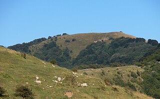
Monte Beigua is a mountain in the Ligurian Apennines in Liguria, northern Italy, between the two communes of Varazze and Sassello.
Monte Antola is a mountain in Liguria, northern Italy, part of the Ligurian Apennines.
Monte Buio is a mountain in Liguria, northern Italy, part of the Ligurian Apennines. It is located between the provinces of Genoa and Alessandria. It lies at an altitude of 1400 metres.
Monte Castello is a mountain in Liguria, northern Italy, part of the Ligurian Apennines. It is located in the provinces of Genoa and Alessandria. It lies at an altitude of 1092 metres.
Monte Colma is a mountain in Liguria, northern Italy, part of the Ligurian Apennines. It is located in the provinces of Genoa and Alessandria. It lies at an altitude of 856 metres.
Monte Reale is a mountain of the Ligurian Apennines. It is located in the Province of Genoa along the watershed between the basin of the Scrivia Torrent and that of the Vobbia, its tributary to the right. It is situated in the more western part of the Regional Natural Park of Antola between the municipal territories of Ronco Scrivia and Isola del Cantone.

Monte Reixa is a mountain in Liguria, northern Italy, part of the Ligurian Apennines.

Monte Saccarello (Italian) or Mont Saccarel (French) is a mountain located on the French-Italian border between Liguria, Piedmont and Provence-Alpes-Côte d'Azur.

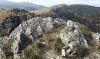
The Alta Via dei Monti Liguri is a long-distance waymarked hiking trail in the Italian region of Liguria. In about 440 kilometres (270 mi) and 44 day hikes, it runs through the arc formed by Ligurian Alps and Ligurian Apennines from Ventimiglia to Ceparana.
Cima Fontanaccia is a 1153 metres high mountain in the Ligurian Apennines, in Italy.
The Beigua Natural Regional Park is a natural park located in province of Savona and the Metropolitan City of Genoa, both in Liguria (Italy). It's the largest protected area of the region. It gets the name from the highest mountain of the area, Monte Beigua.

Bric del Dente is a 1107 metres high mountain of the Apennines located in the Italian region of Liguria.
The Antola Natural Regional Park is a natural park in Metropolitan City of Genoa. It gets the name from the highest mountain of the area, Monte Antola.
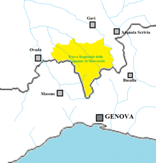
The Capanne di Marcarolo Natural Regional Park is a natural park in the province of Alessandria. It gets the name from a small village in the protected area, Capanne di Marcarolo.

The Stura di Ovada is a 32.9-kilometre (20.4 mi) stream of Liguria and Piedmont (Italy); it is the main tributary of the Orba.

Passo del Faiallo (1044 m) is a mountain pass between the Province of Savona (SV) and the Metropolitan City of Genoa (GE). It connects Urbe (SV) with Passo del Turchino (GE), both in Liguria.


