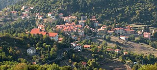
Crocefieschi is a comune (municipality) in the Metropolitan City of Genoa in the Italian region Liguria, located about 20 kilometres (12 mi) northeast of Genoa. Crocefieschi borders the following municipalities: Busalla, Savignone, Valbrevenna, Vobbia.

Isola del Cantone is a comune (municipality) in the Metropolitan City of Genoa in the Italian region Liguria, located about 25 kilometres (16 mi) north of Genoa.

Fascia is a comune (municipality) in the Metropolitan City of Genoa in the Italian region Liguria, located about 30 kilometres (19 mi) northeast of Genoa.
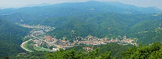
Ronco Scrivia is a comune (municipality) in the Metropolitan City of Genoa in the Italian region Liguria, located about 20 kilometres (12 mi) north of Genoa.

Torriglia is a comune (municipality) in the Metropolitan City of Genoa in the Italian region Liguria, located in the upper Trebbia valley, about 20 kilometres (12 mi) northeast of Genoa. Torriglia borders the following municipalities: Davagna, Lorsica, Lumarzo, Mocònesi, Montebruno, Montoggio, Neirone, Propata, Rondanina, Valbrevenna.

Vobbia is a comune (municipality) in the Metropolitan City of Genoa in the Italian region Liguria, located about 20 kilometres (12 mi) northeast of Genoa. Vobbia borders the following municipalities: Busalla, Carrega Ligure, Crocefieschi, Isola del Cantone, Mongiardino Ligure, Valbrevenna.
Monte Prelà is a mountain in Liguria, northern Italy, part of the Ligurian Appennines.
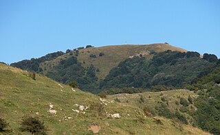
Monte Antola is a mountain in Liguria, northern Italy, part of the Ligurian Appennines.

Bric delle Camere is a mountain in northern Italy, part of the Ligurian Appennines. It is located in the provinces of Genoa and Alessandria. It lies at an altitude of 1016 metres.
Monte Buio is a mountain in Liguria, northern Italy, part of the Ligurian Appennines. It is located between the provinces of Genoa and Alessandria. It lies at an altitude of 1400 metres.
Monte Castello is a mountain in Liguria, northern Italy, part of the Ligurian Appennines. It is located in the provinces of Genoa and Alessandria. It lies at an altitude of 1092 metres.

Monte Reixa is a mountain in Liguria, northern Italy, part of the Ligurian Appennines.

Rocche del Reopasso is a mountain in Liguria, northern Italy, part of the Ligurian Appennines.

The Metropolitan City of Genoa is one of the fourteen Metropolitan cities of Italy, located in the region of Liguria. Its capital is the city of Genoa. It replaced the Province of Genoa.

The Regional Natural Park of the Ligurian Alps is a natural park in Province of Imperia. It was established in 2007 by the legge regionale nr.34 of 15/11/2007.
The Beigua Natural Regional Park is a natural park located in province of Savona and the Metropolitan City of Genoa, both in Liguria (Italy). It's the largest protected area of the region. It gets the name from the highest mountain of the area, Monte Beigua.

Bric del Dente is a 1107 metres high mountain of the Apennines located in the Italian region of Liguria.
The Antola Natural Regional Park is a natural park in Metropolitan City of Genoa. It gets the name from the highest mountain of the area, Monte Antola.

The Capanne di Marcarolo Natural Regional Park is a natural park in the province of Alessandria. It gets the name from a small village in the protected area, Capanne di Marcarolo.

The Brevenna is a 16.138-kilometre (10.028 mi) creek of Liguria, Italy.


