Monte Settepani

Last updated
Monte Settepani
Settepani da gettina.png
Monte Settepani from Bric Gettina
Highest point
Elevation 1,386 m (4,547 ft) [1]
Coordinates 44°14′42″N8°11′51″E / 44.24500°N 8.19750°E / 44.24500; 8.19750 Coordinates: 44°14′42″N8°11′51″E / 44.24500°N 8.19750°E / 44.24500; 8.19750
Geography
Alps location map.png
Red triangle with thick white border.svg
Monte Settepani
Location in the Alps
Location Liguria, Italy
Parent range Ligurian Alps

Monte Settepani is 1,386 metres high mountain in Liguria, northern Italy, part of the Ligurian Prealps.

Contents

Geography

Monte Settepani es seen from the Lake Osiglia Monte Settepani from Lake Osiglia.png
Monte Settepani es seen from the Lake Osiglia

The mountain is located on the main chain of the Alps and its summit stands very close the water divide between Ligurian Sea and River Po basins, on the river Po side. Going South the Colle del Melogno (1,028 m) divides it from Bric Agnellino. [2] On the summit stand some military facilities and a weather radar. The mountain is shared between the territories of five comuni: Osiglia, Bormida, Calizzano, Magliolo and Rialto. [3]

SOIUSA classification

According to the SOIUSA (International Standardized Mountain Subdivision of the Alps) the mountain can be classified in the following way: [4]

History

A structure of the abandoned military base Monte Settepani fortification.png
A structure of the abandoned military base

The area of monte Settepani was involved, as well as other neighbouring mountains, in the Italian campaigns of Napoleone Bonaparte. [5]

During the II World War around the Settepani occurred other fights, this time between Italian partisans and nazi-fascist troops. [6]

Monte Settepani could have hosted an underground united States military base, a facility which, according to some sources, could have been also used by the Gladio Organization. [7]

Access to the summit

The weather radar close to the summit Monte Settepani summit.png
The weather radar close to the summit

The summit of Monte Settepani is reached by a small asphalted road, closed to the general public and built in order to connect the military base on the mountain with the Colle del Melogno national road. The summit can also be reached on foot by some footpath from various starting points as, for instance, the Colla Baltera. [8]

Nature conservation

The mountain and its surrounding area are part of a SIC (Site of Community Importance) called M.Carmo - M.Settepani (code: IT1323112). [9]

Maps

Related Research Articles

<span class="mw-page-title-main">Monte Carmo di Loano</span> Mountain in Italy

Monte Carmo di Loano is a mountain in Liguria, northern Italy, part of the Ligurian Prealps. It is located in the province of Savona. It lies at an altitude of 1389 metres.

<span class="mw-page-title-main">Monte Galero</span> Mountain in Italy

Monte Galero is a mountain in Liguria, northern Italy, part of the Alps. It is located in the provinces of Savona and Cuneo. It lies at an altitude of 1708 metres and, after Monte Armetta, is the second highest summit of the Ligurian Prealps.

<span class="mw-page-title-main">Ronco di Maglio</span> Mountain in Italy

Ronco di Maglio is a mountain in Liguria, northern Italy, part of the Ligurian Prealps.

<span class="mw-page-title-main">Bric Gettina</span> Mountain in Italy

Bric Gettina is a 1025 metres high mountain in the Ligurian Prealps in Italy.

<span class="mw-page-title-main">Rocca delle Penne</span> Mountain in Italy

Rocca delle Penne is a 1501 metres high mountain in the Ligurian Prealps in Italy.

<span class="mw-page-title-main">Rocca Barbena</span> Mountain in Italy

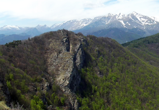
Rocca Barbena is a 1,142-metre (3,747 ft) high mountain in the Ligurian Prealps in Italy.

<span class="mw-page-title-main">Cima di Pertegà</span> Mountain in Italy

Cima di Pertegà (Italian) or Cime de la Pertègue (French) is a mountain located on the French-Italian border between Piemonte and Provence-Alpes-Côte d'Azur.

<span class="mw-page-title-main">Monte Monega</span> Mountain in Italy

Monte Monega is a 1,882-metre (6,175 ft) mountain of the Ligurian Alps, in Italy.

<span class="mw-page-title-main">Carmo di Brocchi</span> Mountain in Italy

Carmo di Brocchi is a 1,610-metre (5,282 ft) mountain of the Ligurian Alps, in Italy.

<span class="mw-page-title-main">Monte Spinarda</span> Mountain in Italy

Monte Spinarda is a 1,357-metre (4,452 ft) mountain of the Ligurian Prealps in Italy.

<span class="mw-page-title-main">Monte della Guardia</span> Mountain in Italy

The Monte della Guardia is a mountain in Piedmont, northern Italy, part of the Alps. At an altitude of 1,658 metres is one of the highest summits of the Ligurian Prealps.

<span class="mw-page-title-main">Monte Bertrand</span> Mountain in Italy

Monte Bertrand (Italian) or Mont Bertrand (French) is a mountain located on the French-Italian border between Piemonte and Provence-Alpes-Côte d'Azur.

<span class="mw-page-title-main">Cime de Missun</span> Mountain in Italy

The Cime de Mussun (French) or Cima Missun (Italian) is a mountain of the Ligurian Alps.

<span class="mw-page-title-main">Cima della Fascia</span> Mountain in Italy

The Cima della Fascia is a mountain of the Ligurian Alps located in Piedmont.

<span class="mw-page-title-main">Monte Antoroto</span> Mountain in Italy

The Monte Antoroto is a mountain of the Ligurian Alps located in Piedmont.

<span class="mw-page-title-main">Monte Cianea</span> Mountain in Italy

Monte Cianea is a 1,226-metre (4,022 ft) mountain of the Ligurian Prealps, in Italy.

<span class="mw-page-title-main">Monte Peso Grande</span> Mountain in Italy

Monte Peso Grande o Castell'Ermo (1.092 m) is a mountain of the Ligurian Prealps, the eastern section of the Ligurian Alps.

<span class="mw-page-title-main">Monte Camulera</span> Mountain in Italy

The Monte Camulera is a mountain of the Ligurian Prealps, the eastern section of the Ligurian Alps.

<span class="mw-page-title-main">Monte Alpe</span> Mountain in Italy

The Monte Alpe is a mountain of the Ligurian Prealps, the eastern section of the Ligurian Alps.

The Ligurian Prealps are a mountain range in northwestern Italy. They belong to the Ligurian Alps and are located between the regions of Piemonte and Liguria. Their highest summit is the monte Armetta, at an elevation of 1,739 metres (5,705 ft).

References

Commons-logo.svg Media related to Monte Settepani at Wikimedia Commons

  1. Provincia di Savona - Carta turistica ed escursionistica scala 1:50.000
  2. Carta turistica ed escursionistica - Provincia di Savona in scala 1:50.000; ed. Provincia di Savona
  3. "Carta tecnica regionale su Limiti Amministrativi (Comunali, Provinciali, Regionali) sc. 1:25000". geoportale.regione.liguria.it (in Italian). Regione Liguria. 2011. Retrieved 2017-03-30.
  4. Marazzi, Sergio (2005). Atlante Orografico delle Alpi. SOIUSA (in Italian). Priuli & Verlucca. ISBN   978-88-8068-273-8.
  5. Corsi, Carlo (1931). Storia militare 1: sino al 1815 (in Italian). Tipografia E. Schioppo. p. 370. Retrieved 2021-05-20.
  6. Gimelli, Giorgio; Gimelli, Franco (2005). La Resistenza in Liguria: dalla difficile ripresa alla Liberazione (in Italian). Carocci. p. 474. Retrieved 2021-05-19.
  7. Mirko Auteri (2013-08-17). "Scoperta dopo 60 anni la base Usa sotterranea". la Repubblica (in Italian). Retrieved 2020-10-08.
  8. Andrea Ferrando (2020). "Colla Baltera - Colletta - Monte Settepani" (in Italian). L'Appeninista. Retrieved 2021-05-20.
  9. Bollettino Ufficiale Regione Liguria nr.13 of 15-7-2009; the Ligurian SIC list is on-line at lrv.regione.liguria.it Archived 2016-03-05 at the Wayback Machine (access: July 2015)