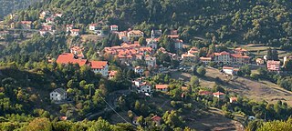
Crocefieschi is a comune (municipality) in the Metropolitan City of Genoa in the Italian region Liguria, located about 20 kilometres (12 mi) northeast of Genoa. Crocefieschi borders the following municipalities: Busalla, Savignone, Valbrevenna, Vobbia.

Gorreto is a comune (municipality) in the Metropolitan City of Genoa in the Italian region Liguria, located about 35 kilometres (22 mi) northeast of Genoa.

Fascia is a comune (municipality) in the Metropolitan City of Genoa in the Italian region Liguria, located about 30 kilometres (19 mi) northeast of Genoa.

Montebruno is a comune (municipality) in the Metropolitan City of Genoa in the Italian region Liguria, located about 30 kilometres (19 mi) northeast of Genoa.

Propata is a comune (municipality) in the Metropolitan City of Genoa in the Italian region Liguria, located about 25 kilometres (16 mi) northeast of Genoa.
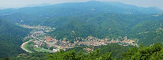
Ronco Scrivia is a comune (municipality) in the Metropolitan City of Genoa in the Italian region Liguria, located about 20 kilometres (12 mi) north of Genoa.

Rondanina is a comune (municipality) in the Metropolitan City of Genoa in the Italian region Liguria, located about 30 kilometres (19 mi) northeast of Genoa.

Vobbia is a comune (municipality) in the Metropolitan City of Genoa in the Italian region Liguria, located about 20 kilometres (12 mi) northeast of Genoa. Vobbia borders the following municipalities: Busalla, Carrega Ligure, Crocefieschi, Isola del Cantone, Mongiardino Ligure, Valbrevenna.
Monte Prelà is a mountain in Liguria, northern Italy, part of the Ligurian Apennines.
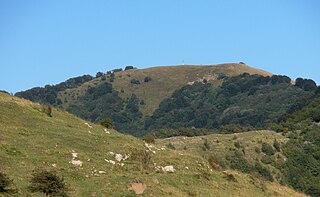
Monte Antola is a mountain in Liguria, northern Italy, part of the Ligurian Apennines.

Bric delle Camere is a mountain in northern Italy, part of the Ligurian Apennines. It is located in the provinces of Genoa and Alessandria. It lies at an altitude of 1016 metres.
Monte Buio is a mountain in Liguria, northern Italy, part of the Ligurian Apennines. It is located between the provinces of Genoa and Alessandria. It lies at an altitude of 1400 metres.
Monte Reale is a mountain of the Ligurian Apennines. It is located in the Province of Genoa along the watershed between the basin of the Scrivia Torrent and that of the Vobbia, its tributary to the right. It is situated in the more western part of the Regional Natural Park of Antola between the municipal territories of Ronco Scrivia and Isola del Cantone.

The Sirente-Velino Regional Park is a regional park in the province of L'Aquila, Abruzzo, central Italy.

The Alta Via dei Monti Liguri is a long-distance waymarked hiking trail in the Italian region of Liguria. In about 440 kilometres (270 mi) and 44 day hikes, it runs through the arc formed by Ligurian Alps and Ligurian Apennines from Ventimiglia to Ceparana.
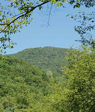
The Antola Natural Regional Park is a natural park in Metropolitan City of Genoa. It gets the name from the highest mountain of the area, Monte Antola.

Passo del Faiallo (1044 m) is a mountain pass between the Province of Savona (SV) and the Metropolitan City of Genoa (GE). It connects Urbe (SV) with Passo del Turchino (GE), both in Liguria.

Carmo di Brocchi is a 1,610-metre (5,282 ft) mountain of the Ligurian Alps, in Italy.

The Brevenna is a 16.138-kilometre (10.028 mi) creek of Liguria, Italy.

The Lessinia Regional Park is a nature reserve in Veneto, Italy. Established in 1990, it covers the northern part of the Lessinia region, in the Venetian Prealps, between the provinces of Verona and Vicenza. It is both a Special Protection Area and a Site of Community Importance.

