Montezuma | |
|---|---|
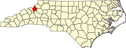
 Montezuma Location within the state of North Carolina | |
| Coordinates: 35°58′17″N82°00′42″W / 35.97139°N 82.01167°W | |
| Country | United States |
| State | North Carolina |
| County | Avery County |
| Founded | 1883 |
| Named after | Moctezuma II |
| Elevation | 3,766 ft (1,148 m) |
| Time zone | UTC-5 (Eastern (EST)) |
| • Summer (DST) | UTC-4 (EDT) |
| ZIP code | 28653 |
| Area code | 828 |
| GNIS feature ID | 1013656 [1] |
Montezuma is an unincorporated community in Avery County, North Carolina, United States. Before its founding in 1883, it had two variant names, Aaron and Bull Scrape. [2] The community is located on Old State Highway 181 and is on the Eastern Continental Divide.