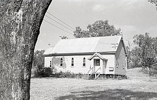
Peranga is a rural town and locality in the Toowoomba Region, Queensland, Australia. In the 2021 census, the locality of Peranga had a population of 98 people.
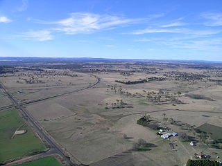
Cecil Plains is a rural town and locality in the Toowoomba Region, Queensland, Australia. In the 2021 census, the locality of Cecil Plains had a population of 380 people.

Cowangie is a locality situated on the section of the Mallee Highway between Ouyen and the South Australian border in the Sunraysia region of Victoria, Australia. The place by road, is situated about 12 kilometres southeast from Tutye and 12 kilometres northwest from Danyo.

Sellicks Hill – formerly spelt Sellick's Hill – is a semi-rural suburb of Adelaide, South Australia. It lies within both the City of Onkaparinga and the District Council of Yankalilla. Before the British colonisation of South Australia, the Sellicks Hill area, was inhabited by the Kaurna people. Sellick's Hill Post Office opened on 2 July 1860.
Kellys Plains is a small rural locality situated about 8 kilometres west south west of Armidale, New South Wales. The settlement is at an altitude of about 1,044 metres on the Northern Tablelands in the New England region of New South Wales, Australia.
She Oaks is a rural locality in Victoria, Australia. The locality is in the Golden Plains Shire, near the regional city of Geelong and 97 kilometres (60 mi) west of the state capital, Melbourne.
Sutherlands Creek is a rural locality in Victoria, Australia. The locality is in the Golden Plains Shire, near the regional city of Geelong and 84 kilometres (52 mi) west of the state capital, Melbourne. At the 2016 census, Sutherlands Creek had a population of 108.
Major Plains is a locality situated to the north-west of Benalla in Victoria, Australia. It is 226 kilometres by road from Melbourne.
Meridan Plains is a locality on the north-western edge of the Caloundra urban area in the Sunshine Coast Region, Queensland, Australia. Traditionally a rural area, the locality is attracting residential development from the expansion of Caloundra. In the 2021 census, Meridan Plains had a population of 4,589 people.
Smithfield Plains is a northern suburb of Adelaide, South Australia in the City of Playford.
Turoar is a locality in the Rural City of Swan Hill, Victoria, Australia. Towan Plains Reserve is in the locality of Turoar and has powdered gypsum and salt. Turoar post office opened on 15 November 1919 and was closed on 31 October 1942.
Tyrrell is a locality in the Rural City of Swan Hill and the Shire of Buloke, Victoria, Australia. Tyrrell West post office opened on 29 May 1909 and was closed on the 2 November 1914. Long Plains post office opened in 1902 and was closed on 31 July 1940.

Aubigny is a rural town and locality in the Toowoomba Region, Queensland, Australia. In the 2021 census, the locality of Aubigny had a population of 283 people.
Hesse is a rural locality in the Golden Plains Shire, Victoria, Australia. In the 2016 census, Hesse had a population of 19 people.
Gretna is a rural locality in the local government areas (LGA) of Central Highlands and Derwent Valley in the Central and South-east LGA regions of Tasmania. The locality is about 20 kilometres (12 mi) south-east of the town of Hamilton. The 2016 census has a population of 211 for the state suburb of Gretna. It was formerly known as Stony Hut Plains, though the Gretna post office was known as Macquarie Plains for many years. It has a postcode of 7140.

Wild Horse Plains is a locality in South Australia on the eastern coastline of Gulf St Vincent about 69 kilometres north-northwest of the Adelaide city centre. Its name is attributed to Thomas Day, who found wild horses grazing within the locality around 1870. Its boundaries, created in June 1997, include the town of Wild Horse Plains, established in 1881 on Port Wakefield Road, and the former Government Town of Lorne. Port Lorne Road marks most of the northern boundary of Wild Horse Plains and is the access road to the former township of Lorne.
Ninnes is a locality at the northeastern corner of Yorke Peninsula and western side of the Mid North of South Australia. It lies where the Upper Yorke Road from Kulpara to Bute is crossed by the road from Paskeville to Lochiel. The dominant industry is broadacre grain and sheep farming.

Geranium Plains is a small town in the Regional Council of Goyder in South Australia. The post office opened in 1894, but has since closed. There was a proposal to rename it to Iperta in 1916, but this did not go ahead.
Boors Plain is a rural locality at the north end of the Yorke Peninsula of South Australia, situated east of Moonta and south of Kadina. It is located in the Copper Coast Council.
Grace Plains is a rural locality in South Australia on the northern Adelaide Plains about 64 kilometres (40 mi) north of the state capital of Adelaide. It is divided between the Adelaide Plains Council and the Wakefield Regional Council. The formal boundaries were established in June 1997 for the long established local name with respect of the section in the District Council of Mallala ; the portion in the Wakefield council was added in January 2000. It is named after Grace Montgomery Farrell, widow of Rev C. B. Howard, the first South Australian Colonial Chaplain; she later married James Farrell, Dean of Adelaide.

