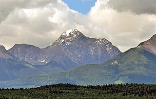
Mount Robson is the most prominent mountain in North America's Rocky Mountain range; it is also the highest point in the Canadian Rockies. The mountain is located entirely within Mount Robson Provincial Park of British Columbia, and is part of the Rainbow Range. Mount Robson is the second highest peak entirely in British Columbia, behind Mount Waddington in the Coast Range. The south face of Mount Robson is clearly visible from the Yellowhead Highway, and is commonly photographed along this route.

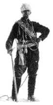
Conrad Kain was an Austrian mountain guide who guided extensively in Europe, Canada, and New Zealand, and was responsible for the first ascents of more than 60 routes in British Columbia. He is particularly known for pioneering climbs in the Purcell Mountains and the first ascents of Mount Robson (1913), Mount Louis (1916) and Bugaboo Spire (1916).

Mount King Edward is a mountain located at the head of the Athabasca River valley in Jasper National Park, Canada. Mt. King Edward is situated on the Continental Divide with Mt. Columbia 51⁄2 km east. The mountain was named in 1906 by Mary Schäffer Warren after King Edward VII.

The Bugaboos are a mountain range in the Purcell Mountains of eastern British Columbia, Canada. The granite spires of the group are a popular mountaineering destination. The Bugaboos are protected within Bugaboo Provincial Park.
Bugaboo Provincial Park is a provincial park in British Columbia, Canada, located in the central Purcell Mountains.

Trapper Peak is a mountain in Alberta and British Columbia, Canada, located on their border along the Continental Divide in the Wapta Icefield.

Snowpatch Spire is a mountain peak in British Columbia, Canada. With its first ascent in 1940, it was the last of the Bugaboo Spires to be climbed. It is located southwest of the Conrad Kain hut, between Bugaboo, Vowell and Crescent Glaciers, at the south end of Bugaboo Provincial Park. The mountain's toponym was officially adopted October 29, 1962, by the Geographical Names Board of Canada.

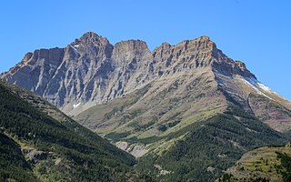
Mount Blakiston is a mountain in the southwestern corner of Alberta, Canada and the highest point within Waterton Lakes National Park. The mountain is situated in the Clark Range, north of Lineham Creek and south of Blakiston Creek. Blakiston's closest neighbours include Mount Hawkins 2,685 m (8,809 ft) directly to the west along a connecting ridge and Mount Lineham 2,728 m (8,950 ft) to the south.

Mount Balfour is a mountain located on the Continental Divide, part of the border between British Columbia and Alberta, in the Waputik Range in the Park Ranges of the Canadian Rockies. It is the 71st highest peak in Alberta and the 113th highest in British Columbia; it is also the 52nd most prominent in Alberta.

Howser Spire, or Howser Spire Massif, is a group of three distinct granite peaks, and the highest mountain of the Canadian Bugaboo Spires. The mountain is located at the southwest corner of the Vowell Glacier, within the Bugaboo mountain range in the Purcell Mountains, a subrange of British Columbia's Columbia Mountains, The highest of the three spires is the North Tower at 3,412 m (11,194 ft), the Central Tower the lowest, and the South Tower is slightly lower than the North at 3,292 m (10,801 ft).

Castleguard Mountain, also known as Mount Castleguard, is an isolated mountain located near the southern edge of the Columbia Icefield at the northern edge of Banff National Park in Alberta, Canada. In 1918, Irish land surveyor Arthur Oliver Wheeler named the mountain because of its castle-like appearance, which seemed to stand guard over the southern portion of the Columbia Icefield. Castleguard was first ascended in 1919 by the Interprovincial Boundary Commission, which determined the exact location of the boundary between British Columbia and Alberta along the continental divide.

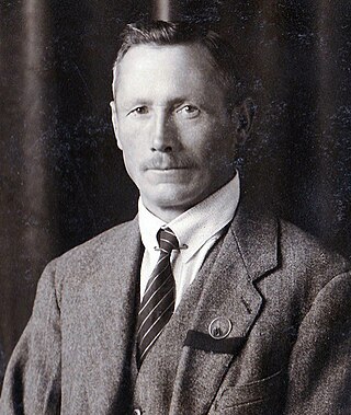
Peter Kaufmann-Bohren was born on June 23, 1886, in Grindelwald, and he died on June 23, 1971, in Thun, at the age of 85. Peter was a Swiss ski instructor and mountain guide, climbing in the Swiss Alps and the Canadian Rockies.

Taurus Mountain is a mountain summit located in British Columbia, Canada.

The Virgin is a mountain summit located in British Columbia, Canada.

Barbette Mountain is 3,072-metre (10,079-foot) summit located on the shared border of Alberta and British Columbia, Canada.

Anniversary Peak is a 2,947-metre (9,669-foot) summit in The Bugaboos of British Columbia, Canada. It is located southeast of the Bugaboo Glacier, on the southern boundary of Bugaboo Provincial Park. Precipitation runoff from Anniversary Peak drains into Bugaboo Creek which is a tributary of the Columbia River. Anniversary Peak is more notable for its steep rise above local terrain than for its absolute elevation as topographic relief is significant with the summit rising 1,350 meters (4,429 ft) above Bugaboo Creek in 4 km (2.5 mi).

Howser Peak is a 3,094-metre (10,151-foot) summit in The Bugaboos of British Columbia, Canada. It is located south of the Bugaboo Glacier and is the southernmost point of Bugaboo Provincial Park. Precipitation runoff from Howser Peak drains north into Bugaboo Creek which is a tributary of the Columbia River; as well as south to Duncan River via Howser Creek. Howser Peak is more notable for its steep rise above local terrain than for its absolute elevation as topographic relief is significant with the south aspect rising 1,380 meters (4,527 ft) in 2.5 km (1.6 mi).

Northpost Spire is a 2,911-metre (9,551-foot) peak in British Columbia, Canada.

Wallace Peak is a 2,940-metre (9,650-foot) summit in British Columbia, Canada.

Mount Ethelbert is a 3,176-metre (10,420-foot) mountain summit in British Columbia, Canada.


