Mulmur, Ontario

Last updated
Mulmur
Township of Mulmur
Back Road on a Cloudy Day (4529559534).jpg
Mulmur within the Dufferin County.svg
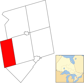
Mulmur within Dufferin County
Canada Southern Ontario location map 2.png
Red pog.svg
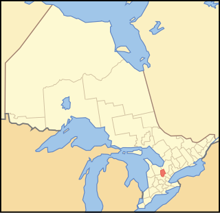
Mulmur
Location of Mulmur within Ontario
Coordinates: 44°11′30″N80°06′30″W / 44.1917°N 80.1083°W / 44.1917; -80.1083 Coordinates: 44°11′30″N80°06′30″W / 44.1917°N 80.1083°W / 44.1917; -80.1083
CountryFlag of Canada.svg  Canada
ProvinceFlag of Ontario.svg  Ontario
County Dufferin
IncorporatedJanuary 1, 1851
Government
  MayorJanet Horner
  Federal riding Dufferin—Caledon
  Prov. riding Dufferin—Caledon
Area
[1]
  Land286.77 km2 (110.72 sq mi)
Population
(2011) [1]
  Total3,478
  Density12.1/km2 (31/sq mi)
Time zone UTC-5 (EST)
  Summer (DST) UTC-4 (EDT)
Postal Code
L0N 1M0
Area code(s) 519 and 226
Website www.mulmurtownship.ca

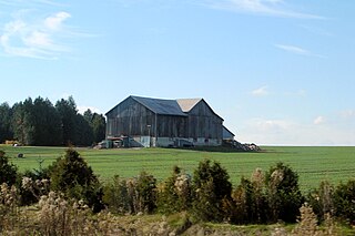
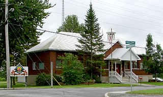
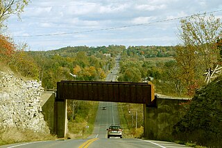
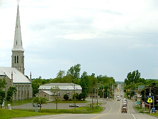
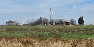
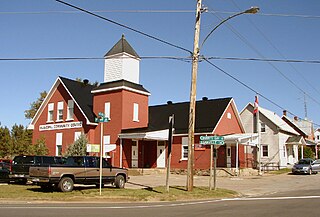
Mulmur is a township in Dufferin County in Southern Ontario, Canada. There are a number of original settlements such as Mulmur Corners, some of which can still be identified as to location, including Rosemont and Stanton. [2]

Dufferin County County in Ontario, Canada

Dufferin County is a county and census division located in Central Ontario, Canada. The county seat is Orangeville, and the current Warden is Paul Mills. The current chief administrative officer is Sonya Pritchard. Dufferin covers an area of 1,486.31 square kilometres (573.87 sq mi), and its population is 61,735 (2016).

Southern Ontario Primary region in Ontario, Canada

Southern Ontario is a primary region of the province of Ontario, Canada, the other primary region being Northern Ontario. It is the most densely populated and southernmost region in Canada. The exact northern boundary of Southern Ontario is disputed; however, the core region is situated south of Algonquin Park, the latter being in an area of transition between coniferous forest north of the French and Mattawa Rivers and southern deciduous forest. It covers between 14 and 15% of the province, depending on the inclusion of the Parry Sound and Muskoka districts which also lie in the transitional area between northern and southern forest regions. With more than 12.7 million people, the region is home to approximately one-third of Canada's population of 35.1 million.

Canada Country in North America

Canada is a country in the northern part of North America. Its ten provinces and three territories extend from the Atlantic to the Pacific and northward into the Arctic Ocean, covering 9.98 million square kilometres, making it the world's second-largest country by total area. Canada's southern border with the United States, stretching some 8,891 kilometres (5,525 mi), is the world's longest bi-national land border. Its capital is Ottawa, and its three largest metropolitan areas are Toronto, Montreal, and Vancouver. As a whole, Canada is sparsely populated, the majority of its land area being dominated by forest and tundra. Consequently, its population is highly urbanized, with over 80 percent of its inhabitants concentrated in large and medium-sized cities, with 70% of citizens residing within 100 kilometres (62 mi) of the southern border. Canada's climate varies widely across its vast area, ranging from arctic weather in the north, to hot summers in the southern regions, with four distinct seasons.

Contents

Communities

The township of Mulmur comprises a number of villages and hamlets, including the following communities such as Airlie (partially), Banda (partially), Black Bank, Earnscliffe, Happy Valley, Honeywood, Kilgorie, Lavender (partially), Mansfield, Mulmur, Mulmur Corners (partially), Perm, Ponton Mills, Randwick, Rookery Creek, Rosemont (partially), Ruskview, Scarlet Hill, Slabtown, Stanton, Terra Nova, Violet Hill (partially), Whitfield; Conover, Henderson's Corners (partially), Hipson's Corners; Boyne Mill, Hall's Corners, Old Egypt, Primrose (partially)

Demographics

Canada census – Mulmur, Ontario community profile
2011 2006
Population:3,391 (2.2% from 2006)3,318 (7.1% from 2001)
Land area:286.73 km2 (110.71 sq mi)286.73 km2 (110.71 sq mi)
Population density:11.8/km2 (31/sq mi)11.6/km2 (30/sq mi)
Median age:45.2 (M: 45.6, F: 44.7)42.3 (M: 42.2, F: 42.4)
Total private dwellings:16431,479
Median household income:$N/A
References: 2011 [3] 2006 [4] earlier [5]

Population trend: [6]

Climate

See also

Related Research Articles

Brighton, Ontario Municipality in Ontario, Canada

Brighton is a town in Northumberland County, Ontario, Canada, approximately 150 kilometres (93 mi) east of Toronto and 100 km (62 mi) west of Kingston. It is traversed by both Highway 401 and the former Highway 2. The west end of the Murray Canal that leads east to the Bay of Quinte is at the east end of the town.

Mono, Ontario Town in Ontario, Canada

The Town of Mono is situated in south-central Ontario, Canada, at the south-east corner of Dufferin County. It stretches from Highway 9 along its southern border to Highway 89 along its northern border. Its border to the west is with the Township of Amaranth and in the east it is bordered by the Township of Adjala-Tosorontio. It was previously known as the Township of Mono.

North Grenville Municipality in Ontario, Canada

North Grenville is a township in eastern Ontario, Canada, in the United Counties of Leeds and Grenville on the Rideau River. It is located just south of Ottawa, Canada's National Capital Region.

Champlain, Ontario Township in Ontario, Canada

Champlain is a township in eastern Ontario, Canada, in the United Counties of Prescott and Russell on the Ottawa River. It was formed on January 1, 1998, through the amalgamation of West Hawkesbury Township, Longueuil Township, Town of Vankleek Hill, and the Village of L'Orignal.

Lanark Highlands Township in Ontario, Canada

Lanark Highlands is a township in eastern Ontario, Canada in Lanark County. The township administrative offices are located in the village of Lanark.

Madoc, Ontario Township in Ontario, Canada

Madoc is a township in Hastings County in Eastern Ontario, Canada.

Centre Hastings Municipality in Ontario, Canada

The Municipality of Centre Hastings is a township in Eastern Ontario, Canada, in Hastings County. It was formed on January 1, 1998, through the amalgamation of Huntingdon Township with the Village of Madoc.

North Stormont, Ontario Township in Ontario, Canada

North Stormont is a lower tier township in eastern Ontario, Canada in the United Counties of Stormont, Dundas and Glengarry.

Severn, Ontario Township in Ontario, Canada

Severn is a township in south-central Ontario, Canada, located between Lake Couchiching, and the Severn River in Simcoe County.

South Frontenac, Ontario Township in Ontario, Canada

South Frontenac is a township in Frontenac County in eastern Ontario, Canada. It was amalgamated in 1998 from the former townships of Bedford, Loughborough, Portland, and Storrington.

Trent Hills Township Municipality in Ontario, Canada

The Municipality of Trent Hills is a township municipality in Northumberland County in Central Ontario, Canada. It is on the Trent River and was created in 2001 through the amalgamation of the municipalities of Campbellford/Seymour, Percy Township and Hastings. Thereafter it was briefly known as Campbellford/Seymour, Percy, Hastings.

Central Huron Municipality in Ontario, Canada

Central Huron is a township in western Ontario, Canada, in Huron County. It is situated on Lake Huron between the Maitland River and the Bayfield River.

Arran–Elderslie Municipality in Ontario, Canada

The Municipality of Arran–Elderslie is a township in Bruce County in Western Ontario, Canada. The township is located at the headwaters of the Sauble River, and the Saugeen River forms the northwestern boundary.

South Stormont Township in Ontario, Canada

South Stormont is a township in eastern Ontario, Canada, in the United Counties of Stormont, Dundas and Glengarry. It is located 53 kilometres (33 mi) southeast of Ottawa. South Stormont borders on, but does not include, the city of Cornwall.

Amaranth, Ontario Township in Ontario, Canada

Amaranth is a township located in Dufferin County, Ontario, Canada, with a 2011 population of 3,963. It is named after the plant which grows abundantly within its borders. It is bordered by Mono to the east and East Luther to the west.

Tyendinaga, Ontario Township in Ontario, Canada

Tyendinaga is a township in the Canadian province of Ontario, located in Hastings County. The community takes its name from a variant spelling of Mohawk leader Joseph Brant's traditional Mohawk name, Thayendanegea.

Melancthon, Ontario Township in Ontario, Canada

Melancthon is a rural Canadian township in the northwest corner of Dufferin County, Ontario, bordered on the east by Mulmur Township, Amaranth Township and East Luther Grand Valley to the south, Southgate Township to the west, and the Municipality of Grey Highlands to the north. The township does not include the town of Shelburne on its southern border. It has one of the lowest population densities in southwestern Ontario.

Grand Valley, Ontario Township in Ontario, Canada

The Town of Grand Valley is a township in the Canadian province of Ontario, composed of the former Township of East Luther and the former Village of Grand Valley. The township is located within Dufferin County, and includes part of the Luther Marsh. The marsh covers over 10,000 acres (40 km²) including Luther Lake. The Grand River is one of the major sites in the town.

North Algona Wilberforce Township in Ontario, Canada

North Algona Wilberforce is a township in Renfrew County, Ontario, Canada. It has a population of 2,873. The township was formed in 1999 when the North Algona and Wilberforce townships were amalgamated.

Faraday, Ontario Township in Ontario, Canada

Faraday is a township in the Canadian province of Ontario, located within Hastings County.

References

  1. 1 2 "Census Profile, 2016 Census - Mulmur, Township". 2016 Census of Population . Government of Canada, Statistics Canada. Retrieved 30 October 2017.
  2. "Our Roots / Nos Racines".
  3. "2011 Community Profiles". Canada 2011 Census . Statistics Canada. July 5, 2013. Retrieved 2012-08-14.
  4. "2006 Community Profiles". Canada 2006 Census . Statistics Canada. March 30, 2011. Retrieved 2009-02-24.
  5. "2001 Community Profiles". Canada 2001 Census . Statistics Canada. February 17, 2012.
  6. Statistics Canada: 1996, 2001, 2006 census
  7. "Ruskview". Canadian Climate Normals 1981−2010. Environment Canada. Retrieved 2016-05-12.