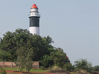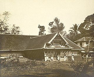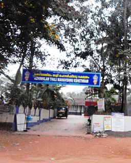
Mananthavady is a municipality and taluk in the Wayanad district of Kerala, India. It is the largest city in Wayanad and also largest municipality of Kerala in terms of area. The town is located on the banks of Mananthavady River, a tributary of the Kabini River. The Adivasi Gothra Mahasabha is headquartered in the town, and the district hospital and the Medical College in Mananthavady is the only major treatment facility for the tribal communities of Wayanad.

Eranhipalam is a suburb of Kozhikode City, in the Kozhikode district of the state of Kerala, South India. It is where the Civil Station and the Passport Office are located. A new bridge is being constructed as part of a major facelift to the area. It is located on Mini Bypass Road. Zonal Office of State Bank of Travancore is situated here. Central Government has sanctioned a Flyover from Calicut Beach and ending at Eranhipalam near Jayasree Group Property under Bharathmala scheme. This Flyover will be passing through Panicker Road.

Sulthan Bathery, formerly known as Sultan's Battery and Ganapathyvattam is a town and municipality in Wayanad district of Kerala, India, near the borders with Tamil Nadu and Karnataka states. It is The second largest city in Wayanad district, it is the headquarters of Sultan Bathery taluk.

Kannur (formerly known in English as Cannanore and Portuguese as Cananor) is a city and a Municipal Corporation in the state of Kerala, India. It is the administrative headquarters of the Kannur District and situated 518 kilometres (322 mi) north of the state capital Thiruvananthapuram & 137 kilometres (85 mi) south of the major port city & a commercial hub, Mangalore. During the period of British colonial rule in India, when Kannur was a part of the Malabar District, the city was known as Cannanore. It is the 6th largest urban agglomeration in Kerala. As of the 2011 census, Kannur corporation had population of 232,486.

Kozhikode or Calicut district, in the central part of the former Malabar district, is a district of Kerala state, on the southwest coast of India. The city of Kozhikode, also known as Calicut, is the district headquarters. The district is 38.25% urbanised.

Koyilandy, IPA: [kojilɐːɳɖi], is a municipality in the taluk of the same name in Kozhikode district, Kerala on the Malabar Coast. The town is located between Kozhikode (Calicut) and Vadakara (Badagara) on National Highway 66.. Koyilandy is the 2nd most cleanest town of South India. Koyilandy harbour is the largest fishing harbour in Asia. The northern part of Pulimuttu is 1600 m long and the southern part is 915 m long. The picturesque Kappad beach lies near Koyilandy. India's first mangrove museum is situated in Koyilandy. Koyilandy is well connected to major towns like Kozhikode, Vatakara, Thamarassery, Balussery & Perambra.

Palazhi is a suburb of Kozhikode city in India. It has risen to prominence quite recently because of the UL cyberpark, the Government Cyber park and the creation of a township called HiLITE City and Landmark world and many other flat projectshere. Palazhi town is four kilometres from Thondayad junction in Kozhikode city. Metro International Cardiac Center and the Cradle Maternity hospital are situated at Palazhi.
Mankavu is a suburb of Kozhikode, in Kerala, India. It is known as the site of the Zamorin's kovilakam and it is called Mankavu Padinhare Kovilakam. Mankavu derives its name from the Zamorin's Mango Orchard that was in the area some historic records says that earlier was known as "Manavedan kavu" and got shortened into "Mankave". The community is primarily residential, and is a common residential location for students from the local Zamorin's Guruvayurappan College. Krishna Varma and Ravi Varma, famous rebels of Calicut were born and brought up in Mankavu.

Cherupuzha is a town in Kannur district, Kerala, India. It is the headquarters of the Cherupuzha Panchayat which is a special grade panchayat in Kerala.

Thamarassery, formerly known as Thazhmalachery, is a major town in the Kozhikode district of Kerala, India, 30 km east of Kozhikode (Calicut) City and 29 km east of Koyilandy. It lies on the Calicut - Wayanad - Mysore route.

Omassery is a town in Kozhikode district, Kerala, India and it is a junction between Thiruvambady, Thamarassery, Mukkam, Koduvally, Kodenchery and Kattangal. Omassery is located 29 kilometers southeast of Kozhikode in the eastern part of Kerala; better known as Malabar. Omassery is a fast developing place and is well connected to the other parts of the state. Besides that, it is known as the gateway to the hill ranges of Western Ghats in Malabar.

Elathur is a part of Calicut corporation in Kozhikode district in the Indian state of Kerala. It is located about 12 km north of Kozhikode city on the National Highway 66. It is bounded by the Arabian Sea at the west and Korapuzha River at the north. The Elathur River is generally considered to be the boundary between the North Malabar and South Malabar in the erstwhile district of Malabar.

Pavangad is a suburb included in Kozhikode corporation in the Kozhikode district of Kerala, India. It is located about 6.5 km north of Calicut on the Calicut-Kannur National Highway 66 (India) and is bounded by the Arabian Sea at the west, Canoli Canal at east and Korapuzha River at the north. State Highway 54 (Kerala) starts from Pavangad and ends in Kalpetta. Late Mr. K. T. Muhammed was a resident in Pavangad, popularly known as KT, was a Malayalam playwright and screenwriter. He died on 25 March 2008 at his residence. Pavangad is a fast-growing residential area towards the northern city limits of Kozhikode. Sneha Residence association is one of the major residential associations in this locality which consists of around 237 houses.

Kovoor Town is a suburb of Kozhikode city on the eastern side.

Mavoor Road is the busiest High street of Kozhikode city in Kerala, India. This road connects the Mananchira pond area with the Kozhikode Medical College. After the medical college, the road is extended further to the little village of Mavoor but the term 'Mavoor Road' refers to the section between the city and the Medical college.

Vellayil is a beach on the northern side of Kozhikode city. The beach road from Chakkum Kadavu bridge runs all the way to Vellayil in the north. The facilities of the fisheries department and the Matsyafed Corporation are situated in Vellayil. A slum called Shanthi Nagar is also located here.

Chevarambalam is a suburb of Kozhikode city. This residential layout lies between the Mavoor Road and the Wayanad Road.

Kozhikode East is a suburb of Kozhikode city in India. Kozhikode East includes areas outside the city jurisdiction but they are still closely associated with the city in terms of commerce and everyday life.

The district capital of Wayanad is Kalpetta town. Kalpetta has very good road connectivity with the rest of Kerala and neighboring South Indian cities. National Highway 766 (India) NH766 connects Kalpetta with Kozhikode and Mysore. State Highways connect Kalpetta with Ooty in Tamil Nadu and Madikeri in Karnataka.

Airport Road, Kozhikode is an important road in Kozhikode, India. It extends from Thondayad Junction to Calicut Airport, about 20 km away. The road passes through Palazhi, Pantheeramkavu, Ramanattukara and Kondotty Thurakkal before reaching the airport.


