
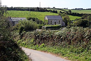
Degibna is a hamlet and farm in the parish of Helston, Cornwall, England, UK. It lies on the eastern bank of the largest natural freshwater lake in Cornwall, The Loe, and forms part of the Penrose Estate.

Goonvrea is a hamlet in the parish of St Agnes, Cornwall, England.
Higher Bal is a hamlet in the parish of St Agnes, Cornwall, England.
Higher Boscaswell is a hamlet near Pendeen in west Cornwall, England. It is east of Pendeen and on the B road from St Ives to St Just. Higher Boscaswell is included in the St Just in Penwith division on Cornwall Council.

Mayon is a hamlet on the A30 main road north of Sennen in west Cornwall, England. Mayon is about 7 miles (11 km) south-west of Penzance.

Meaver is a hamlet east of Mullion and in the parish of Mullion in west Cornwall, England.

Medlyn is a site of disused mines near Porkellis in Cornwall, England.

Menherion is a farm in the parish of Stithians in Cornwall, England. Menherion is west of Stithians churchtown. Menherion is also the name of a hamlet in Cornwall.

Mingoose is a hamlet near St Agnes and north of Mount Hawke in Cornwall, England.

Nance is a hamlet southwest of Carbis Bay in west Cornwall, England.

Nanceddan is a farm north of Ludgvan in west Cornwall, England.

Nantithet is a hamlet near Cury in west Cornwall, England.
Ninnes Bridge is a hamlet in west Cornwall, England. Ninnes Bridge is northwest of Canon's Town and near Trencrom Hill.
Parc Erissey is a hamlet north of Redruth, Cornwall, England.

Park Bottom is a hamlet north of Pool and near Illogan in west Cornwall, England. The village centers around one junction in the lower part of the town. This 5-way junction has roads leading to Camborne, Illogan, Portreath and Pool. The village has three commercial buildings in the centre, a Premier convenience store, a pub called The New Inn and a hair salon.
Paul's Green is a hamlet between Leedstown and Townshend in west Cornwall, England, UK.

Penbeagle is a suburb of St Ives in Cornwall, England, UK.
Pengegon is a residential area east of Camborne, Cornwall, England, which has a fish and chip shop, a playground and memorial to local teen Shakira Pellow. From 2013 to 2021, Pengegon was included in the Camborne Treslothan division on Cornwall Council. After boundary changes at the 2021 local elections, it was placed in the new Four Lanes, Beacon and Troon division.
Penhale Jakes is a hamlet west of Breage, in the civil parish of Breage, in west Cornwall, England, UK.
Penrose Hill is a hamlet near Porthleven, Cornwall, England, UK.

