List of the National Register of Historic Places listings in Madison County, New York
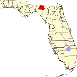
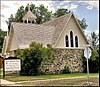
This is a list of the National Register of Historic Places listings in Madison County, Florida.

This is a list of the National Register of Historic Places listings in Madison County, Virginia.

This is a list of the National Register of Historic Places listings in Madison County, Ohio.

This is a list of the National Register of Historic Places listings in Fergus County, Montana. It is intended to be a complete list of the properties and districts on the National Register of Historic Places in Fergus County, Montana, United States. The locations of National Register properties and districts for which the latitude and longitude coordinates are included below, may be seen in a map.

This is a list of the National Register of Historic Places listings in Sanders County, Montana. It is intended to be a complete list of the properties and districts on the National Register of Historic Places in Sanders County, Montana, United States. The locations of National Register properties and districts for which the latitude and longitude coordinates are included below, may be seen in a map.

This is a list of the National Register of Historic Places listings in Glacier County, Montana. It is intended to be a complete list of the properties and districts on the National Register of Historic Places in Glacier County, Montana, United States. The locations of National Register properties and districts for which the latitude and longitude coordinates are included below, may be seen in a map.

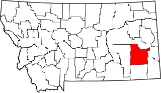
This is a list of the National Register of Historic Places listings in Rosebud County, Montana. It is intended to be a complete list of the properties and districts on the National Register of Historic Places in Rosebud County, Montana, United States. The locations of National Register properties and districts for which the latitude and longitude coordinates are included below, may be seen in a map.
This is a list of the National Register of Historic Places listings in Silver Bow County, Montana. It is intended to be a complete list of the properties and districts on the National Register of Historic Places in Silver Bow County, Montana, United States. The locations of National Register properties and districts for which the latitude and longitude coordinates are included below, may be seen in a map.
This is a list of the National Register of Historic Places listings in Custer County, Montana. It is intended to be a complete list of the properties and districts on the National Register of Historic Places in Custer County, Montana, United States. The locations of National Register properties and districts for which the latitude and longitude coordinates are included below, may be seen in a map.

This is a list of the National Register of Historic Places listings in Mineral County, Montana.
This is a list of the National Register of Historic Places listings in Granite County, Montana. It is intended to be a complete list of the properties and districts on the National Register of Historic Places in Granite County, Montana, United States. The locations of National Register properties and districts for which the latitude and longitude coordinates are included below, may be seen in a map.

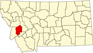
This is a list of the National Register of Historic Places listings in Powell County, Montana.
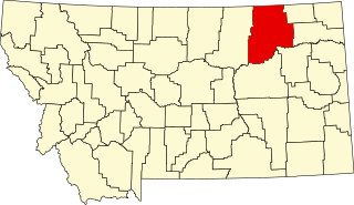
This is a list of the National Register of Historic Places listings in Valley County, Montana. It is intended to be a complete list of the properties and districts on the National Register of Historic Places in Valley County, Montana, United States. The locations of National Register properties and districts for which the latitude and longitude coordinates are included below, may be seen in a map.
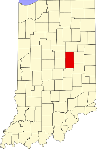
This is a list of the National Register of Historic Places listings in Madison County, Indiana.

This list includes properties and districts listed on the National Register of Historic Places in Madison County, North Carolina. Click the "Map of all coordinates" link to the right to view an online map of all properties and districts with latitude and longitude coordinates in the table below.

This is a list of the National Register of Historic Places listings in Madison County, Arkansas.
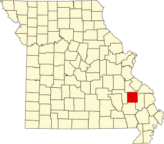
This is a list of the National Register of Historic Places listings in Madison County, Missouri.

This is a list of the National Register of Historic Places listings in Madison County, Nebraska.

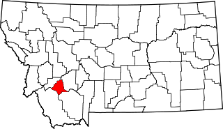
This is a list of the National Register of Historic Places listings in Stillwater County, Montana. It is intended to be a complete list of the properties and districts on the National Register of Historic Places in Stillwater County, Montana, United States. The locations of National Register properties and districts for which the latitude and longitude coordinates are included below, may be seen in a map.