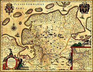
East Frisia or East Friesland is a historic region in the northwest of Lower Saxony, Germany. It is primarily located on the western half of the East Frisian peninsula, to the east of West Frisia and to the west of Landkreis Friesland.
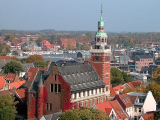
Leer is a town in the district of Leer, in the northwestern part of Lower Saxony, Germany. It is situated on the river Leda, a tributary of the river Ems, near the border with the Netherlands. With 34,958 inhabitants (2021), it is the third-largest city in East Frisia after Emden and Aurich.

Wittmund is a town and capital of the district of Wittmund, in Lower Saxony, Germany.
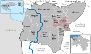
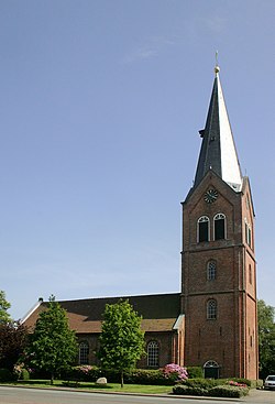
Jümme is a collective municipality (Samtgemeinde) in the district of Leer in the German state of Lower Saxony. It is named after the River Jümme which flows through all three constituent communities. It has an area of 82.34 km2 and a population of 6,421. It is situated in the region of East Frisia. Along with the Samtgemeinde of Hesel, it is one of two in the district. It was formed in the wake of local government reform in 1973. Filsum serves as the administrative centre.

The Rheiderland is a region of Germany and the Netherlands between the River Ems and the Bay of Dollart. The German part of the Rheiderland lies in East Frisia, west of the Ems. The Dutch part lies in the Dutch province of Groningen and is mostly part of Oldambt. The Rheiderland is one of the four historic regions on the mainland in the district of Leer; the others being the Overledingerland, the Moormerland and the Lengenerland.
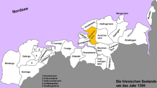
The Brokmerland is a landscape and historic territory, located in western East Frisia, which covers the area in and around the present-day communities of Brookmerland and Südbrookmerland. The Brokmerland borders in the east on the Harlingerland and in the north on the Norderland. The historic Brokmerland is usually written with only one "o". Occasionally one also finds the spelling "Broekmerland", while today's communities have chosen to spell the name with a double "o".
The Battle of Detern on 27 September 1426 marked the prelude to the East Frisian rebellion against the rule of the tom Brok family over East Frisia.

Ocko II tom Brok (1407–1435) was Chieftain of the Brokmerland and the Auricherland in East Frisia.
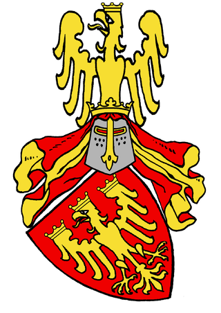
The tom Brok family were a powerful East Frisian line of chieftains, originally from the Norderland on the North Sea coast of Germany. From the second half of the 14th century, the tom Broks tried to gain control of East Frisia over the other chieftain families. The line of tom Brok died out in 1435.
The history of East Frisia developed rather independently from the rest of Germany because the region was relatively isolated for centuries by large stretches of bog to the south, while at the same time its people were oriented towards the sea. Thus in East Frisia in the Middle Ages there was little feudalism, instead a system of fellowship under the so-called Friesian Freedom emerged. It was not until 1464, that the House of Cirksena was enfeoffed with the Imperial County of East Frisia. Nevertheless absolutism had been, and continued to be, unknown in East Frisia. In the two centuries after about 1500, the influence of the Netherlands is discernable - politically, economically and culturally. In 1744, the county lost its independence within the Holy Roman Empire and became part of Prussia. Following the Vienna Congress of 1815, it was transferred to the Kingdom of Hanover, in 1866 it went back to Prussia and, from 1946, it has been part of the German state of Lower Saxony.

Jheringsfehn is a peat village in the region of East Frisia, in Lower Saxony, Germany. Administratively, it is an Ortsteil of the municipality of Moormerland. Warsingsfehn is located just to the east of Warsingsfehn and is approximately 10 kilometers to the northeast of Leer. It has a population of 2,440.
Uko Fockena was an East Frisian chieftain of Moormerland and Emsigerland.

Bedekaspel is an East Frisian village in Lower Saxony, Germany. It is an Ortsteil of the municipality of Südbrookmerland. It is located near the Großes Meer. A Haufendorf, the village of Bedekaspel includes Wochenendsiedlung, a recreational area on the northern shore of the Großes Meer, and Bedekaspeler Marsch.
Visquard is a village in the region of East Frisia, in Lower Saxony, Germany. It is part of the municipality of Krummhörn. The village is located to the north of Pewsum and to the south of Greetsiel.

Oldersum is a village in the region of East Frisia, in Lower Saxony, Germany. Administratively, it is an Ortsteil of the municipality of Moormerland. Located on the north bank of the Ems estuary, Oldersum is to the southeast of Emden and the northwest of Leer. It has a population of 1,533.
Tergast is a village in the region of East Frisia, in Lower Saxony, Germany. Administratively, it is an Ortsteil of the municipality of Moormerland. Tergast is 1.5 kilometers to the northeast of Oldersum and has a population of 457.

Rorichum is a village in the region of East Frisia, in Lower Saxony, Germany. Administratively, it is an Ortsteil of the municipality of Moormerland. Located on the north bank of the Ems estuary, Rorichum is just to the southeast of Oldersum. It has a population of 444.

Terborg is a small village in the region of East Frisia, in Lower Saxony, Germany. Administratively, it is an Ortsteil of the municipality of Moormerland. Located on the north bank of the river Ems, Terborg is approximately 8 kilometers to the northwest of Leer. It has a population of 105.

Berum is a village in the region of East Frisia, Lower Saxony, Germany. It is an Ortsteil of the municipality of Hage, part of the municipal association (Samtgemeinde) of Hage, although its metropolitan area practically borders that of the nearby town of Berumbur, to which it is located to the west.

Arle is an East Frisian village in Lower Saxony, Germany. It is an Ortsteil of the municipality of Großheide, in the Aurich district. The formerly independent municipality was incorporated into Großheide with the municipal reform law of 1 July 1972.