
Brewster is a city in Nobles County, Minnesota, United States. The population was 473 at the 2010 census.
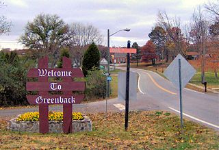
Greenback is a city in Loudon County, Tennessee, United States. Its population was at 1,102, according to the 2020 census. It is included in the Knoxville Metropolitan Statistical Area.
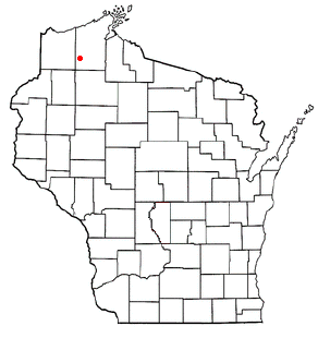
Barnes is a town in Bayfield County, Wisconsin, United States. The population was 769 at the 2010 census. The town was named for an early settler named George Sardis Barnes who opened the first hotel, saloon, and store north of the Eau Claire lakes in the late 1880s.

Pleasant Prairie is a village in the U.S. state of Wisconsin. Located in Kenosha County along the southwestern shoreline of Lake Michigan, Pleasant Prairie was home to 21,250 people at the 2020 census. The village is positioned directly south of the city of Kenosha and directly north of the Illinois border. Although located just 37 miles south of Milwaukee, it is part of the United States Census Bureau's Chicago combined statistical area (CSA) and metropolitan statistical area despite being 57 miles north of that city. Among its notable features are the RecPlex and Chiwaukee Prairie.
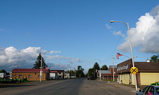
Sheldon is a village in Rusk County, Wisconsin, United States. The population was 237 at the 2010 census.

Elkhart Lake is a village in Sheboygan County, Wisconsin, United States, located within the northwestern part of the county within the Town of Rhine. The population was 967 at the 2010 census. It is included in the Sheboygan, Wisconsin Metropolitan Statistical Area. Elkhart Lake may be best known for hosting road races on public county roads during the 1950s, later moving to a dedicated race track called Road America, which is located a few miles south of the village.

Dodgeville is a city in and the county seat of Iowa County, Wisconsin, United States. The population was 4,984 at the 2020 census, making it the county's most populous city. Dodgeville is part of the Madison Metropolitan Statistical Area.

Kaukauna is a city in Outagamie and Calumet counties, Wisconsin, United States. It is situated on the Fox River, approximately 100 miles (160 km) north of Milwaukee. The population was 15,462 at the 2010 census. It is a part of the Appleton, Wisconsin Metropolitan Statistical Area.

Hudson is a city in St. Croix County, Wisconsin, United States. As of the 2020 United States census, its population was 14,755. It is part of the Minneapolis–St. Paul Metropolitan Statistical Area (MSA). The village of North Hudson is directly north of Hudson.

Kewaskum is a village in Washington and Fond du Lac counties in Wisconsin, United States. The population was 4,004 at the 2010 census. All of this population resided in the Washington County portion of the village. The village is mostly surrounded by the Town of Kewaskum.

Isaar is a small unincorporated community in the Town of Seymour in Outagamie County, the United States, about 10 miles from Green Bay. Isaar has the same zip code as the City of Seymour and its schools are part of the Seymour Community School District.
Briarton is an unincorporated community in Shawano County, Wisconsin, United States, in the Town of Lessor, west of Green Bay.

Slab City, Wisconsin is an unincorporated community in Shawano County, Wisconsin, United States, in the town of Hartland. It is located one mile south of Bonduel, on Wisconsin Highway 47.

Calumetville is an unincorporated community that straddles the county line between Calumet and Fond du Lac counties in Wisconsin. The main part of the community in Fond du Lac County lies in the town of Calumet, and the part in Calumet County lies in the town of Brothertown.
Okeelanta is an unincorporated community in Palm Beach County, Florida, United States, located approximately 4 miles (7 km) south of South Bay on U.S. Route 27 at County Road 827. It was originally developed as a planned community in the 1910s, but had effectively disappeared by the end of the 1920s. The name is a portmanteau of Lake Okeechobee and Atlantic Ocean.
West Lima is an unincorporated community in the Town of Bloom, Richland County, Wisconsin, United States. The community is located at the intersection of County Highway A and County Highway D.
Fancher is an unincorporated community in Portage County, Wisconsin, United States.

Hannibal is an unincorporated community located in Taylor County, Wisconsin, United States. Hannibal is located on Wisconsin Highway 73 and County Highway M north of Gilman, in the town of Cleveland. Today Hannibal is quiet, but once it was a bustling little economic hub at the junction of two logging railroads.
Kickapoo Center is an unincorporated community located in the town of Kickapoo, Vernon County, Wisconsin, United States. Kickapoo Center is located on Wisconsin Highway 131 near the Kickapoo River, 3 miles (4.8 km) south-southwest of Viola.

Wagner is an unincorporated community located in the town of Wagner, Marinette County, Wisconsin, United States. Wagner is 11.5 miles (18.5 km) east-southeast of Wausaukee.


