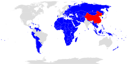
The New International Land-Sea Trade Corridor is a trade and logistics passage with an operational hub centered on Chongqing. According to Xinhua the corridor was connected to 190 ports in 90 countries in September 2019. [1] It is among one of many corridors under the Belt and Road Initiative, a global economic connectivity program organized by China.
The corridor is a joint project of western Chinese provinces (Chongqing, Guangxi, Guizhou, Gansu, Qinghai, Xinjiang, Yunnan and Ningxia) and Singapore under the government-to-government framework of the China-Singapore (Chongqing) Demonstration Initiative on Strategic Connectivity. [2]
The route for the corridor is the railway from Chongqing to ports at the Beibu Gulf in Guangxi like the port of Qinzhou. [3] The cargo is shipped from the Beibu Gulf to other ports worldwide. Examples in Chinese state media of the trade enabled by the corridor are potatoes from Gansu sold to Vietnam and pitaya from Vietnam found in the supermarkets of Chongqing. [4]
From the center of the hub in Chonqing, there are connections in other directions. Rail and truck lines also connect Chongqing to other Belt and Road Initiative corridors in Southeast Asia like the China-Myanmar Economic Corridor, Laos-China Economic Corridor, and Two Corridors, One Belt (Vietnam). Chongqing is also connected with a railway line going to Europe through Central Asia via the New Eurasian Land Bridge.
The corridor puts emphasis on faster customs clearance. Fifteen regional customs under the General Administration of Customs of China entered into a memorandum in 2019 to cooperate on the corridor. [1]
The Gulf of Tonkin is a body of water located off the coast of Northern Vietnam and South China. It is a northern arm of the South China Sea. The Gulf is defined in the west by the northern coastline of Vietnam, in the north by China's Guangxi Zhuang Autonomous Region, and to the east by China's Leizhou Peninsula and Hainan Island.
The Trans-Asian Railway (TAR) is a project to create an integrated freight railway network across Europe and Asia. The TAR is a project of the United Nations Economic and Social Commission for Asia and the Pacific (UNESCAP).
The Eurasian Land Bridge, sometimes called the New Silk Road, or Belt and Road Initiative is the rail transport route for moving freight and passengers overland between Pacific seaports in the Russian Far East and China and seaports in Europe. The route, a transcontinental railroad and rail land bridge, currently comprises the Trans-Siberian Railway, which runs through Russia and is sometimes called the Northern East-West Corridor, and the New Eurasian Land Bridge or Second Eurasian Continental Bridge, running through China and Kazakhstan. As of November 2007, about 1% of the $600 billion in goods shipped from Asia to Europe each year were delivered by inland transport routes.
Lianyungang is a prefecture-level city in northeastern Jiangsu province, China. It borders Yancheng to its southeast, Huai'an and Suqian to its south, Xuzhou to its southwest, and the province of Shandong to its north. Its name derives from Lian Island, the largest island in Jiangsu which lies off its coastline, and Yuntai Mountain, the highest peak in Jiangsu, a few miles from the town center, and the fact that it is a port. The name can be literally translated as the Port Connecting the Clouds.
The East–West Economic corridor is an economic development program initiated in order to promote development and integration of 5 Southeast Asian countries, namely: Myanmar, Thailand, Laos, Cambodia and Vietnam. The concept was agreed upon in 1998 at the Ministerial Conference of the Greater Mekong Subregion, organized in Manila, the Philippines. This corridor became operational on December 12, 2006.
The Delhi–Mumbai Industrial Corridor Project (DMIC) is a planned industrial development project between India's capital, Delhi and its financial hub, Mumbai. The DMIC project was launched in pursuance of an MOU signed between the Government of India and the Government of Japan in December 2006. It is one of the world's largest infrastructure projects with an estimated investment of US$90 billion and is planned as a high-tech industrial zone spread across six states, as well as Delhi, the national capital and itself a Union Territory. The investments will be spread across the 1,500 km long Western Dedicated Freight Corridor which will serve as the industrial corridor's transportation backbone.
The transport infrastructure of Yunnan is served by numerous transport modes, and forms an integral part of the structure Yunnan Province and the Southwest of China. Yunnan is served by several civilian airports and a major highway and rail network. The province is served by a network of bus routes that radiates from the capital city, Kunming.
The Beibu Gulf Economic Rim or Beibu Economic Belt also known as Gulf of Tonkin Economic Belt in defines the economic region or rim surrounding around China's southwestern coastal region and cities around the Gulf of Tonkin. The region is part of Chinese government's "Go West" strategy, to boost its less developed western regions. The implementation of the campaign, has resulted in many construction projects in cities on the Beibu Gulf Rim, especially in Guangxi. The Beibu Gulf economic rim has emerged as a new highlight of China-ASEAN cooperation, especially between Vietnam, who is also cooperating in this economic zone. It covers Guangdong, Hainan and Guangxi, and northern and central Vietnam.
The New Eurasian Land Bridge, also called the Second or New Eurasian Continental Bridge, is the southern branch of the Eurasian Land Bridge rail links running through China. The Eurasian Land Bridge is the overland rail link between Asia and Europe.
The China-Indochina Peninsula economic corridor (CICPEC) is an economic corridor initiated in 2010 and incorporated later into the Belt and Road Initiative. It was known before as the Nanning-Singapore Economic Corridor.
Lanzhou New Area is a state-level new area established in 2012 and is under the direct control of the municipal government of Lanzhou, Gansu province. It is located in the valley around Lanzhou Zhongchuan Airport, 30 kilometres from the old city of Lanzhou. It is the first state-level new development area in northwestern China, and the fifth state-level new area in the country.
The Bangladesh, China, India and Myanmar Economic Corridor (BCIM) is an initiative connecting India and China through Myanmar and Bangladesh as a corridor.
Brunei–China relations refers to bilateral foreign relations between Brunei and China. Brunei has an embassy in Beijing, and China has an embassy in Bandar Seri Begawan.
The 21st Century Maritime Silk Road, commonly just Maritime Silk Road (MSR), is the sea route part of the Belt and Road Initiative which is a Chinese strategic initiative to increase investment and foster collaboration across the historic Silk Road. The China–Pakistan Economic Corridor is an extension to the proposed Silk Road. The Maritime Silk Road coincides with the theory of China's String of Pearls strategy.
The Belt and Road Initiative is a global development strategy adopted by the Chinese government in 2013 involving infrastructure development and investments in nearly 70 countries and international organizations in Asia, Europe, and Africa.
Bharatmala Pariyojana (Project) is a centrally-sponsored and funded Road and Highways project of the Government of India. The total investment for 83,677 km (51,994 mi) committed new highways is estimated at ₹5.35 lakh crore (US$75 billion), making it the single largest outlay for a government road construction scheme. The project will build highways from Gujarat, Rajasthan, Punjab, Haryana and then cover the entire string of Himalayan states - Jammu and Kashmir, Himachal Pradesh, Uttarakhand - and then portions of borders of Uttar Pradesh and Bihar alongside Terai, and move to West Bengal, Sikkim, Assam, Arunachal Pradesh, and right up to the Indo-Myanmar border in Manipur and Mizoram. Special emphasis will be given on providing connectivity to far-flung border and rural areas including the tribal and backward areas. Bharatmala Project will interconnect 550 District Headquarters through a minimum 4-lane highway by raising the number of corridors to 50 and move 80% freight traffic to National Highways by interconnecting 24 logistics parks, 66 inter-corridors (IC) of total 8,000 km (5,000 mi), 116 feeder routes (FR) of total 7,500 km (4,700 mi) and 7 north east Multi-Modal waterway ports.
Modern cultivation of coffee in China began in 1988. In 2016 and 2017, China was among the top 20 worldwide producers of coffee. Ninety-eight per cent of the coffee grown in China comes from Yunnan province.
China-Myanmar Economic Corridor (CMEC) is a number of infrastructure projects supporting connectivity between Myanmar and China. It is an economic corridor of the Belt and Road Initiative.
The Two Corridors, One Belt is a connectivity initiative involving Vietnam and China. It is a part of the Belt and Road Initiative, a Chinese global development initiative fostering connectivity especially across Eurasia.
The China-Central Asia-West Asia Economic Corridor is an economic and transportation corridor of the Belt and Road Initiative, a global economic connectivity program led by China. The corridor was one of the 6 land corridors articulated in the initial vision for the BRI in 2015. It has since the 2nd Belt and Road Forum in 2019 become one of 35 corridors and project officially included in the BRI.