
Liscard is an area of the town of Wallasey, in the Metropolitan Borough of Wirral, Merseyside, England. The most centrally located of Wallasey's townships, it is the main shopping area of the town, with many shops located in the Cherry Tree Shopping Centre. At the 2001 census the population of Liscard local government ward was recorded at 14,301, increasing to 15,574 at the 2011 census.
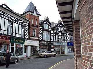
West Kirby is a town on the north-west corner of the Wirral Peninsula in Merseyside, England, at the mouth of the River Dee. Within the boundaries of the historic county of Cheshire, to the north-east lies Hoylake, to the east Grange and Newton, and to the south-east Caldy. At the 2011 Census, the population was 12,733. The town is on the opposite side of the River Dee to Mostyn in North Wales.

Meols is a village on the northern coast of the Wirral Peninsula, England. It is contiguous with the town of Hoylake immediately to the west. Historically in Cheshire, since 1 April 1974 it has been part of the Metropolitan Borough of Wirral, in the metropolitan county of Merseyside.
Moreton is a town on the north coast of the Wirral Peninsula, Merseyside, England. It is located approximately 8 km (5.0 mi) to the west of Wallasey. Historically part of Cheshire, it is now within the Metropolitan Borough of Wirral. The town was divided in 2004 between the local government wards of Leasowe & Moreton East and Moreton West & Saughall Massie. Moreton is also part of the parliamentary constituency of Wallasey.

Irby is a village on the Wirral Peninsula, in Merseyside, England. The village covers an area of 20 square kilometres. To the north of Irby lies the associated hamlet of Irby Hill. It is part of the Greasby, Frankby and Irby Ward of the Metropolitan Borough of Wirral and is within the parliamentary constituency of Wirral West.
Caldy is a small, affluent village on the Wirral Peninsula, England, south-east of West Kirby. It is part of the West Kirby & Thurstaston Ward of the Metropolitan Borough of Wirral and is in the parliamentary constituency of Wirral West. At the time of the 2001 Census, Caldy had 1,290 inhabitants, of a total ward population of 12,869.

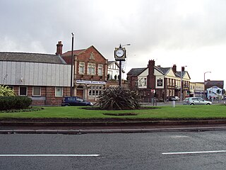
Greasby is a large village on the Wirral Peninsula, Merseyside, England. A predominantly residential area, it is contiguous with Upton to the east and Saughall Massie to the north. The small village of Frankby is to the immediate west. Historically within the county of Cheshire, it is part of the Greasby, Frankby and Irby Ward of the Metropolitan Borough of Wirral and is in the parliamentary constituency of Wirral West.

Poulton is an area of the town of Wallasey, in the Metropolitan Borough of Wirral, Merseyside, England. It is located on the Wirral Peninsula and bordered by Liscard to the north, Egremont to the north east and Seacombe to the east. The West Float, is to the south.

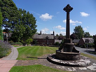
Thurstaston is a village on the Wirral Peninsula, Merseyside, England. It is part of the West Kirby and Thurstaston Ward of the Metropolitan Borough of Wirral and the parliamentary constituency of Wirral West. The village lies on the A540 road between Heswall and Caldy, although it extends some distance down Station Road to the Wirral Way and the River Dee estuary.

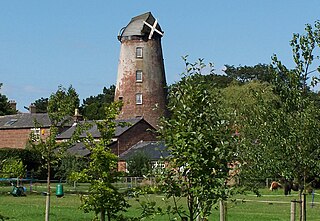
Saughall Massie is a village on the Wirral Peninsula, Merseyside, England. It is part of the Moreton West & Saughall Massie Ward of the Metropolitan Borough of Wirral and the parliamentary constituency of Wallasey. A small village primarily made up of large fields owned by local farmers, it is bordered by Greasby, Meols, Moreton and Upton. At the 2001 census Saughall Massie had a population of 1,260.

Noctorum is a suburb of Birkenhead, Merseyside, England. Administratively it is within the Metropolitan Borough of Wirral as part of Claughton Ward. Noctorum is in the north east of the Wirral Peninsula, bounded by the Beechwood estate to the north, Claughton and Oxton to the east and south east, and the River Fender and M53 motorway to the west.

Frankby is a village on the Wirral Peninsula, in Merseyside, England. It is located between Greasby and Newton on the outskirts of the town of West Kirby. The hamlet of Larton is to the north west. Historically within the county of Cheshire, it is part of the Greasby, Frankby and Irby Ward of the Metropolitan Borough of Wirral and is in the parliamentary constituency of Wirral West.

Grange is a suburb of West Kirby, on the Wirral Peninsula, in the Metropolitan Borough of Wirral, Merseyside, England. The suburb is contiguous with Newton to the north east. Historically part of the county of Cheshire, it is within the local government ward of West Kirby and Thurstaston and the parliamentary constituency of Wirral West.

Landican is a hamlet on the Wirral Peninsula, in the Metropolitan Borough of Wirral, Merseyside, England. The hamlet is on the outskirts of Birkenhead, near to Woodchurch and the M53 motorway. Historically part of the county of Cheshire, it is within the local government ward of Pensby and Thingwall and the parliamentary constituency of Wirral West.

Larton is a hamlet near the town of West Kirby, on the Wirral Peninsula, in Merseyside, England. Administratively it is part of the local government ward of Greasby, Frankby and Irby in the Metropolitan Borough of Wirral and is within the parliamentary constituency of Wirral West.
Willaston is a large village situated on the Wirral Peninsula, Cheshire, England. Centred on a village green, it is located in the unitary authority of Cheshire West and Chester between Neston and Ellesmere Port, less than a mile south of the Metropolitan Borough of Wirral boundary. It is located very closely to Eastham and Bromborough and just a short distance away from Neston. At the 2001 Census, the total population of Willaston and Thornton ward was 4,913.

Raby is a hamlet on the Wirral Peninsula, Merseyside, England. Administratively it is located within the Metropolitan Borough of Wirral as part of Clatterbridge Ward. The settlement is within the parliamentary constituency of Wirral South.

Woodbank is a village and former civil parish, now in the parish of Puddington, in the unitary authority of Cheshire West and Chester and the ceremonial county of Cheshire in northwest England. It is located on the Wirral Peninsula, about 6 miles northwest of the city of Chester and near the larger village of Saughall. The civil parish was abolished in 2015 and merged into Puddington.
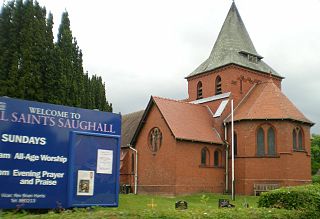
Saughall is a village and former civil parish, in the unitary authority of Cheshire West and Chester and the ceremonial county of Cheshire, England. Located between Shotwick and Blacon, it is approximately 4.8 km (3.0 mi) north west of Chester and 1.8 km (1.1 mi) from Sealand across the Welsh border. The civil parish was abolished on 1 April 2015 to form Saughall and Shotwick Park, with parts also incorporated into the parish of Puddington and the unparished area of Chester.

Claughton is a village and suburb of Birkenhead, on the Wirral Peninsula, Merseyside, England. It is situated approximately 3 km (1.9 mi) to the west of Birkenhead town centre, adjacent to Birkenhead Park. Administratively, Claughton is a ward of the Metropolitan Borough of Wirral. Before local government reorganisation on 1 April 1974, it was part of the County Borough of Birkenhead, within the county of Cheshire.


