Southwick is a semi-rural village and civil parish 3 miles (4.8 km) south-west of the county town of Trowbridge, Wiltshire, England. It is separated from the south-west fringe of Trowbridge only by the Southwick Country Park, which consists of 380 acres (150 ha) of open fields. The majority of the village lies south of the A361, which runs through the village, linking Trowbridge with Frome.

Hibaldstow is a village and civil parish in North Lincolnshire, England. The population of the civil parish at the 2011 census was 2,433. It is situated on the B1206 road, 4 miles (6.4 km) south from Brigg and the M180. The site of the deserted medieval village of Gainsthorpe is nearby.

Queen Camel is a village and civil parish, on the River Cam and the A359 road, in the unitary authority of Somerset, England. It is about 7 miles (11.3 km) north of Yeovil. According to the 2011 census it had a population of 908. The parish includes the hamlet of Wales. Nearby places are West Camel, Sparkford and Marston Magna.

Bishop's Sutton or Bishop's Sutton is a village and civil parish one mile (1.6 km) east of the market town of Alresford in the City of Winchester district of Hampshire, England. According to the 2001 census it had a population of 419, increasing to 463 at the 2011 Census.

Norbury is a hamlet and former civil parish, now in the parish of Marbury and District, in the Cheshire East district, in the ceremonial county of Cheshire, England. It included the small settlements of Gauntons Bank, Hurst Green, Swanwick Green, Norbury Common and Holtridge, with a total population of 194 people in 2011. The hamlet of Norbury lies around 5 miles (8 km) north of Whitchurch, Shropshire. Nearby villages include No Man's Heath, Marbury and Wrenbury.

East Tisted is a village and civil parish in the East Hampshire district of Hampshire, England. It is 4.8 miles (7.7 km) south of Alton on the A32 road.

Stockton is a small village and civil parish in the Wylye Valley in Wiltshire, England, about 8 miles (13 km) southeast of Warminster. The parish includes the hamlet of Bapton.

Hunsterson is a hamlet and former civil parish, now in the parish of Doddington and District, in the unitary authority area of Cheshire East and the ceremonial county of Cheshire, England. The hamlet is located 2¾ miles to the north east of Audlem and 6 miles to the south of Crewe. The parish also included the settlements of Brown Moss, Four Lane End, Foxes Bank and Whittaker's Green. In 2011 the parish had a population of 163. Nearby villages include Audlem, Buerton, Hatherton and Hankelow.

Great Hinton is a small village and civil parish about 3 miles (4.8 km) south of Melksham and 3.5 miles (5.6 km) north-east of Trowbridge in Wiltshire, England. The parish includes the hamlets of Bleet and Cold Harbour.

Stanford Rivers is a village and civil parish in the Epping Forest district of Essex, England. The parish, which is approximately 11 miles (18 km) west from the county town of Chelmsford, contains the village of Toot Hill and the hamlet of Little End, both settlements larger than Stanford Rivers village, and the hamlet of Clatterford End. The village is 2.0 miles (3 km) south-east of Chipping Ongar, 3 miles (5 km) south-west of North Weald Bassett and 3 miles north-west of Kelvedon Hatch. The parish covers an area of 1,749 hectares.
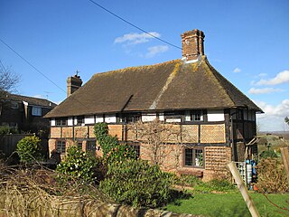
Blackstone is a hamlet in the civil parish of Woodmancote and the Horsham district of West Sussex, England. Blackstone is significant for its listed 17th- and 18th-century houses and cottages.

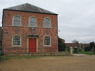
Monkwood is a Hamlet in the south of Ropley parish. Although currently it is spread between Petersfield Road and Hill Farm Road, historically it referred to the settlement on the south side of Smugglers Lane containing the 15th Century Smugglers, the 16th Century The Old Farmhouse and the C18th century cottage between the two. The more recent settlement between Petersfield Road and Hill Farm Lane originates from around the late 1800s, with only two settlements; Hill Farm and Ropley Common Farm visible in the 1870s OS Map.

Priors Dean is a hamlet in the civil parish of Colemore and Priors Dean, in the East Hampshire district, in the county of Hampshire, England. It is in the Hampshire Downs about 3 miles (5 km) west of Liss and about 4 miles (6.4 km) north of Petersfield. It is a deserted medieval village first mentioned in the 1100s. Until 1932 it was a separate parish. The nearest railway station is at Liss.

Midhopestones is a village in the civil parish of Bradfield within the Stocksbridge and Upper Don electoral ward in the borough of the City of Sheffield, England.

Fiddlers Hamlet is a hamlet in the civil parish of Epping, within the Epping Forest District of Essex, England, and is 1 mile (1.6 km) south-east from the market town of Epping, separated by farm and fields. The M11 motorway runs 300 yards (274 m) to the east, with Junction 7 for Harlow being 4 miles (6 km) to the north.

Kitwood is a hamlet in the parish of Four Marks, Hampshire, England. It is in the south east of the Parish and has been part of Four Marks since its creation in 1932. Prior to this, it was part of Ropley Parish.

Hastingwood is a hamlet in the North Weald Bassett civil parish of the Epping Forest district of Essex, England. The hamlet is centred on the junction of Hastingwood Road, which runs southwest to the A414 road and the Hastingwood Junction 7 of the M11 motorway, and Mill Street, which runs north to Harlow Common and Potter Street. Nearby settlements include the town of Harlow, North Weald and the hamlet of Foster Street.
Charlwood is a small hamlet in the East Hampshire district of Hampshire, England. It is in the large civil parish of Ropley and partially in East Tisted.

Knowl Green is a hamlet in the civil parish of Belchamp St Paul and the Braintree district of Essex, England.

Todenham is a village and civil parish in the Cotswold district of Gloucestershire, England. The village is significant for its Grade I listed 14th-century parish church.

