Privett

Last updated • 2 min readFrom Wikipedia, The Free Encyclopedia

Privett
Old Post Office, Privett, Hampshire - geograph.org.uk - 60687.jpg
Privett Old Post Office
Hampshire UK location map.svg
Red pog.svg
Privett
Location within Hampshire
OS grid reference SU675269
Civil parish
District
Shire county
Region
Country England
Sovereign state United Kingdom
Post town Petersfield
Postcode district GU32
Police Hampshire and Isle of Wight
Fire Hampshire and Isle of Wight
Ambulance South Central
UK Parliament
List of places
UK
England
Hampshire
51°02′17″N1°02′13″W / 51.038°N 1.037°W / 51.038; -1.037

Privett is a small village and former civil parish, now in the parish of Froxfield and Privett, [1] in the East Hampshire district of Hampshire, England. It is 5 miles (8.0 km) northwest of Petersfield, just off the A272 road. Its principal feature is Holy Trinity Church, designed by Arthur Blomfield and built at the expense of local landowner, businessman and M.P. William Nicholson. Nicholson was also responsible for building in the village a number of dwellings for workers on his Basing Park estate. [2] In 1931 the parish had a population of 172. [3]

Contents

History

A place called Pryfetesflōd (Privett's River), located in the Weald, is mentioned in the 755 AD entry of the Anglo-Saxon Chronicle (the story of Cynewulf and Cyneheard), as the place where Sigeberht of Wessex, previously a ruler of Hampshire, was driven off to.

The village was known as Pryvet in the 14th century and Pryvate in the 16th century. [4] The parish of Holy Trinity is listed as being part of the parish and manor of West Meon in 1391, belonging to St. Swithun's Monastery, later granted to the Dean and Chapter of Winchester by Henry the Eighth.

Holy Trinity Church Holy Trinity Privett.jpg
Holy Trinity Church

Holy Trinity Church was completed in 1878 on the site of an earlier building. [5] Designated as Grade II* listed in 1978, the building is oversized for the rural community [2] and was declared redundant in 1975. [6] It is now in the care of the Churches Conservation Trust. [7]

The Meon Valley Railway, a cross-country line from Alton towards the south coast which was opened in 1903, passed through a 1,056-yard (966 m) tunnel just north-west of the village. Privett station was further north, where the line passed under the A32. [8] The station was closed in 1955 when passenger services on the line were withdrawn, and the line was dismantled soon after. [9]

The village was designated as a conservation area in 2000. [2]

Governance

The village of Privett is part of the Froxfield and Steep ward of the East Hampshire District Council, which is a non-metropolitan district council of Hampshire County Council. On 1 April 1932 the parish was abolished and merged with Froxfield. [3]

Transport

The nearest railway station is Petersfield, 5 miles (8 km) south-east of the village. Hampshire Bus provide a daily service to and from Alton College on school days. [10]

Related Research Articles

<span class="mw-page-title-main">Wickham, Hampshire</span> Village and parish in Hampshire, England

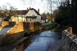
Wickham is a village in the civil parish of Wickham and Knowle, in the Winchester district, in the county of Hampshire, England. It is about 3 miles north of Fareham. In 2021 it had a population of 2173. At the 2001 census, it the parish a population of 4,816, falling to 4,299 at the 2011 Census.

<span class="mw-page-title-main">East Hampshire</span> Non-metropolitan district in England

East Hampshire is a local government district in Hampshire, England. Its council is based in the town of Petersfield, although the largest town is Alton. The district also contains the town of Bordon along with many villages and surrounding rural areas.

<span class="mw-page-title-main">Petersfield</span> Market town in Hampshire, England

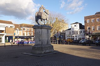
Petersfield is a market town and civil parish in the East Hampshire district of Hampshire, England. It is 15 miles (24 km) north of Portsmouth. The town has its own railway station on the Portsmouth Direct line, the mainline rail link connecting Portsmouth and London. Situated below the northern slopes of the South Downs, Petersfield lies wholly within the South Downs National Park.

<span class="mw-page-title-main">Horndean</span> Village and civil parish in Hampshire, England

Horndean is a village and civil parish in the East Hampshire district, in Hampshire, England, 8 miles (13 km) north of Portsmouth.

<span class="mw-page-title-main">East Meon</span> Village and parish in Hampshire, England

East Meon is a village and civil parish in the East Hampshire district of Hampshire, England. It is 4.4 miles (7.1 km) west of Petersfield.

<span class="mw-page-title-main">Clanfield, Hampshire</span> Village and civil parish in Hampshire, England

Clanfield is a village and civil parish in the south-east of the East Hampshire district of Hampshire, England. It is situated 2.4 miles north of Horndean, 12 mi (19 km) north of Portsmouth and 6 mi (10 km) south of Petersfield. It sits to the west of the main A3 road, just north of where the A3(M) (Motorway) ends.

<span class="mw-page-title-main">Binsted</span> Village and parish in Hampshire, England

Binsted is a village and large civil parish in East Hampshire, England. It is about 4.1 miles (6.6 km) east of Alton, its nearest town. The parish is one of the largest in northern Hampshire and covers almost 7,000 acres (2,800 ha). It contains two villages, Bucks Horn Oak and Holt Pound, as well as two hamlets, Wyck and Wheatley. The parish also covers the entirety of the Alice Holt Forest, a royal forest situated near the border with Surrey. The nearest railway station is 1.8 miles (2.9 km) northeast of the village, at Bentley. According to the 2011 census, the parish had a population of 1,817 people.

<span class="mw-page-title-main">East Hampshire (UK Parliament constituency)</span> Parliamentary constituency in the United Kingdom, 1983 onwards

East Hampshire is a constituency represented in the House of Commons of the UK Parliament since 2010 by Damian Hinds of the Conservative Party.

<span class="mw-page-title-main">Catherington</span> Village and parish in Hampshire, England

Catherington is a village and former civil parish, now in the parish of Horndean, in the East Hampshire district of Hampshire, England. It is 1 mile (1.8 km) northwest of Horndean. The village is also close to Cowplain and Clanfield. It is situated about 10 miles north of Portsmouth and eight miles south of Petersfield, in the very south of the district of East Hampshire. It has a semi-rural character. Catherington is not a very large village and has an approximate population of 3900. The village is a conservation area.

<span class="mw-page-title-main">West Meon</span> Village and parish in Hampshire, England

West Meon is a village and civil parish in Hampshire, England, with a population of 749 people at the 2011 census.

<span class="mw-page-title-main">East Tisted</span> Village and parish in Hampshire, England

East Tisted is a village and civil parish in the East Hampshire district of Hampshire, England. It is 4.8 miles (7.7 km) south of Alton on the A32 road.

<span class="mw-page-title-main">Warnford</span> Village and parish in Hampshire, England

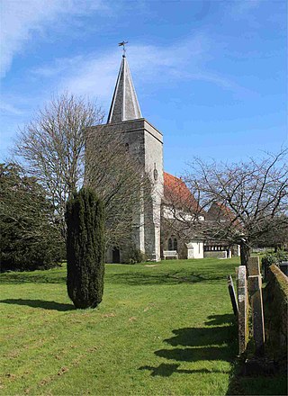
Warnford is a village and civil parish in the City of Winchester district of Hampshire, England. The parish covers 1283 hectares. The village lies on the A32 in the upper valley of the River Meon between West Meon and Exton. The population in 2019 was estimated at 220. The village is rural in character, with most of the buildings along River Lane, Lippen Lane and Hayden Lane.

<span class="mw-page-title-main">Privett railway station</span> Former railway station in Hampshire, England

Privett was an intermediate railway station on the Meon Valley line, which ran from Alton to Fareham in Hampshire, England, during the first half of the 20th century. Named after the hamlet of Privett, the station was located over half a mile away from its namesake and was built in largely uninhabited countryside.

<span class="mw-page-title-main">Steep, Hampshire</span> Village and parish in Hampshire, England

Steep is a village and civil parish in the East Hampshire district of Hampshire, England. Its nearest town is Petersfield, which lies 1.4 miles (2.3 km) south of the village, just off the A3 road. The nearest railway station is Petersfield, at 1.6 miles (2.6 km) south of the village. It has two public houses, The Harrow and the Cricketers Inn, with the former being an 18th-century Grade II listed building. According to the 2011 census, it had a population of 1,391.

<span class="mw-page-title-main">Froxfield Green</span> Village and parish in Hampshire, England

Froxfield Green is a village in the civil parish of Froxfield and Privett, in the East Hampshire district of Hampshire, England. It is 3 miles (5 km) north-west of Petersfield, and lies just north of the A272 road.

<span class="mw-page-title-main">High Cross, Hampshire</span> Village in Hampshire, England

High Cross is a village in the East Hampshire district of Hampshire, England. It lies in Froxfield and Privett parish, about 3 miles (5 km) north-west of Petersfield, north of the A272 road.

<span class="mw-page-title-main">Holy Trinity Church, Privett</span> Church in Hampshire, England

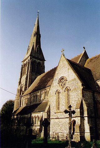
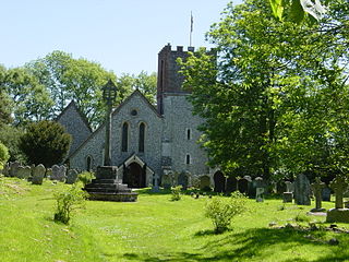
The Church of the Holy Trinity, Privett, is a redundant Anglican church in the parish of Froxfield and Privett, Hampshire, England. It is recorded in the National Heritage List for England as a Grade II* listed building, and is under the care of the Churches Conservation Trust.

<span class="mw-page-title-main">Froxfield and Privett</span> Human settlement in England

Froxfield and Privett is a civil parish in East Hampshire, England, about 3 miles (5 km) northwest of Petersfield. The settlements in the parish are the villages of Froxfield Green, Privett and High Cross, and several hamlets including Bailey Green, Filmore Hill, Stoner Hill and Warren Corner. The population of the parish taken at the 2021 census was 929.

References

  1. "Hampshire County Council's HantsWeb — Froxfield". 2006. Archived from the original on 31 January 2011. Retrieved 20 March 2011.
  2. 1 2 3 "Privett Conservation Area: Study and Character Appraisal" (PDF). East Hampshire District Council. January 2008. Archived from the original (PDF) on 23 July 2011 via Internet Archive.
  3. 1 2 "Privett Ch/CP". A Vision of Britain through Time . University of Portsmouth. Retrieved 15 January 2024.
  4. 'Parishes: Privett', A History of the County of Hampshire. Vol. 3. 1908. p. 336. Retrieved 21 March 2011.
  5. Historic England, "Church of the Holy Trinity, Froxfield (1237168)", National Heritage List for England , retrieved 17 August 2013
  6. "No. 46742". The London Gazette . 18 November 1975. p. 14574.
  7. "Holy Trinity Church, Privett, Hampshire". Churches Conservation Trust. Retrieved 11 January 2024.
  8. "Ordnance Survey One-inch map, Sheet 132". National Library of Scotland. 1939. Retrieved 13 January 2024.
  9. Stone, R. A. (1983). The Meon Valley Railway. Southampton: Kingfisher Railway Productions. p. 101. ISBN   9780946184040.
  10. "201, 205, 207, 211 (Alton Rural services)" (PDF). 20 April 2009. Archived from the original (PDF) on 6 June 2012. Retrieved 22 March 2011.